


<< Other Photo Pages >> Stèle de L'église - Standing Stone (Menhir) in France in Bretagne:Finistère (29)
Submitted by TheCaptain on Tuesday, 28 December 2004 Page Views: 2532
Neolithic and Bronze AgeSite Name: Stèle de L'égliseCountry: France
NOTE: This site is 1.427 km away from the location you searched for.
Département: Bretagne:Finistère (29) Type: Standing Stone (Menhir)
Nearest Town: Pont l'Abbé Nearest Village: Loctudy
Latitude: 47.831798N Longitude: 4.175326W
Condition:
| 5 | Perfect |
| 4 | Almost Perfect |
| 3 | Reasonable but with some damage |
| 2 | Ruined but still recognisable as an ancient site |
| 1 | Pretty much destroyed, possibly visible as crop marks |
| 0 | No data. |
| -1 | Completely destroyed |
| 5 | Superb |
| 4 | Good |
| 3 | Ordinary |
| 2 | Not Good |
| 1 | Awful |
| 0 | No data. |
| 5 | Can be driven to, probably with disabled access |
| 4 | Short walk on a footpath |
| 3 | Requiring a bit more of a walk |
| 2 | A long walk |
| 1 | In the middle of nowhere, a nightmare to find |
| 0 | No data. |
| 5 | co-ordinates taken by GPS or official recorded co-ordinates |
| 4 | co-ordinates scaled from a detailed map |
| 3 | co-ordinates scaled from a bad map |
| 2 | co-ordinates of the nearest village |
| 1 | co-ordinates of the nearest town |
| 0 | no data |
Internal Links:
External Links:
Lovely grooved iron age stele in the churchyard at Loctudy.
The stone has been carved into this stele from a previous menhir, and today is surmounted by a cross. An example of a menhir which has been in continuous use for many thousands of years.
"The stele is currently [2005] behind the apse of the church of St. Tudy. It has been returned to its original location when it was sited for many years before the façade of the church." - Site Loctudy - Archéologie.
You may be viewing yesterday's version of this page. To see the most up to date information please register for a free account.
Do not use the above information on other web sites or publications without permission of the contributor.
has found this location on Google Street View:
Nearby Images from Flickr
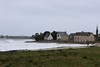
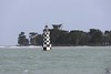
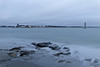


The above images may not be of the site on this page, but were taken nearby. They are loaded from Flickr so please click on them for image credits.
Click here to see more info for this site
Nearby sites
Click here to view sites on an interactive map of the areaKey: Red: member's photo, Blue: 3rd party photo, Yellow: other image, Green: no photo - please go there and take one, Grey: site destroyed
Download sites to:
KML (Google Earth)
GPX (GPS waypoints)
CSV (Garmin/Navman)
CSV (Excel)
To unlock full downloads you need to sign up as a Contributory Member. Otherwise downloads are limited to 50 sites.
Turn off the page maps and other distractions
Nearby sites listing. In the following links * = Image available
2.1km S 173° Dolmen de Plage d'Ezer Burial Chamber or Dolmen
2.7km SW 225° Menhir de Kerdalaë-Plonivel* Standing Stone (Menhir)
2.7km NNW 331° Pennglaouic menhir* Standing Stone (Menhir)
4.3km NNE 27° Treustel menhir* Standing Stone (Menhir)
4.4km SW 220° Dolmen de Menez-Veil 2 Burial Chamber or Dolmen
4.6km WSW 243° Kervadol Dolmens* Burial Chamber or Dolmen
4.6km SW 220° Steir-Nibilic menhir Standing Stone (Menhir)
4.6km SW 223° Dolmen de Menez-Veil* Burial Chamber or Dolmen
4.7km WSW 240° Kervignon Dolmen* Burial Chamber or Dolmen
4.9km WSW 241° Kerfuens Dolmens* Burial Chamber or Dolmen
5.1km SW 226° Menhir de Kerdalaë-Lesconil* Standing Stone (Menhir)
5.3km WNW 289° Menhir de Kernuz* Standing Stone (Menhir)
5.3km W 267° Dolmen de Kerlay Burial Chamber or Dolmen
5.9km WSW 249° Tronval Dolmen* Burial Chamber or Dolmen
5.9km NW 304° Menhir de Guiric* Standing Stone (Menhir)
6.0km WSW 251° Quélarn Dolmens* Burial Chamber or Dolmen
6.0km WSW 251° Quélarn menhir* Standing Stone (Menhir)
6.1km WSW 254° Kervintic menhir Standing Stone (Menhir)
6.6km SW 233° Reun menhir* Standing Stone (Menhir)
6.6km SW 232° Rochers Gravés du Reun* Rock Art
6.9km W 276° Dolmen de Coet Tail Burial Chamber or Dolmen
7.3km WSW 244° Menhir de la Mairie* Standing Stone (Menhir)
7.4km WNW 290° La Vieille Metairie* Standing Stone (Menhir)
7.4km W 259° Dolmen de Kervillogan Burial Chamber or Dolmen
7.5km W 265° Pendreff Alignement* Stone Row / Alignment
View more nearby sites and additional images


 We would like to know more about this location. Please feel free to add a brief description and any relevant information in your own language.
 Wir möchten mehr über diese Stätte erfahren. Bitte zögern Sie nicht, eine kurze Beschreibung und relevante Informationen in Deutsch hinzuzufügen.
 Nous aimerions en savoir encore un peu sur les lieux. S'il vous plaît n'hesitez pas à ajouter une courte description et tous les renseignements pertinents dans votre propre langue.
 Quisieramos informarnos un poco más de las lugares. No dude en añadir una breve descripción y otros datos relevantes en su propio idioma.