

<< Text Pages >> Truffert Dolmen - Burial Chamber or Dolmen in France in Normandie:Manche (50)
Submitted by TheCaptain on Sunday, 19 December 2004 Page Views: 3589
Neolithic and Bronze AgeSite Name: Truffert DolmenCountry: France Département: Normandie:Manche (50) Type: Burial Chamber or Dolmen
Nearest Town: Cherbourg Nearest Village: La Glacerie
Latitude: 49.618000N Longitude: 1.57W
Condition:
| 5 | Perfect |
| 4 | Almost Perfect |
| 3 | Reasonable but with some damage |
| 2 | Ruined but still recognisable as an ancient site |
| 1 | Pretty much destroyed, possibly visible as crop marks |
| 0 | No data. |
| -1 | Completely destroyed |
| 5 | Superb |
| 4 | Good |
| 3 | Ordinary |
| 2 | Not Good |
| 1 | Awful |
| 0 | No data. |
| 5 | Can be driven to, probably with disabled access |
| 4 | Short walk on a footpath |
| 3 | Requiring a bit more of a walk |
| 2 | A long walk |
| 1 | In the middle of nowhere, a nightmare to find |
| 0 | No data. |
| 5 | co-ordinates taken by GPS or official recorded co-ordinates |
| 4 | co-ordinates scaled from a detailed map |
| 3 | co-ordinates scaled from a bad map |
| 2 | co-ordinates of the nearest village |
| 1 | co-ordinates of the nearest town |
| 0 | no data |
Internal Links:
External Links:
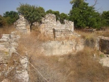
Dolmen, said to be destroyed, near to Cherbourg in Normandy.
IMPORTANT NOTE: Site once believed to be near this position
You may be viewing yesterday's version of this page. To see the most up to date information please register for a free account.
Do not use the above information on other web sites or publications without permission of the contributor.
Nearby Images from Flickr
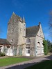
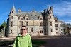

The above images may not be of the site on this page, but were taken nearby. They are loaded from Flickr so please click on them for image credits.
Click here to see more info for this site
Nearby sites
Click here to view sites on an interactive map of the areaKey: Red: member's photo, Blue: 3rd party photo, Yellow: other image, Green: no photo - please go there and take one, Grey: site destroyed
Download sites to:
KML (Google Earth)
GPX (GPS waypoints)
CSV (Garmin/Navman)
CSV (Excel)
To unlock full downloads you need to sign up as a Contributory Member. Otherwise downloads are limited to 50 sites.
Turn off the page maps and other distractions
Nearby sites listing. In the following links * = Image available
2.1km NE 51° Allée Couverte de Tourlaville Passage Grave
2.7km SW 231° Menhirs de la Glacerie* Standing Stones
2.7km NW 305° Maupas menhirs Standing Stones
3.2km SW 226° Pierre Butée de Tourlaville Standing Stone (Menhir)
3.3km ESE 112° Menhirs du Mesnil-Auval Standing Stones
5.4km NE 53° Bretteville Allée Couverte* Passage Grave
5.8km WNW 301° Musée d'Histoire Naturelle Museum
6.1km WSW 251° Roche a Trois Pieds* Burial Chamber or Dolmen
7.1km NE 55° Grande et Petite Pierre* Standing Stones
7.6km NE 56° Maupertus menhir* Modern Stone Circle etc
10.3km ENE 60° La Longue Pierre (Carneville) Standing Stone (Menhir)
10.7km NE 47° La Longue Pierre Ferrant Standing Stone (Menhir)
11.1km ENE 60° Divises de Carneville Stone Circle
11.3km S 175° Menhir dit Pierre Dressée Standing Stone (Menhir)
11.7km NE 50° La Pierre aux Magniants Standing Stone (Menhir)
11.8km SW 220° Menhir de Breuville Standing Stone (Menhir)
12.3km SW 218° Roche de Breuville Standing Stone (Menhir)
12.5km S 182° Galerie des Forges Passage Grave
12.8km NE 47° Fort Joret allée couverte* Passage Grave
12.8km ESE 117° Les Grises Pierres* Standing Stones
13.0km WSW 253° Pierres Tournantes (Néretz) Standing Stones
13.1km NE 50° Menhir des Casernes Standing Stone (Menhir)
13.2km ESE 118° Montaigu-la-Brisette dolmen Burial Chamber or Dolmen
13.5km ENE 61° La Longue Pierre (St-Pierre-Eglise)* Standing Stone (Menhir)
13.6km S 185° Allée Couverte de Câtillon Passage Grave
View more nearby sites and additional images


 We would like to know more about this location. Please feel free to add a brief description and any relevant information in your own language.
 Wir möchten mehr über diese Stätte erfahren. Bitte zögern Sie nicht, eine kurze Beschreibung und relevante Informationen in Deutsch hinzuzufügen.
 Nous aimerions en savoir encore un peu sur les lieux. S'il vous plaît n'hesitez pas à ajouter une courte description et tous les renseignements pertinents dans votre propre langue.
 Quisieramos informarnos un poco más de las lugares. No dude en añadir una breve descripción y otros datos relevantes en su propio idioma.