


<< Our Photo Pages >> Egg Well - Holy Well or Sacred Spring in England in Staffordshire
Submitted by TimPrevett on Monday, 29 March 2004 Page Views: 32972
Springs and Holy WellsSite Name: Egg Well Alternative Name: Ashenhurst WellCountry: England County: Staffordshire Type: Holy Well or Sacred Spring
Nearest Town: Leek Nearest Village: Bradnop
Map Ref: SK00565403 Landranger Map Number: 119
Latitude: 53.083490N Longitude: 1.993092W
Condition:
| 5 | Perfect |
| 4 | Almost Perfect |
| 3 | Reasonable but with some damage |
| 2 | Ruined but still recognisable as an ancient site |
| 1 | Pretty much destroyed, possibly visible as crop marks |
| 0 | No data. |
| -1 | Completely destroyed |
| 5 | Superb |
| 4 | Good |
| 3 | Ordinary |
| 2 | Not Good |
| 1 | Awful |
| 0 | No data. |
| 5 | Can be driven to, probably with disabled access |
| 4 | Short walk on a footpath |
| 3 | Requiring a bit more of a walk |
| 2 | A long walk |
| 1 | In the middle of nowhere, a nightmare to find |
| 0 | No data. |
| 5 | co-ordinates taken by GPS or official recorded co-ordinates |
| 4 | co-ordinates scaled from a detailed map |
| 3 | co-ordinates scaled from a bad map |
| 2 | co-ordinates of the nearest village |
| 1 | co-ordinates of the nearest town |
| 0 | no data |
Internal Links:
External Links:
I have visited· I would like to visit
BrownEdger visited on 3rd Sep 2011 - their rating: Cond: 3 Amb: 4 Access: 4 Improvements have been made to the site with an information board and fence to stop the local livestock crowding round the entrance!
")
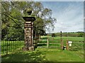
This well is recorded as Pastscape Monument No. 305789, which tells us the well is commonly called the Egg Well because of the oval way it is enclosed in masonry. "Tradition ascribes considerable medicinal properties to Ashenhurst Well, or Egg Well, ... which is of Roman origin." They also add: "Tradition ascribes considerable medicinal properties to Ashenhurst Well, or Egg Well, ... which is of Roman origin." They date the house to late 17th to early 18th century, with 20th century brick enclosure and flat roof in stone slabs.
The Egg Well is also featured on The Northern Antiquarian (TNA) - see their entry for Egg Well, Ashenhurst, Leek, Staffordshire which has photographs of the well housing and the well basin, together with directions for finding this site, a brief archaeology and history and folklore. TNA add that the Latin inscription on the basin reads: "“Renibus, et splenui cordi, jecorique medatur, Mille maelsi prodest ista salubris aqua.” The translation being: “The liver, kidneys, heart’s disease these waters remedy. And by their healing powers assuage full many a malady.”
You may be viewing yesterday's version of this page. To see the most up to date information please register for a free account.
")
")
")
Do not use the above information on other web sites or publications without permission of the contributor.
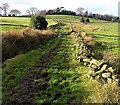
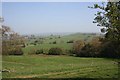
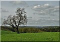
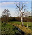
Nearby Images from Geograph Britain and Ireland:
©2006(licence)
©2007(licence)
©2023(licence)
©2023(licence)
©2006(licence)
The above images may not be of the site on this page, they are loaded from Geograph.
Please Submit an Image of this site or go out and take one for us!
Click here to see more info for this site
Nearby sites
Key: Red: member's photo, Blue: 3rd party photo, Yellow: other image, Green: no photo - please go there and take one, Grey: site destroyed
Download sites to:
KML (Google Earth)
GPX (GPS waypoints)
CSV (Garmin/Navman)
CSV (Excel)
To unlock full downloads you need to sign up as a Contributory Member. Otherwise downloads are limited to 50 sites.
Turn off the page maps and other distractions
Nearby sites listing. In the following links * = Image available
2.6km SW 219° The Butter Cross (Cheddleton)* Ancient Cross (SJ989520)
2.7km NW 316° Lady Well (Leek)* Holy Well or Sacred Spring (SJ9871455940)
3.3km NW 321° Nicholson Museum and Art Gallery* Museum (SJ985566)
3.4km NW 319° St Edward the Confessor* Ancient Cross (SJ9831956617)
3.6km NW 311° Cock Low (Leek)* Round Barrow(s) (SJ9783656426)
4.0km SSE 162° Ipstones tympanum* Early Christian Sculptured Stone (SK01785022)
4.5km ESE 103° The Morridge Stone Circle (SK0553)
4.7km NNE 22° Thorncliffe Barrow Round Barrow(s) (SK023584)
5.1km NNW 335° Nine Pins* Stone Circle (SJ984587)
5.2km SE 144° Hopestone ; Ipstones/Foxt ; Staffordshire Natural Stone / Erratic / Other Natural Feature (SK0361049834)
6.4km N 358° Leekfrith Tumulus* Round Barrow(s) (SK003604)
6.4km N 355° Leekfrith Stone* Standing Stone (Menhir) (SK000604)
6.4km NE 45° Elkstone Barrow 1* Round Barrow(s) (SK05155855)
6.4km NE 46° Elkstone Barrow 2 Round Barrow(s) (SK052585)
6.6km E 80° Grindon Moor Barrow* Round Barrow(s) (SK071552)
6.6km E 79° Hurst Low* Round Barrow(s) (SK071553)
7.0km SE 134° Windywaycross* Early Christian Sculptured Stone (SK056492)
7.5km NNE 27° Merryton Low 2* Round Barrow(s) (SK040607)
7.6km E 101° Grub Low* Round Barrow(s) (SK08045255)
7.8km N 0° The Roaches* Natural Stone / Erratic / Other Natural Feature (SK006618)
7.8km NNE 27° Merryton Low 1* Round Barrow(s) (SK041610)
7.9km N 2° Sainter's Circle* Stone Circle (SK008619)
7.9km N 2° Bawd Stone* Natural Stone / Erratic / Other Natural Feature (SK0079561976)
8.0km E 87° All Saints (Grindon) Early Christian Sculptured Stone (SK086545)
8.0km NNW 333° Gun Hill Standing Stone* Standing Stone (Menhir) (SJ969612)
View more nearby sites and additional images


 We would like to know more about this location. Please feel free to add a brief description and any relevant information in your own language.
 Wir möchten mehr über diese Stätte erfahren. Bitte zögern Sie nicht, eine kurze Beschreibung und relevante Informationen in Deutsch hinzuzufügen.
 Nous aimerions en savoir encore un peu sur les lieux. S'il vous plaît n'hesitez pas à ajouter une courte description et tous les renseignements pertinents dans votre propre langue.
 Quisieramos informarnos un poco más de las lugares. No dude en añadir una breve descripción y otros datos relevantes en su propio idioma.