


<< Our Photo Pages >> Cringraval - Stone Circle in Scotland in North Uist
Submitted by enkidu41 on Monday, 11 November 2002 Page Views: 7412
Neolithic and Bronze AgeSite Name: CringravalCountry: Scotland County: North Uist Type: Stone Circle
Map Ref: NF8115364451 Landranger Map Number: 18
Latitude: 57.557267N Longitude: 7.333367W
Condition:
| 5 | Perfect |
| 4 | Almost Perfect |
| 3 | Reasonable but with some damage |
| 2 | Ruined but still recognisable as an ancient site |
| 1 | Pretty much destroyed, possibly visible as crop marks |
| 0 | No data. |
| -1 | Completely destroyed |
| 5 | Superb |
| 4 | Good |
| 3 | Ordinary |
| 2 | Not Good |
| 1 | Awful |
| 0 | No data. |
| 5 | Can be driven to, probably with disabled access |
| 4 | Short walk on a footpath |
| 3 | Requiring a bit more of a walk |
| 2 | A long walk |
| 1 | In the middle of nowhere, a nightmare to find |
| 0 | No data. |
| 5 | co-ordinates taken by GPS or official recorded co-ordinates |
| 4 | co-ordinates scaled from a detailed map |
| 3 | co-ordinates scaled from a bad map |
| 2 | co-ordinates of the nearest village |
| 1 | co-ordinates of the nearest town |
| 0 | no data |
Internal Links:
External Links:
I have visited· I would like to visit
tom_bullock ravensidhe have visited here
")
You may be viewing yesterday's version of this page. To see the most up to date information please register for a free account.
")
Do not use the above information on other web sites or publications without permission of the contributor.
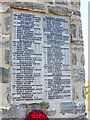
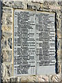
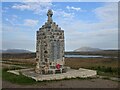
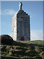
Nearby Images from Geograph Britain and Ireland:
©2014(licence)
©2014(licence)
©2021(licence)
©2014(licence)
©2014(licence)
The above images may not be of the site on this page, they are loaded from Geograph.
Please Submit an Image of this site or go out and take one for us!
Click here to see more info for this site
Nearby sites
Key: Red: member's photo, Blue: 3rd party photo, Yellow: other image, Green: no photo - please go there and take one, Grey: site destroyed
Download sites to:
KML (Google Earth)
GPX (GPS waypoints)
CSV (Garmin/Navman)
CSV (Excel)
To unlock full downloads you need to sign up as a Contributory Member. Otherwise downloads are limited to 50 sites.
Turn off the page maps and other distractions
Nearby sites listing. In the following links * = Image available
150m WSW 251° Cringraval Stone Row Stone Row / Alignment (NF8100764413)
2.2km SE 125° Loch A Phobuill* Stone Circle (NF82896303)
2.2km WSW 245° Carnan nan Long* Chambered Cairn (NF79046367)
2.5km ESE 121° Cairn 430m NW of Craonaval* Cairn (NF83236297)
2.6km NNW 329° Unival Chambered Cairn (NF800668)
2.7km ESE 121° Cairn 330m NW of Craonaval* Cairn (NF83346290)
2.7km NNW 330° Leacach an Tigh Cloiche Standing Stone (Menhir) (NF800669)
2.8km SE 124° Chambered cairn 200m WNW of Craonaval* Chambered Cairn (NF83316271)
2.9km ENE 59° Barpa Langais* Chambered Tomb (NF8376665729)
2.9km NE 56° Loch 'a Bharpa Settlement Ancient Village or Settlement (NF837659)
2.9km ESE 123° Leac A' Mhiosachan Standing Stones (NF83506266)
3.1km ESE 116° Loch Glen Na Feannag* Chambered Cairn (NF83876288)
3.2km ENE 75° Pobull Fhinn* Stone Circle (NF84286502)
3.3km SE 124° Ultach Fhinn Standing Stone (Menhir) (NF83766235)
3.5km NNE 19° Airigh Na Gaoithe Stone Row* Stone Row / Alignment (NF82586767)
3.5km ENE 71° Not-so-Standing Stone* Standing Stone (Menhir) (NF8459765344)
3.5km ENE 71° Beistean's Grave* Rock Art (NF8459865345)
3.6km NNE 23° Airigh Na Gaoithe Long Cairn* Long Barrow (NF82796763)
3.7km ESE 118° Oban Nam Fiadh* Chambered Cairn (NF84296244)
3.8km SW 218° Dun Na H'Ola Stone Fort or Dun (NF78546161)
4.1km SE 132° Possible Carved Footprints near Beinn Na Coille Carving (NF8398761447)
4.5km WNW 288° Clach Mhor a' Che* Standing Stone (Menhir) (NF770662)
4.7km SW 216° Sloc Sabhaid* Ancient Village or Settlement (NF781609)
4.7km SSE 150° Carinish* Stone Circle (NF83236020)
4.9km SE 144° Caravat Barp* Passage Grave (NF837603)
View more nearby sites and additional images


 We would like to know more about this location. Please feel free to add a brief description and any relevant information in your own language.
 Wir möchten mehr über diese Stätte erfahren. Bitte zögern Sie nicht, eine kurze Beschreibung und relevante Informationen in Deutsch hinzuzufügen.
 Nous aimerions en savoir encore un peu sur les lieux. S'il vous plaît n'hesitez pas à ajouter une courte description et tous les renseignements pertinents dans votre propre langue.
 Quisieramos informarnos un poco más de las lugares. No dude en añadir una breve descripción y otros datos relevantes en su propio idioma.