


<< Text Pages >> Dolmen du Terrou - Burial Chamber or Dolmen in France in Midi:Lot (46)
Submitted by TheCaptain on Friday, 06 May 2011 Page Views: 1362
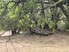
Neolithic and Bronze AgeSite Name: Dolmen du TerrouCountry: France Département: Midi:Lot (46) Type: Burial Chamber or Dolmen
Nearest Town: Souillac Nearest Village: Gramat
Latitude: 44.774400N Longitude: 1.762200E
Condition:
| 5 | Perfect |
| 4 | Almost Perfect |
| 3 | Reasonable but with some damage |
| 2 | Ruined but still recognisable as an ancient site |
| 1 | Pretty much destroyed, possibly visible as crop marks |
| 0 | No data. |
| -1 | Completely destroyed |
| 5 | Superb |
| 4 | Good |
| 3 | Ordinary |
| 2 | Not Good |
| 1 | Awful |
| 0 | No data. |
| 5 | Can be driven to, probably with disabled access |
| 4 | Short walk on a footpath |
| 3 | Requiring a bit more of a walk |
| 2 | A long walk |
| 1 | In the middle of nowhere, a nightmare to find |
| 0 | No data. |
| 5 | co-ordinates taken by GPS or official recorded co-ordinates |
| 4 | co-ordinates scaled from a detailed map |
| 3 | co-ordinates scaled from a bad map |
| 2 | co-ordinates of the nearest village |
| 1 | co-ordinates of the nearest town |
| 0 | no data |
Be the first person to rate this site - see the 'Contribute!' box in the right hand menu.
Internal Links:
External Links:
burial chamber in Midi-Pyrénées:Lot
Dolmen du Terrou is a burial chamber in the community of Gramat, Departement of Lot, Region of Midi-Pyrénées
You may be viewing yesterday's version of this page. To see the most up to date information please register for a free account.
Do not use the above information on other web sites or publications without permission of the contributor.
Nearby Images from Flickr
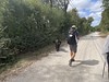

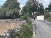
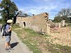
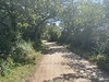
The above images may not be of the site on this page, but were taken nearby. They are loaded from Flickr so please click on them for image credits.
Click here to see more info for this site
Nearby sites
Click here to view sites on an interactive map of the areaKey: Red: member's photo, Blue: 3rd party photo, Yellow: other image, Green: no photo - please go there and take one, Grey: site destroyed
Download sites to:
KML (Google Earth)
GPX (GPS waypoints)
CSV (Garmin/Navman)
CSV (Excel)
To unlock full downloads you need to sign up as a Contributory Member. Otherwise downloads are limited to 50 sites.
Turn off the page maps and other distractions
Nearby sites listing. In the following links * = Image available
981m NW 316° Champ des Courses Tumulus* Chambered Tomb
1.3km W 262° Bouyé Dolmen* Burial Chamber or Dolmen
2.6km S 176° Dolmen de Saint Chignes* Burial Chamber or Dolmen
2.6km S 176° Dolmen dit la Pierre Levée de Lacoste Burial Chamber or Dolmen
5.0km SE 137° Dolmen dit Pierre Levée (Issendolus)* Burial Chamber or Dolmen
5.7km W 268° Dolmen des Plassous* Burial Chamber or Dolmen
6.7km S 187° Gabaudet Dolmen 1* Burial Chamber or Dolmen
6.8km S 187° Gabaudet Dolmen 2* Burial Chamber or Dolmen
6.8km SSE 155° Grotte des Escabasses Cave or Rock Shelter
6.9km SSE 157° Dolmen des Escabasses* Burial Chamber or Dolmen
7.2km W 279° Dolmen du Pech de Grammont Burial Chamber or Dolmen
7.3km SE 145° Grotte de Roucadou Cave or Rock Shelter
7.3km S 186° Dolmen de Sadouilles Burial Chamber or Dolmen
7.6km N 355° Dolmen des Claouzelles Burial Chamber or Dolmen
8.5km N 359° Dolmen des Calcas* Burial Chamber or Dolmen
8.6km W 272° Dolmen dit la Pierre Levée de la Pannonie Burial Chamber or Dolmen
8.8km SSW 202° Dolmen du Moulin (Reilhac) Burial Chamber or Dolmen
8.9km N 4° Dolmen du Pech Plumet 1* Burial Chamber or Dolmen
8.9km N 357° Dolmen dit des Pendus 1 Burial Chamber or Dolmen
8.9km SE 143° Dolmen de Roucous Burial Chamber or Dolmen
9.0km N 6° Dolmen du Pech Plumet 2 Burial Chamber or Dolmen
9.1km N 357° Dolmen dit des Pendus 3* Burial Chamber or Dolmen
9.1km N 351° Dolmen d'Escurettes* Burial Chamber or Dolmen
9.2km NNE 21° Auraste Dolmen* Burial Chamber or Dolmen
9.2km N 350° Dolmen du Champ de Monsieur* Burial Chamber or Dolmen
View more nearby sites and additional images


 We would like to know more about this location. Please feel free to add a brief description and any relevant information in your own language.
 Wir möchten mehr über diese Stätte erfahren. Bitte zögern Sie nicht, eine kurze Beschreibung und relevante Informationen in Deutsch hinzuzufügen.
 Nous aimerions en savoir encore un peu sur les lieux. S'il vous plaît n'hesitez pas à ajouter une courte description et tous les renseignements pertinents dans votre propre langue.
 Quisieramos informarnos un poco más de las lugares. No dude en añadir una breve descripción y otros datos relevantes en su propio idioma.