


<< Our Photo Pages >> Dolmen de Baumescure Nord - Burial Chamber or Dolmen in France in Midi:Aveyron (12)
Submitted by TheCaptain on Friday, 06 May 2011 Page Views: 1482
Neolithic and Bronze AgeSite Name: Dolmen de Baumescure Nord Alternative Name: BeaumescureCountry: France Département: Midi:Aveyron (12) Type: Burial Chamber or Dolmen
Nearest Town: Millau Nearest Village: La Bastide-Pradines
Latitude: 44.038643N Longitude: 3.071047E
Condition:
| 5 | Perfect |
| 4 | Almost Perfect |
| 3 | Reasonable but with some damage |
| 2 | Ruined but still recognisable as an ancient site |
| 1 | Pretty much destroyed, possibly visible as crop marks |
| 0 | No data. |
| -1 | Completely destroyed |
| 5 | Superb |
| 4 | Good |
| 3 | Ordinary |
| 2 | Not Good |
| 1 | Awful |
| 0 | No data. |
| 5 | Can be driven to, probably with disabled access |
| 4 | Short walk on a footpath |
| 3 | Requiring a bit more of a walk |
| 2 | A long walk |
| 1 | In the middle of nowhere, a nightmare to find |
| 0 | No data. |
| 5 | co-ordinates taken by GPS or official recorded co-ordinates |
| 4 | co-ordinates scaled from a detailed map |
| 3 | co-ordinates scaled from a bad map |
| 2 | co-ordinates of the nearest village |
| 1 | co-ordinates of the nearest town |
| 0 | no data |
Internal Links:
External Links:
I have visited· I would like to visit
johnstone visited on 8th Sep 2021 - their rating: Cond: 2 Amb: 3 Access: 4
")
Dolmen de Baumescure Nord is a burial chamber in the community of La Bastide-Pradines, Departement of Aveyron, Region of Midi-Pyrénées
Very ruined dolmen, situated along the GR71D track. One rather thin upright standing and two pieces of capstone (?) on the ground.
Source:Baumescure Nord (T4T35)
You may be viewing yesterday's version of this page. To see the most up to date information please register for a free account.
")
")
")
Do not use the above information on other web sites or publications without permission of the contributor.
Nearby Images from Flickr
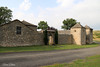
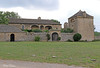
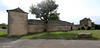


The above images may not be of the site on this page, but were taken nearby. They are loaded from Flickr so please click on them for image credits.
Click here to see more info for this site
Nearby sites
Click here to view sites on an interactive map of the areaKey: Red: member's photo, Blue: 3rd party photo, Yellow: other image, Green: no photo - please go there and take one, Grey: site destroyed
Download sites to:
KML (Google Earth)
GPX (GPS waypoints)
CSV (Garmin/Navman)
CSV (Excel)
To unlock full downloads you need to sign up as a Contributory Member. Otherwise downloads are limited to 50 sites.
Turn off the page maps and other distractions
Nearby sites listing. In the following links * = Image available
306m SE 131° Dolmen de Baumescure Sud Burial Chamber or Dolmen
1.7km WNW 295° Dolmen du Puech del Pous 2* Burial Chamber or Dolmen
1.9km WNW 291° Menhir du Puech del Pous* Standing Stone (Menhir)
2.0km WNW 292° Dolmen du Puech del Pous 3* Burial Chamber or Dolmen
2.2km WNW 290° Dolmen du Puech del Pous 1* Burial Chamber or Dolmen
2.5km W 278° Menhir de la Côte de Labro* Standing Stone (Menhir)
3.3km NNW 341° Dolmen du Boundoulaou* Burial Chamber or Dolmen
3.9km NNE 24° Dolmen de Combets 2* Burial Chamber or Dolmen
3.9km NNE 12° Dolmen de Brunas 2 Burial Chamber or Dolmen
4.0km N 2° Dolmen de Brunas 1 Burial Chamber or Dolmen
4.1km NNE 27° Dolmen de Combets 1* Burial Chamber or Dolmen
4.4km ESE 116° Dolmen du Devez de la Baume Burial Chamber or Dolmen
4.7km NW 304° Menhir des Crottes (Labro)* Standing Stone (Menhir)
5.1km WNW 295° Dolmen des Crottes Burial Chamber or Dolmen
5.3km NW 310° Dolmen Case des Géants Burial Chamber or Dolmen
5.7km NE 51° Dolmen de Potensac* Burial Chamber or Dolmen
5.8km NE 48° Dolmen de la Gardiolle* Burial Chamber or Dolmen
6.2km ESE 107° Jonquet Dolmen* Burial Chamber or Dolmen
6.4km NNE 29° Oppidum de Millau Ancient Village or Settlement
6.6km NNE 15° La Graufesenque* Ancient Village or Settlement
6.9km ENE 75° Rochers de La Blaquière* Rock Outcrop
7.0km SSE 152° La Baraque Dolmen* Burial Chamber or Dolmen
7.1km SSW 202° Dolmen de Coste-Plane Burial Chamber or Dolmen
7.2km ESE 109° Dolmen de la Fabière* Burial Chamber or Dolmen
7.4km S 191° Menhir de Loublacas Standing Stone (Menhir)
View more nearby sites and additional images


 We would like to know more about this location. Please feel free to add a brief description and any relevant information in your own language.
 Wir möchten mehr über diese Stätte erfahren. Bitte zögern Sie nicht, eine kurze Beschreibung und relevante Informationen in Deutsch hinzuzufügen.
 Nous aimerions en savoir encore un peu sur les lieux. S'il vous plaît n'hesitez pas à ajouter une courte description et tous les renseignements pertinents dans votre propre langue.
 Quisieramos informarnos un poco más de las lugares. No dude en añadir una breve descripción y otros datos relevantes en su propio idioma.