


<< Our Photo Pages >> Argibele Dolmen 4 - Burial Chamber or Dolmen in France in Aquitaine:Pyrénées-Atlantiques 64
Submitted by irundarra on Friday, 06 May 2011 Page Views: 1319
Neolithic and Bronze AgeSite Name: Argibele Dolmen 4 Alternative Name: Argibele IV TrikuharriaCountry: France Département: Aquitaine:Pyrénées-Atlantiques 64 Type: Burial Chamber or Dolmen
Nearest Town: St Jean-de-Luz Nearest Village: Ascain
Latitude: 43.330334N Longitude: 1.622513W
Condition:
| 5 | Perfect |
| 4 | Almost Perfect |
| 3 | Reasonable but with some damage |
| 2 | Ruined but still recognisable as an ancient site |
| 1 | Pretty much destroyed, possibly visible as crop marks |
| 0 | No data. |
| -1 | Completely destroyed |
| 5 | Superb |
| 4 | Good |
| 3 | Ordinary |
| 2 | Not Good |
| 1 | Awful |
| 0 | No data. |
| 5 | Can be driven to, probably with disabled access |
| 4 | Short walk on a footpath |
| 3 | Requiring a bit more of a walk |
| 2 | A long walk |
| 1 | In the middle of nowhere, a nightmare to find |
| 0 | No data. |
| 5 | co-ordinates taken by GPS or official recorded co-ordinates |
| 4 | co-ordinates scaled from a detailed map |
| 3 | co-ordinates scaled from a bad map |
| 2 | co-ordinates of the nearest village |
| 1 | co-ordinates of the nearest town |
| 0 | no data |
Be the first person to rate this site - see the 'Contribute!' box in the right hand menu.
Internal Links:
External Links:
")
Arguibele S is a burial chamber in the community of Ascain, Departement of Pyrénées-Atlantiques, Region of Aquitaine
You may be viewing yesterday's version of this page. To see the most up to date information please register for a free account.
")
")
")
Do not use the above information on other web sites or publications without permission of the contributor.
Nearby Images from Flickr
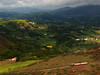

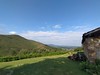
The above images may not be of the site on this page, but were taken nearby. They are loaded from Flickr so please click on them for image credits.
Click here to see more info for this site
Nearby sites
Click here to view sites on an interactive map of the areaKey: Red: member's photo, Blue: 3rd party photo, Yellow: other image, Green: no photo - please go there and take one, Grey: site destroyed
Download sites to:
KML (Google Earth)
GPX (GPS waypoints)
CSV (Garmin/Navman)
CSV (Excel)
To unlock full downloads you need to sign up as a Contributory Member. Otherwise downloads are limited to 50 sites.
Turn off the page maps and other distractions
Nearby sites listing. In the following links * = Image available
10m W 271° Argibele Dolmen 3 Burial Chamber or Dolmen
11m NNW 335° Argibele Dolmen 5 Burial Chamber or Dolmen
25m E 79° Argibele Dolmen 2* Burial Chamber or Dolmen
30m E 91° Argibele Dolmen 1* Burial Chamber or Dolmen
356m NNW 334° La Plana Menhir 2 Standing Stone (Menhir)
357m SW 225° Androla Menhir Standing Stone (Menhir)
452m NNW 332° La Plana Menhir 1 Standing Stone (Menhir)
457m NNW 331° La Plana Cromlech Stone Circle
467m SW 223° Androla Dolmen 1 Burial Chamber or Dolmen
527m SW 221° Androla Dolmen 2 Burial Chamber or Dolmen
1.2km ESE 105° Xoldorixko Dolmen Burial Chamber or Dolmen
1.3km WNW 283° Cheruen Dolmen Burial Chamber or Dolmen
1.4km WSW 241° Ihizelaia Menhir Standing Stone (Menhir)
1.5km WNW 282° Peruen Borda Dolmen Burial Chamber or Dolmen
1.5km SSE 159° Sualar Cromlech Round Barrow(s)
1.5km S 186° Baratz d'Altxanga Chromlech Stone Circle
1.5km S 184° Gorostiarria Cromlech* Stone Circle
1.5km SW 234° Ihizelaia Dolmen* Burial Chamber or Dolmen
1.6km SSW 206° Les 3 Fontaines Erreka Cromlech Stone Circle
1.6km WNW 285° Xeruen Burial Chamber or Dolmen
1.6km SSW 201° Les 3 Fontaines Dolmen Burial Chamber or Dolmen
1.8km N 7° Xoldokorisko Burial Chamber or Dolmen
1.8km SSE 161° Airagarri Chromlech Stone Circle
1.8km W 269° Dolmen de Potxerri Burial Chamber or Dolmen
1.9km S 186° Gorostiarria Dolmen Burial Chamber or Dolmen
View more nearby sites and additional images


 We would like to know more about this location. Please feel free to add a brief description and any relevant information in your own language.
 Wir möchten mehr über diese Stätte erfahren. Bitte zögern Sie nicht, eine kurze Beschreibung und relevante Informationen in Deutsch hinzuzufügen.
 Nous aimerions en savoir encore un peu sur les lieux. S'il vous plaît n'hesitez pas à ajouter une courte description et tous les renseignements pertinents dans votre propre langue.
 Quisieramos informarnos un poco más de las lugares. No dude en añadir una breve descripción y otros datos relevantes en su propio idioma.