

<< Text Pages >> Dolmen de la Ramiere - Burial Chamber or Dolmen in France in Limousin:Corrèze (19)
Submitted by TheCaptain on Wednesday, 08 September 2010 Page Views: 2172
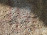
Neolithic and Bronze AgeSite Name: Dolmen de la RamiereCountry: France Département: Limousin:Corrèze (19) Type: Burial Chamber or Dolmen
Nearest Town: Brive-la-Gaillard Nearest Village: Noailhac
Latitude: 45.087389N Longitude: 1.621472E
Condition:
| 5 | Perfect |
| 4 | Almost Perfect |
| 3 | Reasonable but with some damage |
| 2 | Ruined but still recognisable as an ancient site |
| 1 | Pretty much destroyed, possibly visible as crop marks |
| 0 | No data. |
| -1 | Completely destroyed |
| 5 | Superb |
| 4 | Good |
| 3 | Ordinary |
| 2 | Not Good |
| 1 | Awful |
| 0 | No data. |
| 5 | Can be driven to, probably with disabled access |
| 4 | Short walk on a footpath |
| 3 | Requiring a bit more of a walk |
| 2 | A long walk |
| 1 | In the middle of nowhere, a nightmare to find |
| 0 | No data. |
| 5 | co-ordinates taken by GPS or official recorded co-ordinates |
| 4 | co-ordinates scaled from a detailed map |
| 3 | co-ordinates scaled from a bad map |
| 2 | co-ordinates of the nearest village |
| 1 | co-ordinates of the nearest town |
| 0 | no data |
Internal Links:
External Links:
burial chamber in Limousin:Corrèze (19)
Dolmen de la Ramiere is a burial chamber in the community of Noailhac, Departement of Corrèze, Region of Limousin
You may be viewing yesterday's version of this page. To see the most up to date information please register for a free account.
Do not use the above information on other web sites or publications without permission of the contributor.
Nearby Images from Flickr
The above images may not be of the site on this page, but were taken nearby. They are loaded from Flickr so please click on them for image credits.
Click here to see more info for this site
Nearby sites
Click here to view sites on an interactive map of the areaKey: Red: member's photo, Blue: 3rd party photo, Yellow: other image, Green: no photo - please go there and take one, Grey: site destroyed
Download sites to:
KML (Google Earth)
GPX (GPS waypoints)
CSV (Garmin/Navman)
CSV (Excel)
To unlock full downloads you need to sign up as a Contributory Member. Otherwise downloads are limited to 50 sites.
Turn off the page maps and other distractions
Nearby sites listing. In the following links * = Image available
5.8km WNW 286° Dolmen de Combe Fosse Burial Chamber or Dolmen
8.0km NE 52° Dolmen de Fontourcy Burial Chamber or Dolmen
8.2km E 89° Peyre Levade (Serilhac) Burial Chamber or Dolmen
8.8km W 264° Dolmen de la Route Vieille Burial Chamber or Dolmen
8.9km ENE 63° Peyro-Quillado Burial Chamber or Dolmen
8.9km ENE 63° Menhir de Puy de Noix Standing Stone (Menhir)
9.7km NE 47° La Cabane de la Fée* Burial Chamber or Dolmen
10.3km WSW 246° Negre Puech Burial Chamber or Dolmen
11.0km WNW 295° Gravures de Siorat Rock Art
11.1km NNE 24° Dolmen de Rochesseux* Burial Chamber or Dolmen
11.1km NW 316° Grotte de Puy Jarrige Cave or Rock Shelter
11.1km NW 316° Chapelle-aux-Saints* Cave or Rock Shelter
11.1km NW 316° Musée Labenche Museum
11.5km W 272° Gouffre de Blagour* Cave or Rock Shelter
11.8km W 275° Grotte du Moulin de Laguenay Cave or Rock Shelter
11.8km NNE 24° Puy de Pauliac Cromlech* Stone Circle
12.7km W 278° Grotte d'Esclauzur Cave or Rock Shelter
12.8km SW 221° La Peyre Levade (Cressensac) Burial Chamber or Dolmen
13.7km ENE 74° Oppidum de la Roche de Vic* Ancient Village or Settlement
13.8km W 264° Dolmen de Mazajoux* Burial Chamber or Dolmen
15.6km SSE 165° Pierre Plantée de la Font de l'Oulie Standing Stone (Menhir)
15.8km W 268° Dolmen de la Chassagne* Burial Chamber or Dolmen
16.0km ENE 59° Dolmen de Teillol Burial Chamber or Dolmen
16.0km W 269° Dolmen de Buffovent Burial Chamber or Dolmen
16.0km W 271° Dolmen de l'Homme Mort (St-Cernin-de-Larche) Burial Chamber or Dolmen
View more nearby sites and additional images


 We would like to know more about this location. Please feel free to add a brief description and any relevant information in your own language.
 Wir möchten mehr über diese Stätte erfahren. Bitte zögern Sie nicht, eine kurze Beschreibung und relevante Informationen in Deutsch hinzuzufügen.
 Nous aimerions en savoir encore un peu sur les lieux. S'il vous plaît n'hesitez pas à ajouter une courte description et tous les renseignements pertinents dans votre propre langue.
 Quisieramos informarnos un poco más de las lugares. No dude en añadir una breve descripción y otros datos relevantes en su propio idioma.