 with our Megalithic Portal iPhone app")


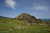
<< Our Photo Pages >> Lassia Tomba di Giganti - Chambered Tomb in Italy in Sardinia (Sardegna)
Submitted by SolarMegalith on Saturday, 25 March 2006 Page Views: 3270
Neolithic and Bronze AgeSite Name: Lassia Tomba di Giganti Alternative Name: Tomba di Giganti Noazza IIICountry: Italy Region: Sardinia (Sardegna) Type: Chambered Tomb
Nearest Town: Nuoro Nearest Village: Birori
Latitude: 40.258540N Longitude: 8.814934E
Condition:
| 5 | Perfect |
| 4 | Almost Perfect |
| 3 | Reasonable but with some damage |
| 2 | Ruined but still recognisable as an ancient site |
| 1 | Pretty much destroyed, possibly visible as crop marks |
| 0 | No data. |
| -1 | Completely destroyed |
| 5 | Superb |
| 4 | Good |
| 3 | Ordinary |
| 2 | Not Good |
| 1 | Awful |
| 0 | No data. |
| 5 | Can be driven to, probably with disabled access |
| 4 | Short walk on a footpath |
| 3 | Requiring a bit more of a walk |
| 2 | A long walk |
| 1 | In the middle of nowhere, a nightmare to find |
| 0 | No data. |
| 5 | co-ordinates taken by GPS or official recorded co-ordinates |
| 4 | co-ordinates scaled from a detailed map |
| 3 | co-ordinates scaled from a bad map |
| 2 | co-ordinates of the nearest village |
| 1 | co-ordinates of the nearest town |
| 0 | no data |
Internal Links:
External Links:
I have visited· I would like to visit
SolarMegalith visited on 15th Apr 2013 - their rating: Cond: 3 Amb: 3 Access: 5
")
The tomb is also known as Noazza III.
You may be viewing yesterday's version of this page. To see the most up to date information please register for a free account.
")
")
")
")
Do not use the above information on other web sites or publications without permission of the contributor.
Nearby Images from Flickr
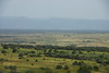
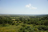

The above images may not be of the site on this page, but were taken nearby. They are loaded from Flickr so please click on them for image credits.
Click here to see more info for this site
Nearby sites
Click here to view sites on an interactive map of the areaKey: Red: member's photo, Blue: 3rd party photo, Yellow: other image, Green: no photo - please go there and take one, Grey: site destroyed
Download sites to:
KML (Google Earth)
GPX (GPS waypoints)
CSV (Garmin/Navman)
CSV (Excel)
To unlock full downloads you need to sign up as a Contributory Member. Otherwise downloads are limited to 50 sites.
Turn off the page maps and other distractions
Nearby sites listing. In the following links * = Image available
664m N 2° Nurattolu Recinto Nuragico* Broch or Nuraghe
983m N 357° Palatu Tomba di Giganti* Chambered Tomb
1.0km NNW 342° Chessa Nuraghe* Broch or Nuraghe
1.1km S 179° Sas Bogadas Ponte Nuragico Ancient Trackway
1.2km S 178° Sarbogadas Ponte Nuragico* Ancient Trackway
1.2km S 181° Sarbogadas Dolmen* Burial Chamber or Dolmen
1.3km N 355° Nuscadore Nuraghe* Broch or Nuraghe
1.4km N 0° Nuscadore Tomba di Giganti* Chambered Tomb
1.4km NE 43° Miuddu Nuraghe* Broch or Nuraghe
1.5km NNW 343° Orosai Nuraghe* Broch or Nuraghe
1.5km WNW 302° San Giorgio Nuraghe (Birori)* Broch or Nuraghe
1.8km S 179° Sorolo Nuraghe* Broch or Nuraghe
2.3km SSW 212° Bau Cannas Domus de Janas* Rock Cut Tomb
2.3km W 269° Lavredu Nuraghe* Broch or Nuraghe
2.6km NNE 15° Tintirriolos Insediamento Nuragico* Ancient Village or Settlement
2.7km NNE 15° Tintirriolos Nuraghe* Broch or Nuraghe
2.7km N 8° Pranu 'e Ruos Nuraghe* Broch or Nuraghe
2.8km NE 35° Sa Corte Nuraghe* Broch or Nuraghe
2.9km SE 139° Cobercada Domus de Janas* Rock Cut Tomb
3.1km W 277° Corte Nuraghe (Macomer)* Broch or Nuraghe
3.1km N 6° Carrarzu e Iddia Nuraghe* Broch or Nuraghe
3.1km N 6° Carrarzu e Iddia Protonuraghe* Broch or Nuraghe
3.2km N 357° Orolo Nuraghe (Bortigali)* Broch or Nuraghe
3.2km N 6° Carrarzu e Iddia Dolmen* Burial Chamber or Dolmen
3.2km SW 228° Tossilo B Nuraghe* Broch or Nuraghe
View more nearby sites and additional images


 We would like to know more about this location. Please feel free to add a brief description and any relevant information in your own language.
 Wir möchten mehr über diese Stätte erfahren. Bitte zögern Sie nicht, eine kurze Beschreibung und relevante Informationen in Deutsch hinzuzufügen.
 Nous aimerions en savoir encore un peu sur les lieux. S'il vous plaît n'hesitez pas à ajouter une courte description et tous les renseignements pertinents dans votre propre langue.
 Quisieramos informarnos un poco más de las lugares. No dude en añadir una breve descripción y otros datos relevantes en su propio idioma.