

<< Text Pages >> Dolmen de la Rouvière 3 (Chanac) - Burial Chamber or Dolmen in France in Languedoc:Lozère (48)
Submitted by TheCaptain on Saturday, 16 April 2005 Page Views: 2333
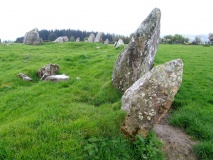
Neolithic and Bronze AgeSite Name: Dolmen de la Rouvière 3 (Chanac) Alternative Name: Dolmen des Rouvière (C)Country: France Département: Languedoc:Lozère (48) Type: Burial Chamber or Dolmen
Nearest Town: Mende Nearest Village: Chanac
Latitude: 44.423932N Longitude: 3.345575E
Condition:
| 5 | Perfect |
| 4 | Almost Perfect |
| 3 | Reasonable but with some damage |
| 2 | Ruined but still recognisable as an ancient site |
| 1 | Pretty much destroyed, possibly visible as crop marks |
| 0 | No data. |
| -1 | Completely destroyed |
| 5 | Superb |
| 4 | Good |
| 3 | Ordinary |
| 2 | Not Good |
| 1 | Awful |
| 0 | No data. |
| 5 | Can be driven to, probably with disabled access |
| 4 | Short walk on a footpath |
| 3 | Requiring a bit more of a walk |
| 2 | A long walk |
| 1 | In the middle of nowhere, a nightmare to find |
| 0 | No data. |
| 5 | co-ordinates taken by GPS or official recorded co-ordinates |
| 4 | co-ordinates scaled from a detailed map |
| 3 | co-ordinates scaled from a bad map |
| 2 | co-ordinates of the nearest village |
| 1 | co-ordinates of the nearest town |
| 0 | no data |
Internal Links:
External Links:
Dolmen in Lozère
You may be viewing yesterday's version of this page. To see the most up to date information please register for a free account.
Do not use the above information on other web sites or publications without permission of the contributor.
Nearby Images from Flickr
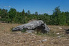
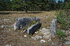
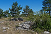
The above images may not be of the site on this page, but were taken nearby. They are loaded from Flickr so please click on them for image credits.
Click here to see more info for this site
Nearby sites
Click here to view sites on an interactive map of the areaKey: Red: member's photo, Blue: 3rd party photo, Yellow: other image, Green: no photo - please go there and take one, Grey: site destroyed
Download sites to:
KML (Google Earth)
GPX (GPS waypoints)
CSV (Garmin/Navman)
CSV (Excel)
To unlock full downloads you need to sign up as a Contributory Member. Otherwise downloads are limited to 50 sites.
Turn off the page maps and other distractions
Nearby sites listing. In the following links * = Image available
444m ESE 104° Dolmen de la Rouvière 1 (Chanac)* Burial Chamber or Dolmen
840m SW 228° Dolmen de Royde Burial Chamber or Dolmen
890m ESE 110° Dolmen de la Rouvière 2 (Chanac) Burial Chamber or Dolmen
1.4km NNE 27° Tumulus de la Lavogne du Sec Cairn
2.4km NE 42° Laumède Dolmen* Burial Chamber or Dolmen
2.9km ESE 113° Cham Dolmen* Burial Chamber or Dolmen
3.0km S 180° Dolmen de Castaoury Burial Chamber or Dolmen
3.3km NNE 31° Dolmen de Nojarède* Burial Chamber or Dolmen
3.9km E 98° Menhirs du Puits de Fraysse* Standing Stone (Menhir)
3.9km ESE 110° L'Aire des Trois Seigneurs* Burial Chamber or Dolmen
4.2km SSE 166° Dolmen de Roussac Burial Chamber or Dolmen
4.9km E 93° Ayguieres Menhir* Standing Stone (Menhir)
4.9km E 93° Ayguières Dolmen* Burial Chamber or Dolmen
4.9km WNW 301° Dolmen de Lou Devezou Burial Chamber or Dolmen
5.0km SSE 147° Dolmen de la Baume (Sainte-Enimie)* Burial Chamber or Dolmen
5.8km WNW 298° Dolmen des Fons Burial Chamber or Dolmen
6.3km ESE 120° Menhir du Bac* Standing Stone (Menhir)
6.4km SSE 167° Devez Dolmen Burial Chamber or Dolmen
7.0km SE 131° Dolmen de Dignas* Burial Chamber or Dolmen
7.1km ESE 107° Dolmen de Champerboux Burial Chamber or Dolmen
7.2km NE 48° Dolmen de Bramonas* Burial Chamber or Dolmen
7.4km WNW 294° Dolmen de Chardonnet Burial Chamber or Dolmen
8.1km SE 141° Dolmen de Téoulets Burial Chamber or Dolmen
8.2km SE 141° Fountain of Burle (Sainte Enimie) Holy Well or Sacred Spring
8.3km ESE 111° Tumulus de Chardounio Cairn
View more nearby sites and additional images


 We would like to know more about this location. Please feel free to add a brief description and any relevant information in your own language.
 Wir möchten mehr über diese Stätte erfahren. Bitte zögern Sie nicht, eine kurze Beschreibung und relevante Informationen in Deutsch hinzuzufügen.
 Nous aimerions en savoir encore un peu sur les lieux. S'il vous plaît n'hesitez pas à ajouter une courte description et tous les renseignements pertinents dans votre propre langue.
 Quisieramos informarnos un poco más de las lugares. No dude en añadir una breve descripción y otros datos relevantes en su propio idioma.