 with our Megalithic Portal iPhone app")


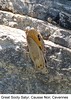
<< Our Photo Pages >> Balmarelesse Dolmen - Burial Chamber or Dolmen in France in Languedoc:Gard (30)
Submitted by TheCaptain on Saturday, 16 April 2005 Page Views: 2932
Neolithic and Bronze AgeSite Name: Balmarelesse Dolmen Alternative Name: Tombeau du Géant, Dolmen dit le Tombeau du GéantCountry: France Département: Languedoc:Gard (30) Type: Burial Chamber or Dolmen
Nearest Town: Millau Nearest Village: Causse-Bégon
Latitude: 44.049626N Longitude: 3.347918E
Condition:
| 5 | Perfect |
| 4 | Almost Perfect |
| 3 | Reasonable but with some damage |
| 2 | Ruined but still recognisable as an ancient site |
| 1 | Pretty much destroyed, possibly visible as crop marks |
| 0 | No data. |
| -1 | Completely destroyed |
| 5 | Superb |
| 4 | Good |
| 3 | Ordinary |
| 2 | Not Good |
| 1 | Awful |
| 0 | No data. |
| 5 | Can be driven to, probably with disabled access |
| 4 | Short walk on a footpath |
| 3 | Requiring a bit more of a walk |
| 2 | A long walk |
| 1 | In the middle of nowhere, a nightmare to find |
| 0 | No data. |
| 5 | co-ordinates taken by GPS or official recorded co-ordinates |
| 4 | co-ordinates scaled from a detailed map |
| 3 | co-ordinates scaled from a bad map |
| 2 | co-ordinates of the nearest village |
| 1 | co-ordinates of the nearest town |
| 0 | no data |
Be the first person to rate this site - see the 'Contribute!' box in the right hand menu.
Internal Links:
External Links:
")
You may be viewing yesterday's version of this page. To see the most up to date information please register for a free account.
")
")
Do not use the above information on other web sites or publications without permission of the contributor.
Nearby Images from Flickr
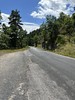
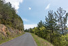
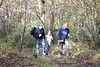
The above images may not be of the site on this page, but were taken nearby. They are loaded from Flickr so please click on them for image credits.
Click here to see more info for this site
Nearby sites
Click here to view sites on an interactive map of the areaKey: Red: member's photo, Blue: 3rd party photo, Yellow: other image, Green: no photo - please go there and take one, Grey: site destroyed
Download sites to:
KML (Google Earth)
GPX (GPS waypoints)
CSV (Garmin/Navman)
CSV (Excel)
To unlock full downloads you need to sign up as a Contributory Member. Otherwise downloads are limited to 50 sites.
Turn off the page maps and other distractions
Nearby sites listing. In the following links * = Image available
306m E 99° Plaine-des-Baldits menhir 1* Standing Stone (Menhir)
553m ENE 61° Plaine-des-Baldits menhir 2* Standing Stone (Menhir)
739m ENE 72° Barjac menhir 2* Standing Stone (Menhir)
1.1km N 351° Dolmen du Sot del Viala Burial Chamber or Dolmen
1.5km ENE 67° Dolmen de Barjac* Burial Chamber or Dolmen
1.5km ENE 61° Barjac menhir 1* Standing Stone (Menhir)
5.1km W 269° Dolmen des Cuns Burial Chamber or Dolmen
5.2km NE 52° Grotte du Pas-de-Joulié Cave or Rock Shelter
5.4km W 269° Dolmen du Baylet Burial Chamber or Dolmen
5.9km NW 309° Dolmen de Revens Burial Chamber or Dolmen
6.3km S 190° Dolmen de la Baurette 2 Burial Chamber or Dolmen
6.3km S 188° Dolmen de la Baurette 1 Burial Chamber or Dolmen
6.3km NW 321° Menhir du Triadou Standing Stone (Menhir)
7.3km S 179° Dolmen de Baume Sauclières Burial Chamber or Dolmen
8.2km W 265° Dolmen de Féneyret des Liquisses Burial Chamber or Dolmen
8.3km S 180° Dolmen du Roc del Fadat Burial Chamber or Dolmen
8.4km N 1° Dolmen des Pradines 3 Burial Chamber or Dolmen
8.5km N 357° Dolmen des Pradines 1 Burial Chamber or Dolmen
8.6km N 359° Dolmen des Pradines 2 Burial Chamber or Dolmen
8.7km N 350° Dolmen des Algas Burial Chamber or Dolmen
8.9km ESE 110° Saint-Guiral Petit Menhir* Standing Stone (Menhir)
8.9km ESE 110° Pèlerins Menhir* Standing Stone (Menhir)
9.0km ESE 110° Saint-Guiral Grand Menhir* Standing Stone (Menhir)
9.0km ESE 110° Dolmen de Saint-Guiral* Burial Chamber or Dolmen
9.3km SE 124° Menhir de Peyrelade (Sauclières)* Standing Stone (Menhir)
View more nearby sites and additional images


 We would like to know more about this location. Please feel free to add a brief description and any relevant information in your own language.
 Wir möchten mehr über diese Stätte erfahren. Bitte zögern Sie nicht, eine kurze Beschreibung und relevante Informationen in Deutsch hinzuzufügen.
 Nous aimerions en savoir encore un peu sur les lieux. S'il vous plaît n'hesitez pas à ajouter une courte description et tous les renseignements pertinents dans votre propre langue.
 Quisieramos informarnos un poco más de las lugares. No dude en añadir una breve descripción y otros datos relevantes en su propio idioma.