


<< Text Pages >> Menhir de la Pierre aux Prades - Standing Stone (Menhir) in France in Auvergne:Puy-de-Dôme (63)
Submitted by TheCaptain on Saturday, 16 April 2005 Page Views: 2862
Neolithic and Bronze AgeSite Name: Menhir de la Pierre aux Prades Alternative Name: Pierre des Prades, La Grosse FemmeCountry: France Département: Auvergne:Puy-de-Dôme (63) Type: Standing Stone (Menhir)
Nearest Town: Ambert Nearest Village: Saint-Germain-l'Herm
Latitude: 45.457993N Longitude: 3.509656E
Condition:
| 5 | Perfect |
| 4 | Almost Perfect |
| 3 | Reasonable but with some damage |
| 2 | Ruined but still recognisable as an ancient site |
| 1 | Pretty much destroyed, possibly visible as crop marks |
| 0 | No data. |
| -1 | Completely destroyed |
| 5 | Superb |
| 4 | Good |
| 3 | Ordinary |
| 2 | Not Good |
| 1 | Awful |
| 0 | No data. |
| 5 | Can be driven to, probably with disabled access |
| 4 | Short walk on a footpath |
| 3 | Requiring a bit more of a walk |
| 2 | A long walk |
| 1 | In the middle of nowhere, a nightmare to find |
| 0 | No data. |
| 5 | co-ordinates taken by GPS or official recorded co-ordinates |
| 4 | co-ordinates scaled from a detailed map |
| 3 | co-ordinates scaled from a bad map |
| 2 | co-ordinates of the nearest village |
| 1 | co-ordinates of the nearest town |
| 0 | no data |
Be the first person to rate this site - see the 'Contribute!' box in the right hand menu.
Internal Links:
External Links:
Menhir in Puy-de-Dôme
Location Source: T4T35
You may be viewing yesterday's version of this page. To see the most up to date information please register for a free account.
Do not use the above information on other web sites or publications without permission of the contributor.
Nearby Images from Flickr
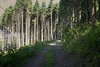
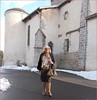
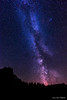

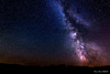
The above images may not be of the site on this page, but were taken nearby. They are loaded from Flickr so please click on them for image credits.
Click here to see more info for this site
Nearby sites
Click here to view sites on an interactive map of the areaKey: Red: member's photo, Blue: 3rd party photo, Yellow: other image, Green: no photo - please go there and take one, Grey: site destroyed
Download sites to:
KML (Google Earth)
GPX (GPS waypoints)
CSV (Garmin/Navman)
CSV (Excel)
To unlock full downloads you need to sign up as a Contributory Member. Otherwise downloads are limited to 50 sites.
Turn off the page maps and other distractions
Nearby sites listing. In the following links * = Image available
2.7km E 85° Petit monolithe discuté Standing Stone (Menhir)
9.1km NNE 33° Pierre du Lit* Natural Stone / Erratic / Other Natural Feature
9.1km NNE 32° Pierres Folles (Fournols)* Natural Stone / Erratic / Other Natural Feature
11.2km ENE 62° Pierre de Gargantua (Chambon-sur-Dolore) Rock Art
18.0km ENE 57° Pierre Couverte d'Ambert* Burial Chamber or Dolmen
20.1km ESE 114° Pierre Couverte (Chassouneyre) Burial Chamber or Dolmen
20.5km WNW 288° Dolmen de Loubaresse* Burial Chamber or Dolmen
21.1km W 270° Dolmen de Tablou Natural Stone / Erratic / Other Natural Feature
22.9km W 264° Collanges menhir Standing Stone (Menhir)
23.7km ESE 105° Triaille Dolmen Burial Chamber or Dolmen
24.0km SSW 194° Dolmen des Quatre Roches Burial Chamber or Dolmen
24.2km WSW 257° L'Usteau du Loup* Passage Grave
24.7km SSW 203° Védrines Dolmen Burial Chamber or Dolmen
25.3km W 274° Allée Couverte de Villeneuve Passage Grave
25.5km ESE 119° Dolmen des Fades* Burial Chamber or Dolmen
26.3km WNW 293° Grottes de Perrier* Cave or Rock Shelter
26.4km ESE 116° Pierre des Soeurs Standing Stone (Menhir)
26.6km ESE 117° Pierre Plantée des Fades* Standing Stone (Menhir)
27.9km NE 45° Dolmen de Pierre Cuberte* Burial Chamber or Dolmen
28.8km WNW 281° Colamine sous Vodable* Standing Stone (Menhir)
31.0km SW 229° Site archeologique de Chalet* Ancient Village or Settlement
31.1km SW 229° La Chassagne Menhir* Standing Stone (Menhir)
31.2km SE 133° Pierre à Cupules de Chadoir Rock Art
32.3km NNW 336° Pierre-aux-Fées Rock Art
33.0km WNW 288° Site archeologique du Chastel* Ancient Village or Settlement
View more nearby sites and additional images


 We would like to know more about this location. Please feel free to add a brief description and any relevant information in your own language.
 Wir möchten mehr über diese Stätte erfahren. Bitte zögern Sie nicht, eine kurze Beschreibung und relevante Informationen in Deutsch hinzuzufügen.
 Nous aimerions en savoir encore un peu sur les lieux. S'il vous plaît n'hesitez pas à ajouter une courte description et tous les renseignements pertinents dans votre propre langue.
 Quisieramos informarnos un poco más de las lugares. No dude en añadir una breve descripción y otros datos relevantes en su propio idioma.