


<< Our Photo Pages >> Dolmen dit de la Madeleine - Burial Chamber or Dolmen in France in Poitou:Charente (16)
Submitted by hewpop on Saturday, 16 April 2005 Page Views: 7025
Neolithic and Bronze AgeSite Name: Dolmen dit de la Madeleine Alternative Name: Pierre Madeleine, Dolmen de la Chapelle, Ste-Madeleine, Saint MadeleineCountry: France Département: Poitou:Charente (16) Type: Burial Chamber or Dolmen
Nearest Town: Poitiers Nearest Village: St-Germaine-de-Confo
Latitude: 46.045180N Longitude: 0.681090E
Condition:
| 5 | Perfect |
| 4 | Almost Perfect |
| 3 | Reasonable but with some damage |
| 2 | Ruined but still recognisable as an ancient site |
| 1 | Pretty much destroyed, possibly visible as crop marks |
| 0 | No data. |
| -1 | Completely destroyed |
| 5 | Superb |
| 4 | Good |
| 3 | Ordinary |
| 2 | Not Good |
| 1 | Awful |
| 0 | No data. |
| 5 | Can be driven to, probably with disabled access |
| 4 | Short walk on a footpath |
| 3 | Requiring a bit more of a walk |
| 2 | A long walk |
| 1 | In the middle of nowhere, a nightmare to find |
| 0 | No data. |
| 5 | co-ordinates taken by GPS or official recorded co-ordinates |
| 4 | co-ordinates scaled from a detailed map |
| 3 | co-ordinates scaled from a bad map |
| 2 | co-ordinates of the nearest village |
| 1 | co-ordinates of the nearest town |
| 0 | no data |
Be the first person to rate this site - see the 'Contribute!' box in the right hand menu.
Internal Links:
External Links:
I have visited· I would like to visit
oldman visited on 1st Sep 2018 - their rating: Access: 1 It would be truer to say we tried to visit this site. We did find someone who knew of its existence but the access is over a private bridge to the island. A boat might be useful. Not possible to get close enough on either side of the river to take a picture.
")
There is a picture of this dolmen, albeit called 'Dolmen de la Chapelle' in Glyn Daniel's book 'Megaliths in History', Thames and Hudson, 1972. Then it was surrounded by vegetation and trees and looked more romantic and mysterious. His caption reads :"The capstone was fourteen and a half feet long by twelve foot broad by three and a half feet thick, supported by columns of Romanesque design with twelfth-century capitals. The site was originally a single simple rectangular chamber: each pillar was inserted separately under the capstone and the site was translated into a Christian chapel. On the underside of the capstone you will find today two incised symbols - a cross and a hafted axe. Here indeed, in art and architecture, the elder faith and Christianity appear to be wedded."
You may be viewing yesterday's version of this page. To see the most up to date information please register for a free account.
")
")
Do not use the above information on other web sites or publications without permission of the contributor.
Nearby Images from Flickr
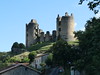
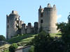
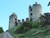
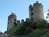

The above images may not be of the site on this page, but were taken nearby. They are loaded from Flickr so please click on them for image credits.
Click here to see more info for this site
Nearby sites
Click here to view sites on an interactive map of the areaKey: Red: member's photo, Blue: 3rd party photo, Yellow: other image, Green: no photo - please go there and take one, Grey: site destroyed
Download sites to:
KML (Google Earth)
GPX (GPS waypoints)
CSV (Garmin/Navman)
CSV (Excel)
To unlock full downloads you need to sign up as a Contributory Member. Otherwise downloads are limited to 50 sites.
Turn off the page maps and other distractions
Nearby sites listing. In the following links * = Image available
2.9km SSW 203° Dolmen de Confolens* Burial Chamber or Dolmen
4.3km SSE 163° Menhir Le Repaire* Standing Stone (Menhir)
10.3km NNW 347° Pierre-Fade Standing Stone (Menhir)
13.7km ENE 57° Dolmen des Grilleres Burial Chamber or Dolmen
16.7km SE 137° Menhirs La Vallade* Standing Stones
17.6km SSE 156° La Feculerie* Standing Stones
18.8km NE 44° Dolmen de Pierre-Levée (St Martial) Burial Chamber or Dolmen
20.0km WSW 251° Champagne-Mouton Oppidum Ancient Village or Settlement
20.7km N 350° Dolmen au Grand-Fâ Burial Chamber or Dolmen
22.0km ESE 106° Ceinturat Menhir 2 Standing Stone (Menhir)
22.2km ESE 106° Ceinturat Menhir* Standing Stone (Menhir)
22.8km ESE 103° Pierre à Sacrifice de Cieux* Rock Outcrop
23.0km ESE 109° Rouffignac Dolmen* Burial Chamber or Dolmen
23.6km NNW 333° Villaigue Dolmen 2* Burial Chamber or Dolmen
23.7km NNW 333° Villaigue Dolmen 1* Burial Chamber or Dolmen
23.8km ESE 108° Pierre a Cupules (Arnac)* Standing Stone (Menhir)
23.9km E 91° Menhir de Rousseix Standing Stone (Menhir)
24.9km ESE 106° Grotte dite le Rocher des Fées (Cieux)* Cave or Rock Shelter
25.6km ESE 113° Menhir de la Valette Standing Stone (Menhir)
25.7km E 94° Dolmen de Puychaud* Burial Chamber or Dolmen
25.8km E 101° Pierre Branlante de Boscartus* Natural Stone / Erratic / Other Natural Feature
25.8km E 94° Les Rochers de Puychaud* Rock Outcrop
25.9km E 90° Menhir de Combe Libert Standing Stone (Menhir)
26.0km E 90° Menhir de Ruilleres Standing Stone (Menhir)
26.3km ESE 110° Menhir du Pic* Standing Stone (Menhir)
View more nearby sites and additional images


 We would like to know more about this location. Please feel free to add a brief description and any relevant information in your own language.
 Wir möchten mehr über diese Stätte erfahren. Bitte zögern Sie nicht, eine kurze Beschreibung und relevante Informationen in Deutsch hinzuzufügen.
 Nous aimerions en savoir encore un peu sur les lieux. S'il vous plaît n'hesitez pas à ajouter une courte description et tous les renseignements pertinents dans votre propre langue.
 Quisieramos informarnos un poco más de las lugares. No dude en añadir una breve descripción y otros datos relevantes en su propio idioma.