


<< Our Photo Pages >> Ballygilbert - Standing Stone (Menhir) in Ireland (Northern) in Co. Antrim
Submitted by Anthony_Weir on Thursday, 06 May 2021 Page Views:
Neolithic and Bronze AgeSite Name: Ballygilbert Alternative Name: CloughoganCountry: Ireland (Northern) County: Co. Antrim Type: Standing Stone (Menhir)
Nearest Town: Larne Nearest Village: Glenarm
Map Ref: D334104
Discoverer Map Number: D9
Latitude: 54.923389N Longitude: 5.920066W
Condition:
| 5 | Perfect |
| 4 | Almost Perfect |
| 3 | Reasonable but with some damage |
| 2 | Ruined but still recognisable as an ancient site |
| 1 | Pretty much destroyed, possibly visible as crop marks |
| 0 | No data. |
| -1 | Completely destroyed |
| 5 | Superb |
| 4 | Good |
| 3 | Ordinary |
| 2 | Not Good |
| 1 | Awful |
| 0 | No data. |
| 5 | Can be driven to, probably with disabled access |
| 4 | Short walk on a footpath |
| 3 | Requiring a bit more of a walk |
| 2 | A long walk |
| 1 | In the middle of nowhere, a nightmare to find |
| 0 | No data. |
| 5 | co-ordinates taken by GPS or official recorded co-ordinates |
| 4 | co-ordinates scaled from a detailed map |
| 3 | co-ordinates scaled from a bad map |
| 2 | co-ordinates of the nearest village |
| 1 | co-ordinates of the nearest town |
| 0 | no data |
Internal Links:
External Links:
I have visited· I would like to visit
jimsouthstand would like to visit
")
3.8 km WNW in Goakstown, half-way up and to the left of a farm-lane running E of the Carncastle-Glenarm road is a well-preserved wedge-tomb (D 316107) which still retains over 25 stones of its kerb, some of its cairn, and one large roofstone. A slab about 120 cms high broken – probably intentionally – at one corner, divides the rectangular portico from the main chamber.
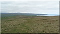
Note: Fourteen 150m tall wind turbines are planned for the ridge of Scawt Hill close to this standing stone and other sites in the area, details in the comments on our page.
You may be viewing yesterday's version of this page. To see the most up to date information please register for a free account.
Do not use the above information on other web sites or publications without permission of the contributor.
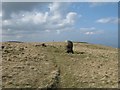
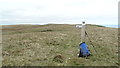
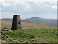
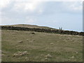
Nearby Images from Geograph Britain and Ireland:
©2008(licence)
©2016(licence)
©2008(licence)
©2008(licence)
©2016(licence)
The above images may not be of the site on this page, they are loaded from Geograph.
Please Submit an Image of this site or go out and take one for us!
Click here to see more info for this site
Nearby sites
Click here to view sites on an interactive map of the areaKey: Red: member's photo, Blue: 3rd party photo, Yellow: other image, Green: no photo - please go there and take one, Grey: site destroyed
Download sites to:
KML (Google Earth)
GPX (GPS waypoints)
CSV (Garmin/Navman)
CSV (Excel)
To unlock full downloads you need to sign up as a Contributory Member. Otherwise downloads are limited to 50 sites.
Turn off the page maps and other distractions
Nearby sites listing. In the following links * = Image available
1.8km WNW 285° Goakstown* Wedge Tomb
1.9km W 276° Deer Park Farms* Standing Stone (Menhir) (NW470661)
2.6km SSW 205° Dunteige* Wedge Tomb (D32350798)
3.0km S 185° Linford Round Cairn Round Cairn
3.2km S 185° Linford Barrows* Artificial Mound (D33230723)
3.8km S 171° Knockdhu* Promontory Fort / Cliff Castle (NW493620)
6.1km S 179° Larne Standing Stone* Standing Stone (Menhir)
7.8km W 276° Antynanum* Court Tomb (D25561094)
8.2km SE 144° Ballycraigy Stone Circle (D384039)
8.8km W 268° Tamybuck Wedge Tomb* Wedge Tomb (NW401660)
10.2km SE 141° Larne Museum and Arts Centre* Museum (D401027)
10.4km WNW 284° Ticloy* Portal Tomb (D232127)
12.6km S 169° Ballrickard More Stone Circle (J362981)
13.0km SE 134° Ballylumford Dolmen* Burial Chamber or Dolmen (D4305201603)
13.1km S 184° Carndoo* Court Tomb (J32849731)
14.5km S 175° Tureagh Stone Circle (J350960)
14.7km NNW 344° Galboly Upper* Passage Grave (D2900724454)
15.1km NNW 346° Galboly Lower* Passage Grave
16.5km NNW 329° Cross-Carved Stone and Children's Burial Ground* Early Christian Sculptured Stone (NW411803)
18.2km WSW 255° St. Patrick's Stone* Standing Stone (Menhir) (NW310621)
20.5km WNW 286° Two Standing Stones in Lisnamanny* Standing Stones (D1345015470)
20.8km WNW 284° Lisnamanny Stone Circle Stone Circle (D130150)
21.0km WNW 287° Lisnamanny Standing Stone* Standing Stone (Menhir) (D1305015860)
21.1km WSW 248° Ballymarlagh* Court Tomb (D14040175)
21.4km WNW 288° Standing Stone (Skerry West)* Standing Stone (Menhir) (NW289735)
View more nearby sites and additional images
<< Oughtihery Burial Ground, Ogham Stones, Souterrain and Ecclesiastical Enclosure


 We would like to know more about this location. Please feel free to add a brief description and any relevant information in your own language.
 Wir möchten mehr über diese Stätte erfahren. Bitte zögern Sie nicht, eine kurze Beschreibung und relevante Informationen in Deutsch hinzuzufügen.
 Nous aimerions en savoir encore un peu sur les lieux. S'il vous plaît n'hesitez pas à ajouter une courte description et tous les renseignements pertinents dans votre propre langue.
 Quisieramos informarnos un poco más de las lugares. No dude en añadir una breve descripción y otros datos relevantes en su propio idioma.