


<< Our Photo Pages >> Baltinglass - Passage Grave in Ireland (Republic of) in Co. Wicklow
Submitted by Anthony_Weir on Sunday, 13 October 2002 Page Views:
Neolithic and Bronze AgeSite Name: BaltinglassCountry: Ireland (Republic of) County: Co. Wicklow Type: Passage Grave
Nearest Town: Baltinglass Nearest Village: Coolinarrig Upper
Map Ref: S8855289249
Discovery Map Number: D61
Latitude: 52.947056N Longitude: 6.68339W
Condition:
| 5 | Perfect |
| 4 | Almost Perfect |
| 3 | Reasonable but with some damage |
| 2 | Ruined but still recognisable as an ancient site |
| 1 | Pretty much destroyed, possibly visible as crop marks |
| 0 | No data. |
| -1 | Completely destroyed |
| 5 | Superb |
| 4 | Good |
| 3 | Ordinary |
| 2 | Not Good |
| 1 | Awful |
| 0 | No data. |
| 5 | Can be driven to, probably with disabled access |
| 4 | Short walk on a footpath |
| 3 | Requiring a bit more of a walk |
| 2 | A long walk |
| 1 | In the middle of nowhere, a nightmare to find |
| 0 | No data. |
| 5 | co-ordinates taken by GPS or official recorded co-ordinates |
| 4 | co-ordinates scaled from a detailed map |
| 3 | co-ordinates scaled from a bad map |
| 2 | co-ordinates of the nearest village |
| 1 | co-ordinates of the nearest town |
| 0 | no data |
Internal Links:
External Links:
I have visited· I would like to visit
rrmoser would like to visit
X-Ice visited - their rating: Cond: 3 Amb: 4 Access: 3
")
On the top of Baltinglass Hill, approached from a narrow by-road to the NE of the hill, this large complex has a massive surrounding wall – which is modern. A large cairn some 27 metres in diameter, robbed for wall-building, still retains most of its internal features. There is a beehive-shaped chamber which the excavator considered contemporary with Tomb I (largely overlaid by Tomb II, a central chamber surrounded by 5 side-chambers, whose gallery is overlaid by Tomb III), and a ruined kist which is at least as recent as Tomb III.
~ 4.8 km S by E of Baltinglass village, in Broughillstown, to the N of Broughillstown House and 80 metres E of the main road to Tullow. is a grooved standing-stone 1.5 metres high, which, like that at Ardristan, belongs to the Carlow-Wicklow-Kildare group.
~ 7.2 km ESE of Baltinglass village , in front of Humewood Castle, is a prostrate stone 1.5 metres long, decorated with cup-and-ring designs.
~ 7.5 km NE of Baltinglass village is Castleruddery stone circle.
~ 15.5 km NNE of Baltinglass village is Athgreany stone circle.
You may be viewing yesterday's version of this page. To see the most up to date information please register for a free account.
")
")
")
")
Do not use the above information on other web sites or publications without permission of the contributor.
Nearby Images from Geograph Britain and Ireland:
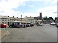
©2006(licence)
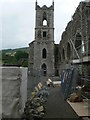
©2020(licence)
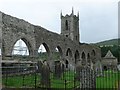
©2020(licence)
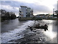
©2010(licence)
The above images may not be of the site on this page, they are loaded from Geograph.
Please Submit an Image of this site or go out and take one for us!
Click here to see more info for this site
Nearby sites
Click here to view sites on an interactive map of the areaKey: Red: member's photo, Blue: 3rd party photo, Yellow: other image, Green: no photo - please go there and take one, Grey: site destroyed
Download sites to:
KML (Google Earth)
GPX (GPS waypoints)
CSV (Garmin/Navman)
CSV (Excel)
To unlock full downloads you need to sign up as a Contributory Member. Otherwise downloads are limited to 50 sites.
Turn off the page maps and other distractions
Nearby sites listing. In the following links * = Image available
3.4km E 94° Gates Of Heaven Burial Chamber or Dolmen
4.9km E 91° Boleycarrigeen* Stone Circle
5.8km NNE 32° Castleruddery* Stone Circle (S9159394210)
5.9km NE 43° Castleruddery Stone Row / Alignment (S925937)
10.2km WNW 291° Moone High Cross* Ancient Cross (S7891192693)
10.9km N 353° Tournant Stone Circle (N870000)
10.9km WSW 248° Castledermot High Crosses* Ancient Cross
11.2km ENE 61° The Long Stone (Knickeen)* Standing Stone (Menhir) (S983948)
11.4km S 173° Haroldstown* Portal Tomb (S90087793)
13.1km NNW 338° Brewel Hill Stone Circle (N833013)
14.6km NNE 19° Athgreany* Stone Circle (N930032)
15.4km SSE 150° Clonmore* Ancient Cross
15.4km NNW 339° Kilgowan* Standing Stone (Menhir)
16.2km S 175° Rathgall Hill Fort* Hillfort (S90227315)
16.3km S 176° Rathgall Destroyed Stone Circle Stone Circle (S900730)
18.0km NNE 14° Whiteleas Stone Circle
18.0km SW 228° Browne’s Hill* Portal Tomb (S7538476873)
18.4km SSW 195° Ardristan* Standing Stone (Menhir) (S8413871337)
18.6km NNW 344° Old Kilcullen High Cross Ancient Cross
18.9km NNE 14° Broadleas* Stone Circle (N9292507609)
19.7km NNW 342° Knockaulin Timber Circle (N820078)
23.5km ENE 74° Glendalough settlement and pilgrim cross* Ancient Village or Settlement
25.2km ENE 73° The Glendalough Cross and Deer Stone* Early Christian Sculptured Stone (T126969)
25.2km NNE 21° Blessington Desmesne Stone Circle (N9713)
26.5km NW 325° St Brigid's Holy Well Kildare* Holy Well or Sacred Spring (N73061080)
View more nearby sites and additional images


 We would like to know more about this location. Please feel free to add a brief description and any relevant information in your own language.
 Wir möchten mehr über diese Stätte erfahren. Bitte zögern Sie nicht, eine kurze Beschreibung und relevante Informationen in Deutsch hinzuzufügen.
 Nous aimerions en savoir encore un peu sur les lieux. S'il vous plaît n'hesitez pas à ajouter une courte description et tous les renseignements pertinents dans votre propre langue.
 Quisieramos informarnos un poco más de las lugares. No dude en añadir una breve descripción y otros datos relevantes en su propio idioma.