


<< Text Pages >> Bill Hill (Somerset) - Standing Stones in England in Somerset
Submitted by vicky on Sunday, 22 December 2002 Page Views: 5204
Neolithic and Bronze AgeSite Name: Bill Hill (Somerset)Country: England County: Somerset Type: Standing Stones
Map Ref: SS723408 Landranger Map Number: 180
Latitude: 51.152168N Longitude: 3.827247W
Condition:
| 5 | Perfect |
| 4 | Almost Perfect |
| 3 | Reasonable but with some damage |
| 2 | Ruined but still recognisable as an ancient site |
| 1 | Pretty much destroyed, possibly visible as crop marks |
| 0 | No data. |
| -1 | Completely destroyed |
| 5 | Superb |
| 4 | Good |
| 3 | Ordinary |
| 2 | Not Good |
| 1 | Awful |
| 0 | No data. |
| 5 | Can be driven to, probably with disabled access |
| 4 | Short walk on a footpath |
| 3 | Requiring a bit more of a walk |
| 2 | A long walk |
| 1 | In the middle of nowhere, a nightmare to find |
| 0 | No data. |
| 5 | co-ordinates taken by GPS or official recorded co-ordinates |
| 4 | co-ordinates scaled from a detailed map |
| 3 | co-ordinates scaled from a bad map |
| 2 | co-ordinates of the nearest village |
| 1 | co-ordinates of the nearest town |
| 0 | no data |
Internal Links:
External Links:
Pair of Standing Stones in Somerset
Have you visited this site? Please add a comment below.
You may be viewing yesterday's version of this page. To see the most up to date information please register for a free account.
Do not use the above information on other web sites or publications without permission of the contributor.
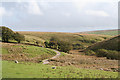
Nearby Images from Geograph Britain and Ireland:
©2007(licence)
©2007(licence)
©2013(licence)
©2018(licence)
©2005(licence)
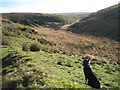
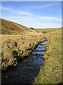
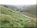
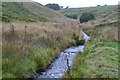
The above images may not be of the site on this page, they are loaded from Geograph.
Please Submit an Image of this site or go out and take one for us!
Click here to see more info for this site
Nearby sites
Key: Red: member's photo, Blue: 3rd party photo, Yellow: other image, Green: no photo - please go there and take one, Grey: site destroyed
Download sites to:
KML (Google Earth)
GPX (GPS waypoints)
CSV (Garmin/Navman)
CSV (Excel)
To unlock full downloads you need to sign up as a Contributory Member. Otherwise downloads are limited to 50 sites.
![]()
Turn off the page maps and other distractions
Nearby sites listing. In the following links * = Image available
999m SW 215° Rooshitchen Standing Stones (SS717400)
1.1km SSE 168° Brayford NW Standing Stones (SS725397)
1.6km NE 45° Chains Barrow* Round Barrow(s) (SS73464190)
1.7km NNW 330° Woodbarrow Stone Setting* Multiple Stone Rows / Avenue (SS71474233)
1.8km NNW 336° Woodbarrow (Exmoor)* Round Barrow(s) (SS716425)
2.2km NNW 337° Woodbarrow Hangings* Multiple Stone Rows / Avenue (SS71514283)
2.3km NW 317° Longstone Barrow Row* Stone Row / Alignment (SS70774252)
2.3km ENE 58° Long Chains Coombe SW Standing Stones (SS743420)
2.4km SW 234° Shoulsbury Common Stone Row* Stone Row / Alignment (SS7035739444)
2.4km SW 224° Shoulsbury Castle* Hillfort (SS706391)
2.6km NW 320° Longstone Barrow* Round Barrow(s) (SS707428)
2.7km NE 54° Long Chains Coombe NE Multiple Stone Rows / Avenue (SS745423)
2.7km N 9° Benjamy* Stone Row / Alignment (SS72804344)
2.7km S 173° Setta Barrow* Round Barrow(s) (SS7255738068)
2.8km ENE 68° Chains Valley* Stone Row / Alignment (SS7491541775)
2.9km NW 320° Longstone (Challacombe)* Standing Stone (Menhir) (SS70514307)
2.9km S 173° Brayford SE Multiple Stone Rows / Avenue (SS72573791)
3.0km N 358° Winnaway* Stone Row / Alignment (SS72264376)
3.0km SSE 148° Squallacombe Centre* Multiple Stone Rows / Avenue (SS73813822)
3.0km SSE 147° Squallacombe NE Standing Stones (SS739382)
3.2km NNW 340° Thornworthy Little Common* Stone Row / Alignment (SS71264381)
3.2km NE 54° Hoaroak stones* Standing Stones (SS74984263)
3.3km NW 315° Chapman Down Barrow* Round Barrow(s) (SS700432)
3.3km NNE 20° Furzehill Common 1* Stone Row / Alignment (SS7351843922)
3.4km N 8° Warcombe Water stone* Standing Stone (Menhir) (SS72854417)
View more nearby sites and additional images


 We would like to know more about this location. Please feel free to add a brief description and any relevant information in your own language.
 Wir möchten mehr über diese Stätte erfahren. Bitte zögern Sie nicht, eine kurze Beschreibung und relevante Informationen in Deutsch hinzuzufügen.
 Nous aimerions en savoir encore un peu sur les lieux. S'il vous plaît n'hesitez pas à ajouter une courte description et tous les renseignements pertinents dans votre propre langue.
 Quisieramos informarnos un poco más de las lugares. No dude en añadir una breve descripción y otros datos relevantes en su propio idioma.