

<< Our Photo Pages >> Stèle and menhir de la Chapelle de Larret - Standing Stones in France in Bretagne:Finistère (29)
Submitted by regina on Saturday, 12 October 2019 Page Views: 708
Neolithic and Bronze AgeSite Name: Stèle and menhir de la Chapelle de LarretCountry: France Département: Bretagne:Finistère (29) Type: Standing Stones
Nearest Town: Brest Nearest Village: Porspoder
Latitude: 48.504660N Longitude: 4.73371W
Condition:
| 5 | Perfect |
| 4 | Almost Perfect |
| 3 | Reasonable but with some damage |
| 2 | Ruined but still recognisable as an ancient site |
| 1 | Pretty much destroyed, possibly visible as crop marks |
| 0 | No data. |
| -1 | Completely destroyed |
| 5 | Superb |
| 4 | Good |
| 3 | Ordinary |
| 2 | Not Good |
| 1 | Awful |
| 0 | No data. |
| 5 | Can be driven to, probably with disabled access |
| 4 | Short walk on a footpath |
| 3 | Requiring a bit more of a walk |
| 2 | A long walk |
| 1 | In the middle of nowhere, a nightmare to find |
| 0 | No data. |
| 5 | co-ordinates taken by GPS or official recorded co-ordinates |
| 4 | co-ordinates scaled from a detailed map |
| 3 | co-ordinates scaled from a bad map |
| 2 | co-ordinates of the nearest village |
| 1 | co-ordinates of the nearest town |
| 0 | no data |
Internal Links:
External Links:
")
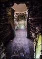
Christianized stele in front of the chapel.
To the right of the hydrangea hedge is also a menhir.
You may be viewing yesterday's version of this page. To see the most up to date information please register for a free account.
")
")
")
")
")
")
Do not use the above information on other web sites or publications without permission of the contributor.
Click here to see more info for this site
Nearby sites
Click here to view sites on an interactive map of the areaKey: Red: member's photo, Blue: 3rd party photo, Yellow: other image, Green: no photo - please go there and take one, Grey: site destroyed
Download sites to:
KML (Google Earth)
GPX (GPS waypoints)
CSV (Garmin/Navman)
CSV (Excel)
To unlock full downloads you need to sign up as a Contributory Member. Otherwise downloads are limited to 50 sites.
Turn off the page maps and other distractions
Nearby sites listing. In the following links * = Image available
1.3km WNW 299° Menhir de Kerhouézel* Standing Stone (Menhir)
1.4km N 0° Menhir de Kerveleoc Standing Stone (Menhir)
1.4km SSE 153° Kergadiou Menhirs* Standing Stones
1.5km WNW 294° Menhir de Prat Bihan* Standing Stone (Menhir)
1.5km NNW 336° Menhirs de Kerguiabo* Standing Stones
1.5km WSW 238° Saint-Denec Alignement de Menhirs* Stone Row / Alignment
1.6km NNE 21° Saint-Gonvarc'h menhir* Standing Stone (Menhir)
2.2km WSW 240° Menhir de Calès Standing Stone (Menhir)
2.2km W 279° Cupules du Spernoc Rock Art
2.2km SSW 212° Dolmen de Poulliot* Burial Chamber or Dolmen
2.2km WSW 250° Kerivoret Menhir* Standing Stone (Menhir)
2.3km WSW 250° Kerivoret Dolmen* Burial Chamber or Dolmen
2.3km SW 232° Traonigou alignement de menhirs* Stone Row / Alignment
2.4km SSW 204° Mezdoun menhirs* Standing Stones
2.4km SW 233° Allee Couverte De Traonigou* Chambered Tomb
2.5km SW 228° Dolmen de Lannidult* Burial Chamber or Dolmen
2.9km W 272° Dolmen de la Pointe du Dreff* Burial Chamber or Dolmen
2.9km WSW 254° Dolmen de Kerizella* Burial Chamber or Dolmen
3.1km NE 52° Menhir De Kerougana* Standing Stone (Menhir)
3.1km WNW 292° Parc-ar-Varret menhirs* Standing Stones
3.2km NNW 339° Menhir de Penfoul* Standing Stone (Menhir)
3.2km NNW 343° Dolmen de Penn-al-Lann Burial Chamber or Dolmen
3.3km WNW 295° Dolmen de Beg-ar-Vir* Burial Chamber or Dolmen
3.3km NW 325° Dolmen de Men-Milliget* Burial Chamber or Dolmen
3.3km NNW 342° Menhir de Penquer* Standing Stone (Menhir)
View more nearby sites and additional images


 We would like to know more about this location. Please feel free to add a brief description and any relevant information in your own language.
 Wir möchten mehr über diese Stätte erfahren. Bitte zögern Sie nicht, eine kurze Beschreibung und relevante Informationen in Deutsch hinzuzufügen.
 Nous aimerions en savoir encore un peu sur les lieux. S'il vous plaît n'hesitez pas à ajouter une courte description et tous les renseignements pertinents dans votre propre langue.
 Quisieramos informarnos un poco más de las lugares. No dude en añadir una breve descripción y otros datos relevantes en su propio idioma.