


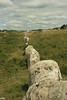
<< Our Photo Pages >> Le Menhir Isole du Manio - Standing Stone (Menhir) in France in Bretagne:Morbihan (56)
Submitted by karolus on Wednesday, 09 January 2019 Page Views: 893
Neolithic and Bronze AgeSite Name: Le Menhir Isole du ManioCountry: France Département: Bretagne:Morbihan (56) Type: Standing Stone (Menhir)
Nearest Town: Trinite Sur Mer Nearest Village: Kerlescan
Latitude: 47.602580N Longitude: 3.05331W
Condition:
| 5 | Perfect |
| 4 | Almost Perfect |
| 3 | Reasonable but with some damage |
| 2 | Ruined but still recognisable as an ancient site |
| 1 | Pretty much destroyed, possibly visible as crop marks |
| 0 | No data. |
| -1 | Completely destroyed |
| 5 | Superb |
| 4 | Good |
| 3 | Ordinary |
| 2 | Not Good |
| 1 | Awful |
| 0 | No data. |
| 5 | Can be driven to, probably with disabled access |
| 4 | Short walk on a footpath |
| 3 | Requiring a bit more of a walk |
| 2 | A long walk |
| 1 | In the middle of nowhere, a nightmare to find |
| 0 | No data. |
| 5 | co-ordinates taken by GPS or official recorded co-ordinates |
| 4 | co-ordinates scaled from a detailed map |
| 3 | co-ordinates scaled from a bad map |
| 2 | co-ordinates of the nearest village |
| 1 | co-ordinates of the nearest town |
| 0 | no data |
Internal Links:
External Links:
")
It is quite a large stone and creates precise geometrical triangles (3:4:5 & 30 degrees) between the Geant du Manio menhir and Le Manio II Menhir. I've called it the Menhir Isole as that's what Howard Crowhurst names it in one of his books, who also discovered it's significance.
You may be viewing yesterday's version of this page. To see the most up to date information please register for a free account.
Do not use the above information on other web sites or publications without permission of the contributor.
Nearby Images from Flickr
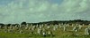
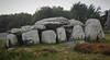
The above images may not be of the site on this page, but were taken nearby. They are loaded from Flickr so please click on them for image credits.
Click here to see more info for this site
Nearby sites
Click here to view sites on an interactive map of the areaKey: Red: member's photo, Blue: 3rd party photo, Yellow: other image, Green: no photo - please go there and take one, Grey: site destroyed
Download sites to:
KML (Google Earth)
GPX (GPS waypoints)
CSV (Garmin/Navman)
CSV (Excel)
To unlock full downloads you need to sign up as a Contributory Member. Otherwise downloads are limited to 50 sites.
Turn off the page maps and other distractions
Nearby sites listing. In the following links * = Image available
106m SE 140° Dolmen du Manio* Burial Chamber or Dolmen
237m WNW 302° Geant du Manio* Standing Stone (Menhir)
242m WNW 294° La Pierre Carree* Standing Stone (Menhir)
248m NE 40° Kerlescan cromlech* Stone Circle
266m WNW 295° La Dame Du Manio* Standing Stone (Menhir)
281m WNW 302° Le Quadrilatere* Passage Grave
285m SW 232° Alignement de Kerloquet* Multiple Stone Rows / Avenue
316m NNE 32° Kerlescan Tertre and menhir* Standing Stone (Menhir)
345m NE 52° Kerlescan Alignements* Multiple Stone Rows / Avenue
358m W 260° Tertre du Manio Chambered Tomb
395m NNE 25° Kerlescan North Cromlech* Stone Circle
567m NE 47° Kerlescan nord allée couverte* Passage Grave
644m NE 35° Menhir de Kerlescan 2 Standing Stone (Menhir)
703m N 6° Menhirs de Parc er Manio Stone Row / Alignment
743m NE 37° Menhir de Kerlescan 1* Standing Stone (Menhir)
764m S 186° Kercado Tumulus* Chambered Tomb
874m N 354° Moustoir Champ de Menhirs* Standing Stones
892m W 271° Dolmen de Rosnual* Burial Chamber or Dolmen
993m WNW 299° Moustoir sud menhir Standing Stone (Menhir)
1.0km ENE 77° Le Petit Ménec* Multiple Stone Rows / Avenue
1.1km ESE 119° Kermarquer Dolmen* Burial Chamber or Dolmen
1.2km NNW 332° Moustoir tumulus* Chambered Tomb
1.2km SW 235° Kermario Alignements* Multiple Stone Rows / Avenue
1.2km NNW 330° Moustoir menhir* Standing Stone (Menhir)
1.2km NNW 334° Menhir du tumulus du Moustoir* Standing Stone (Menhir)
View more nearby sites and additional images


 We would like to know more about this location. Please feel free to add a brief description and any relevant information in your own language.
 Wir möchten mehr über diese Stätte erfahren. Bitte zögern Sie nicht, eine kurze Beschreibung und relevante Informationen in Deutsch hinzuzufügen.
 Nous aimerions en savoir encore un peu sur les lieux. S'il vous plaît n'hesitez pas à ajouter une courte description et tous les renseignements pertinents dans votre propre langue.
 Quisieramos informarnos un poco más de las lugares. No dude en añadir una breve descripción y otros datos relevantes en su propio idioma.