


<< Our Photo Pages >> Stèle de Louannec - Standing Stone (Menhir) in France in Bretagne:Côtes-D'Armor (22)
Submitted by regina on Monday, 01 October 2018 Page Views: 863
Neolithic and Bronze AgeSite Name: Stèle de LouannecCountry: France Département: Bretagne:Côtes-D'Armor (22) Type: Standing Stone (Menhir)
Nearest Town: Lannion Nearest Village: Louannec
Latitude: 48.794960N Longitude: 3.41132W
Condition:
| 5 | Perfect |
| 4 | Almost Perfect |
| 3 | Reasonable but with some damage |
| 2 | Ruined but still recognisable as an ancient site |
| 1 | Pretty much destroyed, possibly visible as crop marks |
| 0 | No data. |
| -1 | Completely destroyed |
| 5 | Superb |
| 4 | Good |
| 3 | Ordinary |
| 2 | Not Good |
| 1 | Awful |
| 0 | No data. |
| 5 | Can be driven to, probably with disabled access |
| 4 | Short walk on a footpath |
| 3 | Requiring a bit more of a walk |
| 2 | A long walk |
| 1 | In the middle of nowhere, a nightmare to find |
| 0 | No data. |
| 5 | co-ordinates taken by GPS or official recorded co-ordinates |
| 4 | co-ordinates scaled from a detailed map |
| 3 | co-ordinates scaled from a bad map |
| 2 | co-ordinates of the nearest village |
| 1 | co-ordinates of the nearest town |
| 0 | no data |
Internal Links:
External Links:
")
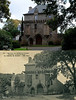
Celtic stèle behind the church in Louannec.
You may be viewing yesterday's version of this page. To see the most up to date information please register for a free account.
")
Do not use the above information on other web sites or publications without permission of the contributor.
Nearby Images from Flickr
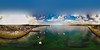
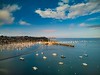
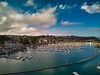
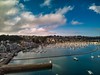
The above images may not be of the site on this page, but were taken nearby. They are loaded from Flickr so please click on them for image credits.
Click here to see more info for this site
Nearby sites
Click here to view sites on an interactive map of the areaKey: Red: member's photo, Blue: 3rd party photo, Yellow: other image, Green: no photo - please go there and take one, Grey: site destroyed
Download sites to:
KML (Google Earth)
GPX (GPS waypoints)
CSV (Garmin/Navman)
CSV (Excel)
To unlock full downloads you need to sign up as a Contributory Member. Otherwise downloads are limited to 50 sites.
Turn off the page maps and other distractions
Nearby sites listing. In the following links * = Image available
2.8km SSW 202° Dolmen dit le Lit de Saint-Yves* Burial Chamber or Dolmen
3.6km SW 223° Crec'h Quillé* Passage Grave
4.9km E 79° Coat Mez allée couverte* Passage Grave
5.9km ESE 107° Menhir du Run* Standing Stone (Menhir)
6.4km W 277° Trémarche menhir* Standing Stone (Menhir)
6.7km W 269° Lit de Saint-Samson* Natural Stone / Erratic / Other Natural Feature
6.9km NW 307° Oratoire de St Guirec* Ancient Temple
7.0km NW 312° Rochers de Ploumanac'h* Natural Stone / Erratic / Other Natural Feature
7.2km W 271° St Samson Chapel well* Holy Well or Sacred Spring
7.2km W 270° Menhir a Vertu* Standing Stone (Menhir)
7.6km E 90° Tossen-Keler Tumulus* Chambered Tomb
7.6km ENE 66° Menhir de Kergastel* Standing Stone (Menhir)
8.1km WNW 283° Kerguntuil allée couverte* Passage Grave
8.1km NW 305° Ty-Lia (Ile Renote)* Passage Grave
8.1km WNW 284° Kerguntuil Dolmen* Burial Chamber or Dolmen
8.1km WNW 296° Menhir de Keredol* Standing Stone (Menhir)
8.1km ENE 74° Menhir de Kerbriand* Standing Stone (Menhir)
8.6km ENE 65° Menhir de Kervéniou* Standing Stone (Menhir)
8.6km WNW 299° Roche tremblante (Trégastel)* Rock Outcrop
8.6km WNW 282° Menhir du Guern* Standing Stone (Menhir)
8.7km WNW 301° La Tête de Mort* Natural Stone / Erratic / Other Natural Feature
8.7km ENE 71° Menhir de Kermarker* Standing Stone (Menhir)
8.8km WNW 300° Roche tremblante (Cos Porz)* Rock Outcrop
8.8km WNW 296° Le Roi Gradlon* Rock Outcrop
8.8km WNW 281° Menhir du Cleguer Standing Stone (Menhir)
View more nearby sites and additional images


 We would like to know more about this location. Please feel free to add a brief description and any relevant information in your own language.
 Wir möchten mehr über diese Stätte erfahren. Bitte zögern Sie nicht, eine kurze Beschreibung und relevante Informationen in Deutsch hinzuzufügen.
 Nous aimerions en savoir encore un peu sur les lieux. S'il vous plaît n'hesitez pas à ajouter une courte description et tous les renseignements pertinents dans votre propre langue.
 Quisieramos informarnos un poco más de las lugares. No dude en añadir una breve descripción y otros datos relevantes en su propio idioma.