Featured: Friendly specialist tours to ancient, mystical and historical sites in the UK and beyond

Friendly specialist tours to ancient, mystical and historical sites in the UK and beyond

The Archaeology of People: Dimensions of Neolithic Life, Whittle

The Archaeology of People: Dimensions of Neolithic Life, Whittle

Who's Online

There are currently, 299 guests and 2 members online.

You are a guest. To join in, please register for free by clicking here

Sponsors

<< Our Photo Pages >> Brent Knoll Camp - Hillfort in England in Somerset

Submitted by TheCaptain on Saturday, 27 November 2004  Page Views: 26289

Iron Age and Later PrehistorySite Name: Brent Knoll Camp
Country: England County: Somerset Type: Hillfort
Nearest Town: Burnham-on-Sea  Nearest Village: East Brent
Map Ref: ST34115097  Landranger Map Number: 182
Latitude: 51.254072N  Longitude: 2.945541W
Condition:
5Perfect
4Almost Perfect
3Reasonable but with some damage
2Ruined but still recognisable as an ancient site
1Pretty much destroyed, possibly visible as crop marks
0No data.
-1Completely destroyed
4 Ambience:
5Superb
4Good
3Ordinary
2Not Good
1Awful
0No data.
4 Access:
5Can be driven to, probably with disabled access
4Short walk on a footpath
3Requiring a bit more of a walk
2A long walk
1In the middle of nowhere, a nightmare to find
0No data.
3 Accuracy:
5co-ordinates taken by GPS or official recorded co-ordinates
4co-ordinates scaled from a detailed map
3co-ordinates scaled from a bad map
2co-ordinates of the nearest village
1co-ordinates of the nearest town
0no data
5

Internal Links:
External Links:

I have visited· I would like to visit

lucasn saw from a distance on 30th May 2017 - their rating: Cond: 3 Amb: 4 Access: 4

achiersnakes visited on 14th Jun 2016 - their rating: Cond: 3 Amb: 5 Access: 3 Amazing site. Very steep climb from a footpath through a field (possible bridle-path). Site has a great view from the top and large area in the middle. Recognisable henge. Very nice place to visit.

jlfern2 visited on 1st Jan 2011 - their rating: Cond: 3 Amb: 4 Access: 4

TheCaptain SteveC AnnabelleStar have visited here

Average ratings for this site from all visit loggers: Condition: 3 Ambience: 4.33 Access: 3.67

Brent Knoll Camp
Brent Knoll Camp submitted by TheCaptain : Brent Knoll Hillfort, Somerset. ST341510. This wonderful steep sided, flat topped hill rises 450 feet out of the Somerset Levels not far from the sea in Bridgwater Bay. Legend has it that it was created by the Devil when he was carving out Cheddar Gorge, and threw a handful of rock out towards the sea. Geology has it that this limestone outcrop of the Mendip hills dates from the Jurassic times... (Vote or comment on this photo)
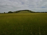
This wonderful steep sided, flat topped hill rises 450 feet out of the Somerset Levels not far from the sea in Bridgwater Bay. Legend has it that it was created by the Devil when he was carving out Cheddar Gorge, and threw a handful of rock out towards the sea. Geology has it that this limestone outcrop of the Mendip hills dates from the Jurassic times of 300 million years ago. Personally, I always think it looks like the hill out of Close Encounters, and is a landing pad for Alien craft !

Over the years the knoll has been sculpted and adapted my man for various uses. Bronze Age and Iron Age people set up forts and encampments on the summit which became a focus for religious activity. The Romans built a temple and fortifications there, and referred to the hill as “The Mount of Frogs”. Roman coins of the Emperor Trajan (AD98 -117) and Septimus Severus (AD145 - 211) have been found on the Knoll. Legend claims this hill to be the site of Mons Badonicus, with its King Arthur connections. The Anglo-Saxons made good use of the Knoll, and on its eastern slopes is the site of a battle in AD875 when the Saxons drove away the Vikings. Hence, the "Battleborough Grange" Hotel, and Battleborough Lane.

The Knoll was even used during the last world war as a look out post, and modifications and the remains of gun emplacements built by the Home Guard can be seen. Today it is still used for celebratory purposes, such as jubilee beacons, and indeed the name Brent is probably derived from an old word for beacon. I like the name Frog Island better !

The view from the top of the Knoll is exceptional, with a massive view in all 360 degrees. To the west is the Bristol Channel, with its islands, and Wales over on the far shore. In the foreground can be seen Burnham-on-Sea, Brean Down and up to Weston-Super-Mare further north. Round to the north, and the Mendip Hills come into view, with Crooks Peak and Cheddar Gorge standing out. Then to the east over the Somerset levels in the distance can be seen Glastonbury Tor and the Polden Hills which come round to the south. Then it’s round to Bridgwater Bay, with the Quantock Hills and Exmoor beyond that.

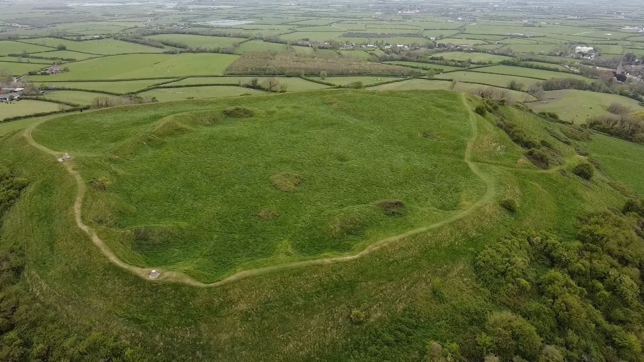
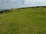
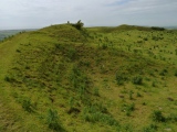
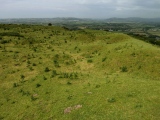
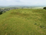
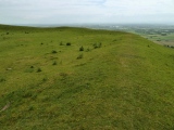
As for the ancient remains on the top of the hill, the top has probably been slightly flattened, with stone and rubble built ramparts completely surrounding the summit, and although these are not particularly large, they are very steep on the outer face, no doubt helped by the steepness of the hillside. Within these ramparts, are all sorts of lumps, bumps and hollows, which includes a large crescent shaped mound roughly in the middle. The entrance to the fortifications would have been, and still is, from the north east, and external fortifications for these can be seen.
You may be viewing yesterday's version of this page. To see the most up to date information please register for a free account.
Brent Knoll Camp
Brent Knoll Camp submitted by mattimpey : There are 360 degree views all around Brent Knoll camp. The top of Glastonbury Tor is visible on clear days and a lot of Weston-Super-Mare is also visible in the opposite direction. (Vote or comment on this photo)

Brent Knoll Camp
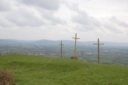
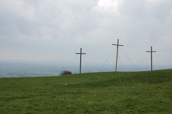
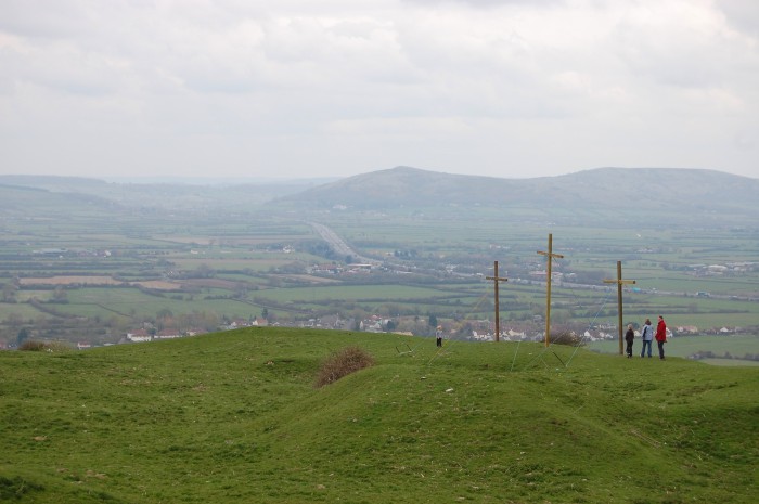
Brent Knoll Camp submitted by mattimpey : Around the time of Easter the local church put up three wooden crosses which can be seen from the M5. (Vote or comment on this photo)

Brent Knoll Camp
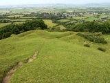
Brent Knoll Camp submitted by mattimpey : The public path to the top of Brent Knoll Camp is steep but well gravelled. (Vote or comment on this photo)

Brent Knoll Camp
Brent Knoll Camp submitted by camperman : Aerial view from the south east showing the eastern entrance with narrow original hollow way up the slope, reused later as a quarry track into the fort. (Vote or comment on this photo)

Brent Knoll Camp
Brent Knoll Camp submitted by camperman : Aerial view from the west. (Vote or comment on this photo)

Brent Knoll Camp
Brent Knoll Camp submitted by camperman : Brent Knoll Camp contour hillfort viewed from the south showing the steep sides and flat top of the hill.

Brent Knoll Camp
Brent Knoll Camp submitted by Bladup : Brent Knoll Camp from the West.

Brent Knoll Camp
Brent Knoll Camp submitted by Bladup : Brent Knoll Camp, South West side looking South.

Brent Knoll Camp
Brent Knoll Camp submitted by Bladup : Brent Knoll Camp, North East side looking North.

Brent Knoll Camp
Brent Knoll Camp submitted by Bladup : Brent Knoll Camp, East side looking South.

Brent Knoll Camp
Brent Knoll Camp submitted by Bladup : Brent Knoll Camp, Looking North from the large bank inside the fort, It was probably part of an older, smaller and circular fort with the enlargement to the North later.

Brent Knoll Camp
Brent Knoll Camp submitted by Bladup : Brent Knoll Camp, Southern part of the fort looking East, The bank is the largest here.

Brent Knoll Camp
Brent Knoll Camp submitted by Bladup : Brent Knoll Camp, Western side looking North East, Note the big bank inside the fort on the right of photo.

Brent Knoll Camp
Brent Knoll Camp submitted by Bladup : Brent Knoll Camp, The South West area of the fort looking West.

Brent Knoll Camp
Brent Knoll Camp submitted by Bladup : The large bank at the South of Brent Knoll Camp.

Brent Knoll Camp
Brent Knoll Camp submitted by Bladup : Brent Knoll Camp, East side looking North East.

Brent Knoll Camp
Brent Knoll Camp submitted by Bladup : The Northern end of Brent Knoll Camp.

Brent Knoll Camp
Brent Knoll Camp submitted by Bladup : Brent Knoll Camp, Large bank and humps and bumps on the North West side.

Brent Knoll Camp
Brent Knoll Camp submitted by Bladup : Brent Knoll Camp, Bank on the Western side.

Brent Knoll Camp
Brent Knoll Camp submitted by Bladup : Brent Knoll Camp from the West.

Brent Knoll Camp
Brent Knoll Camp submitted by mattimpey : The top of Brent Knoll camp is no longer very flat.

Brent Knoll Camp
Brent Knoll Camp submitted by mattimpey : Around the time of Easter the local church put up three wooden crosses which can be seen from the M5. The local church also organise a walk to the top on Easter Sunday.

Brent Knoll Camp
Brent Knoll Camp submitted by mattimpey : Brent Knoll camp was used as the site of bonfires for Golden and Diamond Jubilees of Queen Victoria.

Brent Knoll Camp
Brent Knoll Camp submitted by caradoc68 : Brent Knoll Camp, is a free standing hill on the nofth of the Somerset levels. A multivallate fort on the top of the hill would have been a island in Iron age times, and the lower hill would have been farmed. The first thing you notice getting to the summit is that there are no ditches to the bank and second in the middle of the fort it seems to be of very uneven ground and bumpy. Some of this m...

Brent Knoll Camp
Brent Knoll Camp submitted by TheCaptain : Brent Knoll Hillfort, Somerset. ST341510. This is the stone and rubble built ramparts on the western side of the hill summit looking north, showing the way they have been cut into the hill.

These are just the first 25 photos of Brent Knoll Camp. If you log in with a free user account you will be able to see our entire collection.

Do not use the above information on other web sites or publications without permission of the contributor.
Click here to see more info for this site

Nearby sites

Click here to view sites on an interactive OS map

Key: Red: member's photo, Blue: 3rd party photo, Yellow: other image, Green: no photo - please go there and take one, Grey: site destroyed

Download sites to:
KML (Google Earth)
GPX (GPS waypoints)
CSV (Garmin/Navman)
CSV (Excel)

To unlock full downloads you need to sign up as a Contributory Member. Otherwise downloads are limited to 50 sites.


Turn off the page maps and other distractions

Nearby sites listing. In the following links * = Image available
 962m NNE 16° East Brent Churchyard Cross* Ancient Cross (ST3439051891)
 2.1km SW 217° Unknown earthworks at Edithmead* Misc. Earthwork (ST32864933)
 4.8km ENE 58° Biddisham Churchyard Cross* Ancient Cross (ST3819353429)
 5.0km SE 128° Mark Village Cross* Ancient Cross (ST3804947838)
 5.9km N 359° Bleadon Cross* Ancient Cross (ST3411056921)
 6.0km NE 35° Loxton Churchyard Cross* Ancient Cross (ST3762455813)
 6.5km NNE 21° Loxton Hill Barrows Round Barrow(s) (ST36565704)
 6.8km E 96° Chapel Allerton Cross* Ancient Cross (ST4089050199)
 7.0km NE 50° Compton Bishop Church Cross* Ancient Cross (ST3959955378)
 7.4km NNW 340° Walborough Barrows Round Barrow(s) (ST31615791)
 7.5km ENE 76° Weare Churchyard Cross* Ancient Cross (ST4140952670)
 7.6km NNE 29° Flagstaff Hill* Stone Circle (ST3785257630)
 7.8km ENE 60° Compton Bishop* Standing Stones (ST409548)
 8.2km NE 52° Wavering Down cairn* Round Cairn (ST40705590)
 8.4km NE 35° Wook's Quoit* Standing Stone (Menhir) (ST39045783)
 8.5km SSW 208° Pawlett Cursus Cursus (ST300435)
 9.0km SSW 211° Pawlett Cursus Cursus (ST294433)
 9.8km NW 324° Brean Down* Hillfort (ST28535898)
 9.8km ENE 67° Axbridge Church Wells* Holy Well or Sacred Spring (ST432546)
 10.5km NE 39° Banwell Camp Hillfort (ST409590)
 10.6km SSE 163° Sulphur spring Holy Well or Sacred Spring (ST37124085)
 10.7km N 349° North Somerset Museum Museum (ST322615)
 10.8km N 349° Weston-super-Mare Museum* Museum (ST3217061568)
 11.2km NNE 24° Rolstone* Standing Stone (Menhir) (ST38736120)
 11.5km SE 137° Abbot's Way* Ancient Trackway (ST419425)
View more nearby sites and additional images

<< Ashen Hill Barrows

Felton Bowl Barrows T28 & T29 >>

Please add your thoughts on this site

Understanding the Neolithic

Understanding the Neolithic

Sponsors

Auto-Translation (Google)

Translate from English into:

"Brent Knoll Camp" | Login/Create an Account | 6 News and Comments
  
Go back to top of page    Comments are owned by the poster. We aren't responsible for their content.
Re: Brent Knoll Camp Aerial Photograph by Adrian Warren by AngieLake on Monday, 10 August 2015
(User Info | Send a Message)
Please check out this amazing website where I first found a lovely aerial shot of Brent Knoll hill fort way back in 2004.

I have been checking through my Megalithic Portal bits and bobs, getting rid of odd papers I've saved over the years and found this:
http://www.lastrefuge.co.uk/php/sitesearch2.php?q=brent+knoll&Submit=Search

That link will take you to the super photo of this site taken by Adrian Warren.

When I opened the Home page for 'lastrefuge' I was saddened to see that Adrian had died of melanoma back in 2011.
There's a special memorial page including a lovely comment by Sir David Attenborough.
What an amazing man he must have been.
[ Reply to This ]

Re: Brent Knoll Camp by Anonymous on Saturday, 22 June 2013
Just drove past as a passanger and was perplexed by the power of the auric energy shooting into the sky. Hence the now research of what hill it is. I can see why it is a well used and magical place.
[ Reply to This ]

Re: Brent Knoll Camp by Shin_Akuma on Monday, 23 July 2012
(User Info | Send a Message)
Luckily for me, I can see the Knoll from my living room window.

Looks fantastic on sunny days, and eerie when the mist and fog roll in from the sea, which is little more than a mile away...
[ Reply to This ]

Brent Knoll Alignment by Anonymous on Sunday, 14 August 2011
At the risk of inviting a frown or two from the purists, I offer this information. If one stands in the yard of St Michael's Church near the summit of Brent Knoll, one can see Glastonbury Tor's ruined St Michael's tower. Allow the eye to drift down into the Levels and you will see the spire of yet another St Michael's church in a village intriguingly called Mark. The alignment of the three St Micks is geometrically perfect. Take a drive (or better, cycle ride) down there and you will find yourself on three or four miles of arrow-straight road on a precise course between Brent and Mark. Who's for a ley, anyone?
[ Reply to This ]

Street View by coldrum on Wednesday, 24 March 2010
(User Info | Send a Message)

View Larger Map
[ Reply to This ]

Re: Brent Knoll Camp by TheCaptain on Tuesday, 27 April 2004
(User Info | Send a Message)
Brent Knoll, Somerset.

This wonderful steep sided, flat topped hill rises 450 feet out of the Somerset Levels not far from the sea in Bridgwater Bay. Legend has it that it was created by the Devil when he was carving out Cheddar Gorge, and threw a handful of rock out towards the sea. Geology has it that this limestone outcrop of the Mendip hills dates from the Jurassic times of 300 million years ago. Personally, I always think it looks like the hill out of Close Encounters, and is a landing pad for Alien craft !

I have been meaning to get to the top of this hill for the best part of thirty years now, having passed it on the M5 a multitude of times, but never making time to stop and explore.

Over the years the knoll has been sculpted and adapted my man for various uses. Bronze Age and Iron Age people set up forts and encampments on the summit which became a focus for religious activity. The Romans built a temple and fortifications there, and referred to the hill as “The Mount of Frogs”. Roman coins of the Emperor Trajan (AD98 -117) and Septimus Severus (AD145 - 211) have been found on the Knoll. Legend claims this hill to be the site of Mons Badonicus, with its King Arthur connections. The Anglo-Saxons made good use of the Knoll, and on its eastern slopes is the site of a battle in AD875 when the Saxons drove away the Vikings. Hence, the "Battleborough Grange" Hotel, and Battleborough Lane. The Knoll was even used during the last world war as a look out post, and modifications and the remains of gun emplacements built by the Home Guard can be seen. Today it is still used for celebratory purposes, such as jubilee beacons, and indeed the name Brent is probably derived from an old word for beacon. I like the name Frog Island better !

The view from the top of the Knoll is exceptional, with a massive view in all 360 degrees. To the west is the Bristol Channel, with its islands, and Wales over on the far shore. In the foreground can be seen Burnham-on-Sea, Brean Down and up to Weston-Super-Mare further north. Round to the north, and the Mendip Hills come into view, with Crooks Peak and Cheddar Gorge standing out. Then to the east over the Somerset levels in the distance can be seen Glastonbury Tor and the Polden Hills which come round to the south. Then it’s round to Bridgwater Bay, with the Quantock Hills and Exmoor beyond that.

As for the ancient remains on the top of the hill, the top has probably been slightly flattened, with stone and rubble built ramparts completely surrounding the summit, and although these are not particularly large, they are very steep on the outer face, no doubt helped by the steepness of the hillside. Within these ramparts, are all sorts of lumps, bumps and hollows, which includes a large crescent shaped mound roughly in the middle. The entrance to the fortifications would have been, and still is, from the north east, and external fortifications for these can be seen.
[ Reply to This ]

Your Name: Anonymous [ Register Now ]
Subject:


Add your comment or contribution to this page. Spam or offensive posts are deleted immediately, don't even bother

<<< What is five plus one as a number? (Please type the answer to this question in the little box on the left)
You can also embed videos and other things. For Youtube please copy and paste the 'embed code'.
For Google Street View please include Street View in the text.
Create a web link like this: <a href="https://www.megalithic.co.uk">This is a link</a>  

Allowed HTML is:
<p> <b> <i> <a> <img> <em> <br> <strong> <blockquote> <tt> <li> <ol> <ul> <object> <param> <embed> <iframe>

We would like to know more about this location. Please feel free to add a brief description and any relevant information in your own language.
Wir möchten mehr über diese Stätte erfahren. Bitte zögern Sie nicht, eine kurze Beschreibung und relevante Informationen in Deutsch hinzuzufügen.
Nous aimerions en savoir encore un peu sur les lieux. S'il vous plaît n'hesitez pas à ajouter une courte description et tous les renseignements pertinents dans votre propre langue.
Quisieramos informarnos un poco más de las lugares. No dude en añadir una breve descripción y otros datos relevantes en su propio idioma.