


<< Our Photo Pages >> Ōhira Kofungun - Chambered Cairn in Japan in Honshū
Submitted by Aska on Saturday, 23 December 2017 Page Views: 1795
Neolithic and Bronze AgeSite Name: Ōhira Kofungun Alternative Name: 大平古墳群Country: Japan Region: Honshū Type: Chambered Cairn
Nearest Town: Kōfu (Yamanashi pref.) Nearest Village: Yumura 湯村
Latitude: 35.685220N Longitude: 138.548570E
Condition:
| 5 | Perfect |
| 4 | Almost Perfect |
| 3 | Reasonable but with some damage |
| 2 | Ruined but still recognisable as an ancient site |
| 1 | Pretty much destroyed, possibly visible as crop marks |
| 0 | No data. |
| -1 | Completely destroyed |
| 5 | Superb |
| 4 | Good |
| 3 | Ordinary |
| 2 | Not Good |
| 1 | Awful |
| 0 | No data. |
| 5 | Can be driven to, probably with disabled access |
| 4 | Short walk on a footpath |
| 3 | Requiring a bit more of a walk |
| 2 | A long walk |
| 1 | In the middle of nowhere, a nightmare to find |
| 0 | No data. |
| 5 | co-ordinates taken by GPS or official recorded co-ordinates |
| 4 | co-ordinates scaled from a detailed map |
| 3 | co-ordinates scaled from a bad map |
| 2 | co-ordinates of the nearest village |
| 1 | co-ordinates of the nearest town |
| 0 | no data |
Internal Links:
External Links:
")
You may be viewing yesterday's version of this page. To see the most up to date information please register for a free account.
")
Do not use the above information on other web sites or publications without permission of the contributor.
Nearby Images from Flickr

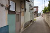
The above images may not be of the site on this page, but were taken nearby. They are loaded from Flickr so please click on them for image credits.
Click here to see more info for this site
Nearby sites
Click here to view sites on an interactive map of the areaKey: Red: member's photo, Blue: 3rd party photo, Yellow: other image, Green: no photo - please go there and take one, Grey: site destroyed
Download sites to:
KML (Google Earth)
GPX (GPS waypoints)
CSV (Garmin/Navman)
CSV (Excel)
To unlock full downloads you need to sign up as a Contributory Member. Otherwise downloads are limited to 50 sites.
Turn off the page maps and other distractions
Nearby sites listing. In the following links * = Image available
668m ESE 124° Yumurayama Kofungun* Chambered Cairn
1.1km N 5° Otengusan Kofun* Chambered Cairn
4.1km ESE 117° Tōkō-ji temple* Modern Stone Circle etc
6.0km ESE 111° Yokone Sakurai Kofungun* Chambered Cairn
6.6km W 278° Myōzen-ji temple* Modern Stone Circle etc
9.6km E 88° Eian-ji temple* Modern Stone Circle etc
11.8km S 178° Ōzuka Kofun (in Yamanashi)* Long Barrow
12.7km ESE 114° Kyōzuka Kofun (in Yamanashi)* Passage Grave
15.8km ENE 68° Jōko-ji temple* Modern Stone Circle etc
16.6km ENE 57° Somaguchi* Standing Stone (Menhir)
21.8km NW 307° Mumei-no Daisekitō* Modern Stone Circle etc
23.4km NW 321° Kinsei* Stone Circle
23.9km E 97° Seiun-ji temple* Modern Stone Circle etc
28.7km ESE 109° Oni-no Tateishi* Standing Stone (Menhir)
32.6km NW 311° Mukōhara* Stone Circle
37.5km NW 317° Tsubodaira* Burial Chamber or Dolmen
38.1km E 101° Oni-no Tsue* Standing Stone (Menhir)
43.9km S 178° Sengo* Stone Circle
44.2km WNW 294° Onshō-ji temple* Modern Stone Circle etc
46.2km NW 322° Togariishi* Ancient Village or Settlement
50.3km E 96° Uenoyama Kofun (in Yamanashi)* Chambered Cairn
53.7km N 353° Kitazawa* Standing Stone (Menhir)
58.8km ENE 77° Gyokudō Bijutsukan art museum* Modern Stone Circle etc
60.4km WNW 295° Ina Baien plum orchard* Modern Stone Circle etc
61.0km NW 317° Manji-no Sekibutsu* Sculptured Stone
View more nearby sites and additional images


 We would like to know more about this location. Please feel free to add a brief description and any relevant information in your own language.
 Wir möchten mehr über diese Stätte erfahren. Bitte zögern Sie nicht, eine kurze Beschreibung und relevante Informationen in Deutsch hinzuzufügen.
 Nous aimerions en savoir encore un peu sur les lieux. S'il vous plaît n'hesitez pas à ajouter une courte description et tous les renseignements pertinents dans votre propre langue.
 Quisieramos informarnos un poco más de las lugares. No dude en añadir una breve descripción y otros datos relevantes en su propio idioma.