


<< Our Photo Pages >> Weatherhill Henge - Henge in England in Wiltshire
Submitted by vieveforward on Friday, 24 March 2017 Page Views: 3655
Neolithic and Bronze AgeSite Name: Weatherhill Henge Alternative Name: Everleigh HengeCountry: England County: Wiltshire Type: Henge
Nearest Village: Everleigh
Map Ref: SU20635259
Latitude: 51.272090N Longitude: 1.705657W
Condition:
| 5 | Perfect |
| 4 | Almost Perfect |
| 3 | Reasonable but with some damage |
| 2 | Ruined but still recognisable as an ancient site |
| 1 | Pretty much destroyed, possibly visible as crop marks |
| 0 | No data. |
| -1 | Completely destroyed |
| 5 | Superb |
| 4 | Good |
| 3 | Ordinary |
| 2 | Not Good |
| 1 | Awful |
| 0 | No data. |
| 5 | Can be driven to, probably with disabled access |
| 4 | Short walk on a footpath |
| 3 | Requiring a bit more of a walk |
| 2 | A long walk |
| 1 | In the middle of nowhere, a nightmare to find |
| 0 | No data. |
| 5 | co-ordinates taken by GPS or official recorded co-ordinates |
| 4 | co-ordinates scaled from a detailed map |
| 3 | co-ordinates scaled from a bad map |
| 2 | co-ordinates of the nearest village |
| 1 | co-ordinates of the nearest town |
| 0 | no data |
Internal Links:
External Links:
I have visited· I would like to visit
optimistic20814 would like to visit
")
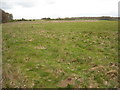
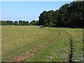
There is little to see of the henge itself, which is virtually completely ploughed out.
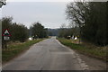
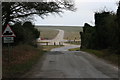
The site can only be visited when no army exercises are taking place nearby, and is only a short walk from a parking place.
You may be viewing yesterday's version of this page. To see the most up to date information please register for a free account.
Do not use the above information on other web sites or publications without permission of the contributor.
Nearby Images from Geograph Britain and Ireland:
©2015(licence)

©2017(licence)
©2011(licence)
©2007(licence)
©2007(licence)
The above images may not be of the site on this page, they are loaded from Geograph.
Please Submit an Image of this site or go out and take one for us!
Click here to see more info for this site
Nearby sites
Key: Red: member's photo, Blue: 3rd party photo, Yellow: other image, Green: no photo - please go there and take one, Grey: site destroyed
Download sites to:
KML (Google Earth)
GPX (GPS waypoints)
CSV (Garmin/Navman)
CSV (Excel)
To unlock full downloads you need to sign up as a Contributory Member. Otherwise downloads are limited to 50 sites.
Turn off the page maps and other distractions
Nearby sites listing. In the following links * = Image available
1.2km SW 219° Fittleton 5 Long Barrow Long Barrow (SU19885166)
1.2km ESE 109° Snail Down Barrow Cemetery* Barrow Cemetery (SU218522)
1.3km S 190° Weather Hill Disc Barrow* Round Barrow(s) (SU20425131)
2.3km SSE 155° Sidbury Camp* Hillfort (SU216505)
2.4km NNE 14° Collingbourne Kingston 2 Bowl Barrow Round Barrow(s) (SU2122454921)
2.5km ESE 114° Cow Down Barrow Cemetery Barrow Cemetery (SU229516)
2.9km NNE 25° Collingbourne Kingston 3 Bowl Barrow Round Barrow(s) (SU21845520)
4.1km W 281° Lidbury Camp Hillfort (SU16645335)
4.2km NNW 328° Everleigh Barrows Barrow Cemetery (SU184561)
5.0km SSW 206° Figheldean Earthwork* Misc. Earthwork (SU1846348131)
5.1km SW 225° Idmiston Cursus Cursus (SU1749)
5.6km SE 140° Tidworth Bowl Barrow Round Barrow(s) (SU24274837)
5.6km WNW 284° Chisenbury Camp Hillfort (SU15195387)
5.8km E 84° Collingbourne Ducis 22 Bowl Barrow* Round Barrow(s) (SU26405317)
5.9km NNW 343° Giant's Grave (Wiltshire)* Long Barrow (SU18925820)
5.9km ESE 104° Ludgershall Castle Southern Enclosure* Misc. Earthwork (SU2639051130)
5.9km SSW 195° Silk Hill Barrow Cemetery (SU1915246835)
6.0km W 276° East Chisenbury Midden Ancient Village or Settlement (SU14605323)
6.2km S 170° Devil's Ditch (Wiltshire) Misc. Earthwork (SU21744649)
6.4km S 171° Milston Down Long Barrows* Long Barrow (SU2171146251)
6.5km NE 51° Collingbourne Kingston 21 Long Barrow* Long Barrow (SU25645671)
6.7km N 4° Easton Clump Disc Barrow Round Barrow(s) (SU21085927)
6.8km SW 228° Gallows Barrow Round Barrow(s) (SU15564800)
7.0km SW 216° Ablington Barrow Clump* Round Barrow(s) (SU1654546924)
7.4km ENE 60° Grafton 9-11 Disc Barrows* Barrow Cemetery (SU271563)
View more nearby sites and additional images


 We would like to know more about this location. Please feel free to add a brief description and any relevant information in your own language.
 Wir möchten mehr über diese Stätte erfahren. Bitte zögern Sie nicht, eine kurze Beschreibung und relevante Informationen in Deutsch hinzuzufügen.
 Nous aimerions en savoir encore un peu sur les lieux. S'il vous plaît n'hesitez pas à ajouter une courte description et tous les renseignements pertinents dans votre propre langue.
 Quisieramos informarnos un poco más de las lugares. No dude en añadir una breve descripción y otros datos relevantes en su propio idioma.