


<< Text Pages >> Gidleigh North - Chambered Tomb in England in Devon
Submitted by Anne T on Friday, 23 September 2016 Page Views: 1404
Neolithic and Bronze AgeSite Name: Gidleigh North Alternative Name: Grinsell List A Gidleight 1; Buttern Hill Chambered Cairn 2Country: England County: Devon Type: Chambered Tomb
Nearest Town: Okehampton Nearest Village: Gidleigh
Map Ref: SX6586688971
Latitude: 50.684889N Longitude: 3.900113W
Condition:
| 5 | Perfect |
| 4 | Almost Perfect |
| 3 | Reasonable but with some damage |
| 2 | Ruined but still recognisable as an ancient site |
| 1 | Pretty much destroyed, possibly visible as crop marks |
| 0 | No data. |
| -1 | Completely destroyed |
| 5 | Superb |
| 4 | Good |
| 3 | Ordinary |
| 2 | Not Good |
| 1 | Awful |
| 0 | No data. |
| 5 | Can be driven to, probably with disabled access |
| 4 | Short walk on a footpath |
| 3 | Requiring a bit more of a walk |
| 2 | A long walk |
| 1 | In the middle of nowhere, a nightmare to find |
| 0 | No data. |
| 5 | co-ordinates taken by GPS or official recorded co-ordinates |
| 4 | co-ordinates scaled from a detailed map |
| 3 | co-ordinates scaled from a bad map |
| 2 | co-ordinates of the nearest village |
| 1 | co-ordinates of the nearest town |
| 0 | no data |
Be the first person to rate this site - see the 'Contribute!' box in the right hand menu.
Internal Links:
External Links:
Chambered Tomb in Devon
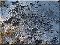
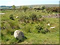
The Prehistoric Dartmoor Walks (PDW) includes the Gidleigh North Chambered Tomb, describing it as "a chambered cairn located on an east facing slope of Buttern Hill. The cairn mound measures 26 metres long and 9 metres wide and stands up to 1 metre high. Several set stones at the western end of the mound represent the remains of a passage leading towards a chamber." The tomb sits on the lower slopes of the eastern face of Buttern Hill and is much disturbed.
The Pastscape record for this Monument Number 443678 adds that this is a "simple form of passage grave. Built into a natural mound with its entrance sealed and a very ruined chamber." It describes a "large granite slab, 1.6m high, 0.7m wide and 0.2m thick, leaning at about 40 degrees to the north and supported on the underside by a roughly centrally placed upright orthostat ..... situated in stone strewn moorland on a west hill slope at 1,050ft OD."
The Heritage Gateway for Devon & Dartmoor HER MDV6212 (Gidleigh North Chambered Tomb) dates this chambered tomb to the Neolithic (4000 BC to 2201 BC) and it is also scheduled as Historic England List ID 1021217 (Chambered cairn 430m south of Buttern).
Note: Have you visited this site? Are you able to add any photographs, images or further information?
You may be viewing yesterday's version of this page. To see the most up to date information please register for a free account.
Do not use the above information on other web sites or publications without permission of the contributor.
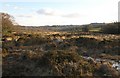
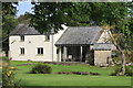
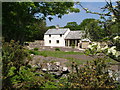
Nearby Images from Geograph Britain and Ireland:
©2010(licence)
©2019(licence)
©2012(licence)
©2010(licence)
©2012(licence)
The above images may not be of the site on this page, they are loaded from Geograph.
Please Submit an Image of this site or go out and take one for us!
Click here to see more info for this site
Nearby sites
Key: Red: member's photo, Blue: 3rd party photo, Yellow: other image, Green: no photo - please go there and take one, Grey: site destroyed
Download sites to:
KML (Google Earth)
GPX (GPS waypoints)
CSV (Garmin/Navman)
CSV (Excel)
To unlock full downloads you need to sign up as a Contributory Member. Otherwise downloads are limited to 50 sites.
Turn off the page maps and other distractions
Nearby sites listing. In the following links * = Image available
455m SSW 204° Gidleigh Chambered Cairn* Chambered Cairn (SX65678856)
520m SW 223° Buttern Hill Hut Circle* Ancient Village or Settlement (SX655886)
801m WSW 236° Buttern Hill Possible Menhir* Standing Stone (Menhir) (SX6518688544)
1.0km WSW 240° Buttern E* Stone Circle (SX6493988475)
1.1km SSW 208° Buttern Hill settlement* Ancient Village or Settlement (SX6531488003)
1.2km N 0° Higher Shilstone Hut Circle* Ancient Village or Settlement (SX659902)
1.3km S 186° Gidleigh Common Cairns Cairn (SX657877)
1.6km WSW 255° Buttern W* Stone Circle (SX643886)
1.6km SSW 193° Scorhill* Stone Circle (SX65468738)
1.8km S 191° Scorhill Cairn and Rows* Multiple Stone Rows / Avenue (SX65488721)
1.8km N 356° Throwleigh Common prehistoric settlement and field system* Ancient Village or Settlement (SX65779078)
1.9km S 189° The Tolmen Stone (Dartmoor)* Natural Stone / Erratic / Other Natural Feature (SX65508708)
2.2km SSE 165° The Round Pound* Ancient Village or Settlement (SX66398685)
2.6km W 280° White Moor Stone* Standing Stone (Menhir) (SX6335289476)
2.6km SSE 159° Modern Stone Circle near Kestor Rock* Modern Stone Circle etc (SX66748652)
2.6km W 281° White Moor Cairn* Cairn (SX6330289534)
2.7km WNW 282° White Moor Down* Stone Circle (SX63288961)
2.7km SSE 164° Kestor Settlement* Ancient Village or Settlement (SX66538633)
2.8km S 179° Shovel Down stone circle* Stone Circle (SX65828620)
2.8km S 177° Shovel Down row 2* Multiple Stone Rows / Avenue (SX65958620)
2.8km S 176° Shovel Down row 1* Stone Row / Alignment (SX660862)
2.8km SSE 165° Kes Tor Cairn* Cairn (SX6653286277)
2.8km SSE 164° Kes Tor Rock Basin* Natural Stone / Erratic / Other Natural Feature (SX66558628)
2.8km S 178° Shovel Down row 3* Multiple Stone Rows / Avenue (SX65898616)
2.9km S 177° Shovel Down Fourfold Circle* Stone Circle (SX65958603)
View more nearby sites and additional images


 We would like to know more about this location. Please feel free to add a brief description and any relevant information in your own language.
 Wir möchten mehr über diese Stätte erfahren. Bitte zögern Sie nicht, eine kurze Beschreibung und relevante Informationen in Deutsch hinzuzufügen.
 Nous aimerions en savoir encore un peu sur les lieux. S'il vous plaît n'hesitez pas à ajouter une courte description et tous les renseignements pertinents dans votre propre langue.
 Quisieramos informarnos un poco más de las lugares. No dude en añadir una breve descripción y otros datos relevantes en su propio idioma.