


<< Text Pages >> Lower Piles Enclosed Settlement - Ancient Village or Settlement in England in Devon
Submitted by Anne T on Friday, 23 September 2016 Page Views: 1127
Multi-periodSite Name: Lower Piles Enclosed SettlementCountry: England County: Devon Type: Ancient Village or Settlement
Nearest Town: Ivybridge Nearest Village: Harford
Map Ref: SX64376048
Latitude: 50.428467N Longitude: 3.91089W
Condition:
| 5 | Perfect |
| 4 | Almost Perfect |
| 3 | Reasonable but with some damage |
| 2 | Ruined but still recognisable as an ancient site |
| 1 | Pretty much destroyed, possibly visible as crop marks |
| 0 | No data. |
| -1 | Completely destroyed |
| 5 | Superb |
| 4 | Good |
| 3 | Ordinary |
| 2 | Not Good |
| 1 | Awful |
| 0 | No data. |
| 5 | Can be driven to, probably with disabled access |
| 4 | Short walk on a footpath |
| 3 | Requiring a bit more of a walk |
| 2 | A long walk |
| 1 | In the middle of nowhere, a nightmare to find |
| 0 | No data. |
| 5 | co-ordinates taken by GPS or official recorded co-ordinates |
| 4 | co-ordinates scaled from a detailed map |
| 3 | co-ordinates scaled from a bad map |
| 2 | co-ordinates of the nearest village |
| 1 | co-ordinates of the nearest town |
| 0 | no data |
Be the first person to rate this site - see the 'Contribute!' box in the right hand menu.
Internal Links:
External Links:
Ancient Village or Settlement in Devon
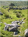
The Prehistoric Dartmoor Walks (PDW) website includes the Lower Piles Enclosed Settlement in its walk 'The Neolithic tombs of Cuckoo Ball & Corringdon Ball'. Their record describes the site as being "within the newtake known as Lower Piles. A group of seven huts near the south east corner of the enclosed land. All now composed of fairly small stones the walls appearing as thick banks of stone and turf, not high, but spreading to a width of 1.8m or more. The diameters vary from c 9.20 to c 12.20m outside measurements. Only one hut has a well defined entrance, this is on the south east side of the circle."
Further details can be found in the Pastscape Record for this site, Monument Number 442333. This record describes "9 hut circles and the remains of 3 possible enclosures, on a gentle, well drained west facing slope, at 265.0m above OD."
The settlement is also recorded as MDV4354 (UNENCLOSED HUT CIRCLE SETTLEMENT in the Parish of Harford) in the Devon and Dartmoor HER and scheduled as Historic England List Entry No. 1009578 (Agglomerated enclosure with hut circles, south of Lower Piles).
Note: Have you visited this site? Do you have any photographs, images or further information you can add?
You may be viewing yesterday's version of this page. To see the most up to date information please register for a free account.
Do not use the above information on other web sites or publications without permission of the contributor.
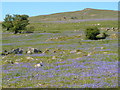
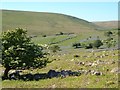
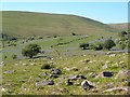
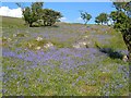
Nearby Images from Geograph Britain and Ireland:
©2006(licence)
©2011(licence)
©2011(licence)
©2011(licence)
©2011(licence)
The above images may not be of the site on this page, they are loaded from Geograph.
Please Submit an Image of this site or go out and take one for us!
Click here to see more info for this site
Nearby sites
Key: Red: member's photo, Blue: 3rd party photo, Yellow: other image, Green: no photo - please go there and take one, Grey: site destroyed
Download sites to:
KML (Google Earth)
GPX (GPS waypoints)
CSV (Garmin/Navman)
CSV (Excel)
To unlock full downloads you need to sign up as a Contributory Member. Otherwise downloads are limited to 50 sites.
Turn off the page maps and other distractions
Nearby sites listing. In the following links * = Image available
279m SE 142° Lower Piles* Ring Cairn (SX6453660255)
683m WSW 240° Burford Down (Tristis Rock)* Cairn (SX63776015)
696m WNW 286° Burford Down Standing Stone* Standing Stone (Menhir) (SX6370360687)
736m WSW 244° Burford Down Cairn Circle* Stone Circle (SX6370060170)
750m WSW 243° Burford Down Stone Row* Stone Row / Alignment (SX63696016)
812m S 170° Harford Moor Encircled Cairn* Stone Circle (SX6449459677)
854m NW 312° Stalldown South East* Stone Row / Alignment (SX63756107)
926m NE 46° Piles Hill W* Multiple Stone Rows / Avenue (SX65056111)
931m SE 127° Harford Moor N* Stone Row / Alignment (SX651599)
996m SE 132° Harford S.* Multiple Stone Rows / Avenue (SX651598)
1.0km ESE 124° Butterbrook* Stone Row / Alignment (SX652599)
1.0km ENE 64° Piles Hill Cairns* Cairn (SX653609)
1.0km NNW 336° Stalldown Settlement* Ancient Village or Settlement (SX6397361429)
1.1km ENE 75° The Longstone (Piles Hill)* Standing Stone (Menhir) (SX65436074)
1.1km E 89° Hobajons Cross* Standing Stone (Menhir) (SX65516047)
1.2km S 175° Harford settlement* Ancient Village or Settlement (SX6444559313)
1.2km E 101° Butterdon Hill Row* Stone Row / Alignment (SX6553960225)
1.3km SSE 163° Butter Brook* Standing Stone (Menhir) (SX64725926)
1.4km E 91° Glasscombe Ball North (South Cairn)* Cairn (SX65736041)
1.4km E 91° Glasscombe Ball North* Stone Row / Alignment (SX6573360429)
1.4km E 89° Glasscombe Ball North (North Cairn)* Cairn (SX6578360473)
1.5km NNE 24° Sharp Tor cairn* Cairn (SX65006179)
1.5km NNE 23° Sharp Tor North East* Stone Row / Alignment (SX65006188)
1.6km ESE 110° Spurrells Cross Row* Multiple Stone Rows / Avenue (SX6583759896)
1.6km ESE 114° Spurrells Cross Cairn Circle* Stone Circle (SX658598)
View more nearby sites and additional images


 We would like to know more about this location. Please feel free to add a brief description and any relevant information in your own language.
 Wir möchten mehr über diese Stätte erfahren. Bitte zögern Sie nicht, eine kurze Beschreibung und relevante Informationen in Deutsch hinzuzufügen.
 Nous aimerions en savoir encore un peu sur les lieux. S'il vous plaît n'hesitez pas à ajouter une courte description et tous les renseignements pertinents dans votre propre langue.
 Quisieramos informarnos un poco más de las lugares. No dude en añadir una breve descripción y otros datos relevantes en su propio idioma.