Featured: Ark of Secrets - Neolithic spirit alive in the Middle Ages

Ark of Secrets - Neolithic spirit alive in the Middle Ages

Megaliths by David Corio

Megaliths by David Corio

Who's Online

There are currently, 351 guests and 4 members online.

You are a guest. To join in, please register for free by clicking here

Sponsors

<< Other Photo Pages >> Knowle Hill Farm long barrow - Long Barrow in England in Dorset

Submitted by Andy B on Saturday, 13 August 2016  Page Views: 3611

Neolithic and Bronze AgeSite Name: Knowle Hill Farm long barrow
Country: England County: Dorset Type: Long Barrow

Map Ref: SU0306210415
Latitude: 50.893210N  Longitude: 1.957834W
Condition:
5Perfect
4Almost Perfect
3Reasonable but with some damage
2Ruined but still recognisable as an ancient site
1Pretty much destroyed, possibly visible as crop marks
0No data.
-1Completely destroyed
1 Ambience:
5Superb
4Good
3Ordinary
2Not Good
1Awful
0No data.
3 Access:
5Can be driven to, probably with disabled access
4Short walk on a footpath
3Requiring a bit more of a walk
2A long walk
1In the middle of nowhere, a nightmare to find
0No data.
no data Accuracy:
5co-ordinates taken by GPS or official recorded co-ordinates
4co-ordinates scaled from a detailed map
3co-ordinates scaled from a bad map
2co-ordinates of the nearest village
1co-ordinates of the nearest town
0no data
5

Internal Links:
External Links:

Knowle Hill Farm long barrow
Knowle Hill Farm long barrow submitted by dodomad : View of the trench from the spoil heap. The two flanking ditches of the long mound are clearly visible. The excavation of two slots through the feature have shown it to have a character, similar to the ditches of the long mound, formed by a series of pits dug next to one another. Photo Credit: Jake Rowland (Vote or comment on this photo)
Excavations at Knowlton, run by the University of Southampton, are investigating a possible Neolithic long barrow or mortuary enclosure located around 500m from the Knowlton henge complex. The trapezoidal anomaly, identified from cropmark evidence and limited geophysical survey suggests the presence of two diverging ditches or lines of pits/posts, most probably the flanking ditches of a ploughed out long mound.

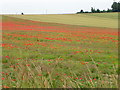
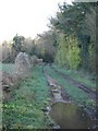
The Knowle Hill Farm cropmark measures approximately 15-20m long and 10m wide and has been provisionally identified as a ‘short’ long barrow. If identified correctly this hints at the significance of the place as early as the 4th millennium BC and has implications for understanding the development of the Knowlton henge complex.

The excavation, which will encompass the entire Knowle Hill Farm cropmark, aims to characterise and date the cropmark feature, and establish its relationship to monuments within its environs.

More at Facets Archaeology

You may be viewing yesterday's version of this page. To see the most up to date information please register for a free account.


Knowle Hill Farm long barrow
Knowle Hill Farm long barrow submitted by dodomad : One of the most interesting features on site is a pit located in between the two flanking ditches of the long mound. The pit yielded very few finds however it is very similar in character to Mesolithic pits excavated in the Stonehenge carpark and those beneath Thickthorn longbarrow although radiocarbon dates from charcoal found in the base of the pit will confirm its date. Perhaps more surpr... (Vote or comment on this photo)

Do not use the above information on other web sites or publications without permission of the contributor.

Nearby Images from Geograph Britain and Ireland:
SU0310 : Field poppies near Knowlton by Maigheach-gheal
by Maigheach-gheal
©2011(licence)
SU0310 : B3078 passing woods of St Giles's Park by David Smith
by David Smith
©2014(licence)
SU0310 : Farmland near Wimborne Lodge by Toby
by Toby
©2007(licence)
SU0310 : Road past The Drive Plantation - B3078 by Toby
by Toby
©2007(licence)
SU0310 : Track to Wimborne Lodge by Toby
by Toby
©2007(licence)

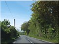
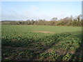
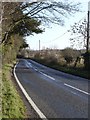
The above images may not be of the site on this page, they are loaded from Geograph.
Please Submit an Image of this site or go out and take one for us!


Click here to see more info for this site

Nearby sites

Click here to view sites on an interactive OS map

Key: Red: member's photo, Blue: 3rd party photo, Yellow: other image, Green: no photo - please go there and take one, Grey: site destroyed

Download sites to:
KML (Google Earth)
GPX (GPS waypoints)
CSV (Garmin/Navman)
CSV (Excel)

To unlock full downloads you need to sign up as a Contributory Member. Otherwise downloads are limited to 50 sites.


Turn off the page maps and other distractions

Nearby sites listing. In the following links * = Image available
 540m WSW 254° Knowlton Great Barrow* Round Barrow(s) (SU02541027)
 693m W 259° Knowlton Rings* Henge (SU02381028)
 837m SW 232° Knowlton Great Circle* Henge (SU024099)
 2.1km NNE 30° Wimborne St Giles* Round Barrow(s) (SU041122)
 3.7km NNW 332° Monkton-up-Wimborne Late Neolithic pit circle/shaft complex* Misc. Earthwork (SU01311367)
 3.7km SSE 147° Roman Barrow, Knob's Crook* Round Barrow(s) (SU051073)
 3.7km ESE 114° Woodlands Common Barrow* Round Barrow(s) (SU065089)
 4.2km NE 38° The Ancient Technology Centre* Museum (SU05671374)
 4.4km SE 133° David's Cross* Round Barrow(s) (SU063074)
 4.6km NNW 339° Drive Plantation* Long Barrow (SU014147)
 4.7km NW 305° Gussage South-East Long Barrow (ST992131)
 4.7km S 177° Colebarrow* Hillfort (SU033057)
 4.8km NW 311° Gussage Down (South)* Long Barrow (ST994136)
 5.0km W 281° Parsonage Hill* Long Barrow (ST98131137)
 5.1km NW 312° Gussage Down (North)* Long Barrow (ST993138)
 5.1km SE 125° Redman's Hill Barrow* Round Barrow(s) (SU073075)
 5.2km NNW 336° Wyke Down barrows* Round Barrow(s) (SU009152)
 5.3km SW 216° High Lea Farm* Barrow Cemetery (ST999061)
 5.4km NW 312° Gussage Hill Ancient Village or Settlement (ST990140)
 5.4km NNW 343° Gussage St Michael Cursus Cursus (SU015156)
 5.4km NNW 343° Pentridge Cursus Cursus (SU015156)
 5.5km NNW 333° Wyke Down henge* Henge (SU006153)
 5.5km SE 126° Horton Common Earthworks* Misc. Earthwork (SU075072)
 5.7km NNW 347° Dorset Cursus* Cursus (SU01751600)
 6.0km SSE 156° Holt Heath* Round Barrow(s) (SU055049)
View more nearby sites and additional images

<< Matronenheiligtum Colonia Ulpia Traiana

Kinik Hoyuk >>

Please add your thoughts on this site

Prehistoric Dorset

Prehistoric Dorset

Sponsors

Auto-Translation (Google)

Translate from English into:

"Knowle Hill Farm long barrow" | Login/Create an Account | 3 News and Comments
  
Go back to top of page    Comments are owned by the poster. We aren't responsible for their content.
Re: Knowle Hill Farm long barrow by Zooks777 on Saturday, 21 August 2021
(User Info | Send a Message)
This site seems to have vanished from 2020 Environment Agency lidar (grey icon next to CamRA) as a result of recent excavation, but maybe it was never a topographic feature, just crop-marked
[ Reply to This ]

Re: Knowle Hill Farm (possible) long barrow dig 2016 by Andy B on Friday, 12 August 2016
(User Info | Send a Message)
Knowlton Dig 2016: Day 5, August 6th: Jake Rowland writes: One of the most interesting features on site is a pit located in between the two flanking ditches of the long mound. The pit yielded very few finds however it is very similar in character to Mesolithic pits excavated in the Stonehenge carpark and those beneath Thickthorn longbarrow although radiocarbon dates from charcoal found in the base of the pit will confirm its date.

Perhaps more surprisingly the centre of the pit was recut at a later date, possibly during the Neolithic or Bronze Age, potentially being used as a post hole. If the earlier pit does date to the Mesolithic it represents a rare example of Neolithic or Bronze Age reworking of Mesolithic pits and may explain why the long barrow was constructed at the site.
More at
https://facetsarchaeology.com/2016/08/06/knowlton-dig-2016-day-5

Knowlton Dig 2016: Day 10, August 9th: Jake Rowland writes: Today the main focus on the site has been on part of a C-shaped, curvilinear feature, measuring 10m in length, which showed up on a geophysical survey of the site.

The excavation of two slots through the feature have shown it to have a character, similar to the ditches of the long mound, formed by a series of pits dug next to one another.

It is unclear as to what this C-shaped feature was however at the base of one of the large pits which form the ditch the natural chalk has been very heavily compressed, possibly as a result of the pit having contained a very heavy object.

This is just speculation at this stage but the site directors plan to extend the trench and put sections through the ditch terminals to better understand the character of the whole feature.
More at
https://facetsarchaeology.com/2016/08/09/knowlton-dig-2016-day-10/
[ Reply to This ]

Knowle Hill Farm (possible) long barrow dig 2016 by Andy B on Friday, 12 August 2016
(User Info | Send a Message)
Specific objectives of the project include:

* ascertaining the character of the features producing the cropmark (e.g. ditches, pits or large post-holes);
* the recovery of dateable material from primary contexts;
* the recovery of artefactual and/or structural evidence that will enable the function of the monument and its subsequent life to be established;
* the recovery of environmental evidence pertaining to the period of the monument’s construction and subsequent life.

The 3 week long excavation (30th July – 19th August) is run by Dr Josh Pollard and Professor Alistair Pike from the University of Southampton in collaboration with archaeologists Dr Mark Gillings, University of Leicester and archaeologist Martin Green.

You can keep up to date with all of the latest discoveries from the site on https://facetsarchaeology.com or by following @Jake_Rowland1 on Twitter

[ Reply to This ]

Your Name: Anonymous [ Register Now ]
Subject:


Add your comment or contribution to this page. Spam or offensive posts are deleted immediately, don't even bother

<<< What is five plus one as a number? (Please type the answer to this question in the little box on the left)
You can also embed videos and other things. For Youtube please copy and paste the 'embed code'.
For Google Street View please include Street View in the text.
Create a web link like this: <a href="https://www.megalithic.co.uk">This is a link</a>  

Allowed HTML is:
<p> <b> <i> <a> <img> <em> <br> <strong> <blockquote> <tt> <li> <ol> <ul> <object> <param> <embed> <iframe>

We would like to know more about this location. Please feel free to add a brief description and any relevant information in your own language.
Wir möchten mehr über diese Stätte erfahren. Bitte zögern Sie nicht, eine kurze Beschreibung und relevante Informationen in Deutsch hinzuzufügen.
Nous aimerions en savoir encore un peu sur les lieux. S'il vous plaît n'hesitez pas à ajouter une courte description et tous les renseignements pertinents dans votre propre langue.
Quisieramos informarnos un poco más de las lugares. No dude en añadir una breve descripción y otros datos relevantes en su propio idioma.