


<< Text Pages >> Dolmen des Liboureaux 1 - Burial Chamber or Dolmen in France in Poitou:Vienne (86)
Submitted by holger_rix on Thursday, 03 March 2016 Page Views: 812
Neolithic and Bronze AgeSite Name: Dolmen des Liboureaux 1Country: France Département: Poitou:Vienne (86) Type: Burial Chamber or Dolmen
Nearest Town: Montmorillon Nearest Village: Les Libouraux
Latitude: 46.683228N Longitude: 0.882209E
Condition:
| 5 | Perfect |
| 4 | Almost Perfect |
| 3 | Reasonable but with some damage |
| 2 | Ruined but still recognisable as an ancient site |
| 1 | Pretty much destroyed, possibly visible as crop marks |
| 0 | No data. |
| -1 | Completely destroyed |
| 5 | Superb |
| 4 | Good |
| 3 | Ordinary |
| 2 | Not Good |
| 1 | Awful |
| 0 | No data. |
| 5 | Can be driven to, probably with disabled access |
| 4 | Short walk on a footpath |
| 3 | Requiring a bit more of a walk |
| 2 | A long walk |
| 1 | In the middle of nowhere, a nightmare to find |
| 0 | No data. |
| 5 | co-ordinates taken by GPS or official recorded co-ordinates |
| 4 | co-ordinates scaled from a detailed map |
| 3 | co-ordinates scaled from a bad map |
| 2 | co-ordinates of the nearest village |
| 1 | co-ordinates of the nearest town |
| 0 | no data |
Be the first person to rate this site - see the 'Contribute!' box in the right hand menu.
Internal Links:
External Links:
Burial Chamber (Dolmen) in Poitou:Vienne (86)
Les Libouraux, Saint-Pierre-de-Maillé, Montmorillon, Vienne, Aquitaine-Limousin-Poitou-Charentes
Source: T4T35.fr
You may be viewing yesterday's version of this page. To see the most up to date information please register for a free account.
Do not use the above information on other web sites or publications without permission of the contributor.
Nearby Images from Flickr

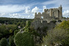
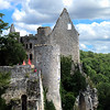
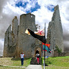
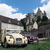

The above images may not be of the site on this page, but were taken nearby. They are loaded from Flickr so please click on them for image credits.
Click here to see more info for this site
Nearby sites
Click here to view sites on an interactive map of the areaKey: Red: member's photo, Blue: 3rd party photo, Yellow: other image, Green: no photo - please go there and take one, Grey: site destroyed
Download sites to:
KML (Google Earth)
GPX (GPS waypoints)
CSV (Garmin/Navman)
CSV (Excel)
To unlock full downloads you need to sign up as a Contributory Member. Otherwise downloads are limited to 50 sites.
Turn off the page maps and other distractions
Nearby sites listing. In the following links * = Image available
277m N 356° Dolmen des Liboureaux 2 Burial Chamber or Dolmen
505m ESE 118° Grotte Angles sur l'Anglin* Cave or Rock Shelter
1.2km NNE 15° Roc-aux-Sorciers Museum
6.1km SSW 203° Dolmen de Busserais Burial Chamber or Dolmen
11.0km NNW 343° Dolmen de la Pierre Levée (Confluent)* Burial Chamber or Dolmen
11.2km SE 127° Dolmen de la Pierre au Loup Burial Chamber or Dolmen
11.6km E 84° Dolmen des Barges 1 Burial Chamber or Dolmen
11.8km ENE 77° Dolmen des Barges 2 Burial Chamber or Dolmen
12.9km WSW 248° Dolmen dit la Maison du Fadet Burial Chamber or Dolmen
13.0km E 84° Dolmen dit la Pierre Levée (La Josière) Burial Chamber or Dolmen
16.6km WNW 303° Dolmen de la Chenaillère Burial Chamber or Dolmen
17.5km W 267° Dolmen au Trépaizan Burial Chamber or Dolmen
20.1km ENE 67° Menhir du Grand-Aslon* Standing Stone (Menhir)
20.6km E 80° Dolmen des Sablons* Burial Chamber or Dolmen
20.8km N 356° Menhir de La Touche Standing Stone (Menhir)
21.2km E 81° Dolmen de la Pierre-à-la-Fade* Burial Chamber or Dolmen
24.1km WNW 297° Dolmen des Pelyverts* Burial Chamber or Dolmen
26.7km N 6° La Pierre Birette* Polissoir
27.0km NNW 348° Le Grand-Pressigny flint mines Ancient Mine, Quarry or other Industry
27.2km NNW 347° Grand-Pressigny Musée de la Préhistoire* Museum
27.2km NNW 347° Coeur de Birette* Polissoir
28.6km NNE 20° Dolmen dit les Palets-de-Gargantua* Burial Chamber or Dolmen
28.7km E 94° Sénévaut Dolmen* Burial Chamber or Dolmen
29.0km ESE 124° Dolmen de Chalais Burial Chamber or Dolmen
29.7km WNW 288° La Pierre Levée (Chézelles)* Standing Stone (Menhir)
View more nearby sites and additional images


 We would like to know more about this location. Please feel free to add a brief description and any relevant information in your own language.
 Wir möchten mehr über diese Stätte erfahren. Bitte zögern Sie nicht, eine kurze Beschreibung und relevante Informationen in Deutsch hinzuzufügen.
 Nous aimerions en savoir encore un peu sur les lieux. S'il vous plaît n'hesitez pas à ajouter une courte description et tous les renseignements pertinents dans votre propre langue.
 Quisieramos informarnos un poco más de las lugares. No dude en añadir una breve descripción y otros datos relevantes en su propio idioma.