


<< Other Photo Pages >> Dolmen de la Brainée - Burial Chamber or Dolmen in France in Provence:Alpes-Maritimes (06)
Submitted by holger_rix on Sunday, 31 January 2016 Page Views: 803
Neolithic and Bronze AgeSite Name: Dolmen de la BrainéeCountry: France Département: Provence:Alpes-Maritimes (06) Type: Burial Chamber or Dolmen
Nearest Town: Grasse Nearest Village: Escragnolles
Latitude: 43.721670N Longitude: 6.756900E
Condition:
| 5 | Perfect |
| 4 | Almost Perfect |
| 3 | Reasonable but with some damage |
| 2 | Ruined but still recognisable as an ancient site |
| 1 | Pretty much destroyed, possibly visible as crop marks |
| 0 | No data. |
| -1 | Completely destroyed |
| 5 | Superb |
| 4 | Good |
| 3 | Ordinary |
| 2 | Not Good |
| 1 | Awful |
| 0 | No data. |
| 5 | Can be driven to, probably with disabled access |
| 4 | Short walk on a footpath |
| 3 | Requiring a bit more of a walk |
| 2 | A long walk |
| 1 | In the middle of nowhere, a nightmare to find |
| 0 | No data. |
| 5 | co-ordinates taken by GPS or official recorded co-ordinates |
| 4 | co-ordinates scaled from a detailed map |
| 3 | co-ordinates scaled from a bad map |
| 2 | co-ordinates of the nearest village |
| 1 | co-ordinates of the nearest town |
| 0 | no data |
Be the first person to rate this site - see the 'Contribute!' box in the right hand menu.
Internal Links:
External Links:
")
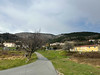
Pont du Ray, Escragnolles, Grasse, Alpes-Maritimes, Provence-Alpes-Côte d'Azur
Source: T4T35.fr
You may be viewing yesterday's version of this page. To see the most up to date information please register for a free account.
Do not use the above information on other web sites or publications without permission of the contributor.
Nearby Images from Flickr
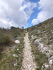
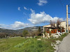
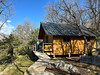
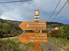
The above images may not be of the site on this page, but were taken nearby. They are loaded from Flickr so please click on them for image credits.
Click here to see more info for this site
Nearby sites
Click here to view sites on an interactive map of the areaKey: Red: member's photo, Blue: 3rd party photo, Yellow: other image, Green: no photo - please go there and take one, Grey: site destroyed
Download sites to:
KML (Google Earth)
GPX (GPS waypoints)
CSV (Garmin/Navman)
CSV (Excel)
To unlock full downloads you need to sign up as a Contributory Member. Otherwise downloads are limited to 50 sites.
Turn off the page maps and other distractions
Nearby sites listing. In the following links * = Image available
970m SW 225° Dolmen de la Colle* Burial Chamber or Dolmen
2.4km E 79° Dolmen des Claps Burial Chamber or Dolmen
2.4km ENE 62° Dolmen de Saint-Pons Burial Chamber or Dolmen
2.6km ENE 73° Escragnolles Tumulus Round Cairn
2.7km ENE 75° Tombe à incinération de la Collette Multiple Stone Rows / Avenue
3.6km SW 223° Dolmen des Riens* Burial Chamber or Dolmen
5.3km SW 220° la Bramee Dolmen Burial Chamber or Dolmen
5.7km S 188° Dolmen des Collets Burial Chamber or Dolmen
5.8km S 189° Dolmen du Colleton Burial Chamber or Dolmen
6.0km SE 144° Ciste des Puades Cist
6.0km SE 143° Puades Dolmen* Burial Chamber or Dolmen
6.1km NNW 329° Grotte aux Cranes Cave or Rock Shelter
6.2km ESE 112° Tumulus du Caillassou Round Barrow(s)
6.3km NNE 22° Aven-des-Cranes Cave or Rock Shelter
6.4km SE 135° Mauvans Nord Dolmen Burial Chamber or Dolmen
6.4km ESE 113° Pseudo-Dolmen du Deffends 1 Burial Chamber or Dolmen
6.4km NNE 21° Andon Tumulus No.4 Artificial Mound
6.4km NNE 20° Andon Tumulus No.3 Artificial Mound
6.4km NNE 22° Andon Tumulus No.5 Artificial Mound
6.4km NNE 20° Andon Tumulus No.2 Artificial Mound
6.4km NNE 19° Andon Tumulus No.1 Artificial Mound
6.4km ESE 118° Tumulus de la Croix de Cabris No.2 Artificial Mound
6.5km NNE 24° Andon Ciste Court Tomb
6.5km SE 131° Degoutay Dolmen* Burial Chamber or Dolmen
6.5km SE 145° Les Vallons Tumulus Burial Chamber or Dolmen
View more nearby sites and additional images


 We would like to know more about this location. Please feel free to add a brief description and any relevant information in your own language.
 Wir möchten mehr über diese Stätte erfahren. Bitte zögern Sie nicht, eine kurze Beschreibung und relevante Informationen in Deutsch hinzuzufügen.
 Nous aimerions en savoir encore un peu sur les lieux. S'il vous plaît n'hesitez pas à ajouter une courte description et tous les renseignements pertinents dans votre propre langue.
 Quisieramos informarnos un poco más de las lugares. No dude en añadir una breve descripción y otros datos relevantes en su propio idioma.