 with our Megalithic Portal iPhone app")


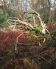
<< Text Pages >> La Chaire du Diable - Sculptured Stone in France in Pays de la Loire:Mayenne (53)
Submitted by holger_rix on Friday, 15 January 2016 Page Views: 1050
Multi-periodSite Name: La Chaire du DiableCountry: France Département: Pays de la Loire:Mayenne (53) Type: Sculptured Stone
Nearest Town: Mayenne Nearest Village: Jublains
Latitude: 48.273170N Longitude: 0.5196W
Condition:
| 5 | Perfect |
| 4 | Almost Perfect |
| 3 | Reasonable but with some damage |
| 2 | Ruined but still recognisable as an ancient site |
| 1 | Pretty much destroyed, possibly visible as crop marks |
| 0 | No data. |
| -1 | Completely destroyed |
| 5 | Superb |
| 4 | Good |
| 3 | Ordinary |
| 2 | Not Good |
| 1 | Awful |
| 0 | No data. |
| 5 | Can be driven to, probably with disabled access |
| 4 | Short walk on a footpath |
| 3 | Requiring a bit more of a walk |
| 2 | A long walk |
| 1 | In the middle of nowhere, a nightmare to find |
| 0 | No data. |
| 5 | co-ordinates taken by GPS or official recorded co-ordinates |
| 4 | co-ordinates scaled from a detailed map |
| 3 | co-ordinates scaled from a bad map |
| 2 | co-ordinates of the nearest village |
| 1 | co-ordinates of the nearest town |
| 0 | no data |
Be the first person to rate this site - see the 'Contribute!' box in the right hand menu.
Internal Links:
External Links:
Sculptured Stone in Pays de la Loire:Mayenne (53)
Jublains, Mayenne, Pays de la Loire, Metropolitanes
Source: T4T35.fr
You may be viewing yesterday's version of this page. To see the most up to date information please register for a free account.
Do not use the above information on other web sites or publications without permission of the contributor.
Nearby Images from Flickr
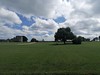
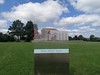
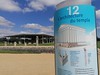

The above images may not be of the site on this page, but were taken nearby. They are loaded from Flickr so please click on them for image credits.
Click here to see more info for this site
Nearby sites
Click here to view sites on an interactive map of the areaKey: Red: member's photo, Blue: 3rd party photo, Yellow: other image, Green: no photo - please go there and take one, Grey: site destroyed
Download sites to:
KML (Google Earth)
GPX (GPS waypoints)
CSV (Garmin/Navman)
CSV (Excel)
To unlock full downloads you need to sign up as a Contributory Member. Otherwise downloads are limited to 50 sites.
Turn off the page maps and other distractions
Nearby sites listing. In the following links * = Image available
2.6km SE 138° Les Fouées* Standing Stone (Menhir)
2.6km SE 141° Jublains museum stone* Standing Stone (Menhir)
2.6km SE 137° Jublains Stèle Gauloise* Standing Stone (Menhir)
2.7km SE 144° Camp Romain de Jublains* Ancient Village or Settlement
3.8km NW 314° Aron Stèle Gauloise* Standing Stone (Menhir)
4.3km NNE 30° Stèles de petite croix* Standing Stones
6.3km NNW 329° Bas Villette Dolmen Burial Chamber or Dolmen
6.4km NNW 333° Allée Couverte de la Petite Giraudière Passage Grave
7.4km WSW 241° Les Chauvières* Standing Stone (Menhir)
7.9km W 268° Oppidum de Moulay Ancient Village or Settlement
9.5km NW 321° Menhir dit la Chaire au Diable* Standing Stone (Menhir)
10.9km SE 131° Pierre Aigue, Richebourg* Passage Grave
11.2km SE 130° Dolmen des Pierres Jumelles* Burial Chamber or Dolmen
13.1km ESE 119° Fort de Rubricaire* Ancient Village or Settlement
15.2km ESE 123° Pierres dit Palais du Diable* Natural Stone / Erratic / Other Natural Feature
15.2km SE 124° La Chaise du Diable* Natural Stone / Erratic / Other Natural Feature
15.3km E 100° Menhir du Gué Blandin* Standing Stone (Menhir)
15.3km WNW 300° Menhir de la Chablère* Standing Stone (Menhir)
15.6km SSE 146° Menhir Basilique Notre Dame de L'épine* Standing Stone (Menhir)
15.7km SE 146° Menhir Marie d'Évron* Standing Stone (Menhir)
16.2km N 350° La Hamelinière* Passage Grave
16.7km ESE 114° La Fosses* Standing Stones
17.0km SE 126° Dolmen de la Pierre au Renard Burial Chamber or Dolmen
17.0km E 99° Pierre Longue de Lèverie Standing Stone (Menhir)
17.1km E 99° Menhir du Gué Péan Standing Stone (Menhir)
View more nearby sites and additional images


 We would like to know more about this location. Please feel free to add a brief description and any relevant information in your own language.
 Wir möchten mehr über diese Stätte erfahren. Bitte zögern Sie nicht, eine kurze Beschreibung und relevante Informationen in Deutsch hinzuzufügen.
 Nous aimerions en savoir encore un peu sur les lieux. S'il vous plaît n'hesitez pas à ajouter une courte description et tous les renseignements pertinents dans votre propre langue.
 Quisieramos informarnos un poco más de las lugares. No dude en añadir una breve descripción y otros datos relevantes en su propio idioma.