


<< Our Photo Pages >> Cae Camp Hillfort - Hillfort in Wales in Monmouthshire
Submitted by caradoc68 on Wednesday, 25 February 2004 Page Views: 7543
Iron Age and Later PrehistorySite Name: Cae Camp HillfortCountry: Wales County: Monmouthshire Type: Hillfort
Nearest Town: Newport Nearest Village: Llanhennock Fawr
Map Ref: ST359939 Landranger Map Number: 171
Latitude: 51.640233N Longitude: 2.927686W
Condition:
| 5 | Perfect |
| 4 | Almost Perfect |
| 3 | Reasonable but with some damage |
| 2 | Ruined but still recognisable as an ancient site |
| 1 | Pretty much destroyed, possibly visible as crop marks |
| 0 | No data. |
| -1 | Completely destroyed |
| 5 | Superb |
| 4 | Good |
| 3 | Ordinary |
| 2 | Not Good |
| 1 | Awful |
| 0 | No data. |
| 5 | Can be driven to, probably with disabled access |
| 4 | Short walk on a footpath |
| 3 | Requiring a bit more of a walk |
| 2 | A long walk |
| 1 | In the middle of nowhere, a nightmare to find |
| 0 | No data. |
| 5 | co-ordinates taken by GPS or official recorded co-ordinates |
| 4 | co-ordinates scaled from a detailed map |
| 3 | co-ordinates scaled from a bad map |
| 2 | co-ordinates of the nearest village |
| 1 | co-ordinates of the nearest town |
| 0 | no data |
Internal Links:
External Links:
I have visited· I would like to visit
Ellpezz visited on 1st Jan 2016 - their rating: Cond: 2 Amb: 3 Have ridden past this many times.
")
Coflein site no. 307883.
You may be viewing yesterday's version of this page. To see the most up to date information please register for a free account.
")
Do not use the above information on other web sites or publications without permission of the contributor.
coldrum has found this location on Google Street View:
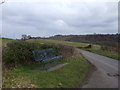
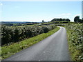
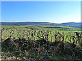
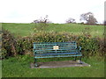
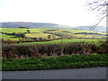
Nearby Images from Geograph Britain and Ireland:
©2010(licence)
©2010(licence)
©2011(licence)
©2014(licence)
©2014(licence)
The above images may not be of the site on this page, they are loaded from Geograph.
Please Submit an Image of this site or go out and take one for us!
Click here to see more info for this site
Nearby sites
Key: Red: member's photo, Blue: 3rd party photo, Yellow: other image, Green: no photo - please go there and take one, Grey: site destroyed
Download sites to:
KML (Google Earth)
GPX (GPS waypoints)
CSV (Garmin/Navman)
CSV (Excel)
To unlock full downloads you need to sign up as a Contributory Member. Otherwise downloads are limited to 50 sites.
Turn off the page maps and other distractions
Nearby sites listing. In the following links * = Image available
661m ENE 60° Cae Camp standing stone* Modern Stone Circle etc (ST36489422)
685m E 81° Cefn-Henllan Stone Circle* Modern Stone Circle etc (ST36589400)
854m SSE 159° Glen Usk Hillfort Hillfort (ST362931)
951m NNW 339° Llwyn-celyn Defended Enclosure Hillfort (ST3556294790)
1.5km N 3° Cefn-Carnau* Stone Circle (ST360954)
2.6km E 80° Bwllfa Cottages Henge Henge (ST38509431)
2.9km W 259° Cerau* Hillfort (ST330934)
3.1km SE 141° Coed y Caerau* Ancient Village or Settlement (ST378915)
3.1km SE 125° Kemeys Graig Earthworks Misc. Earthwork (ST384921)
3.2km NNE 28° St Cybi's Well (Llangybi)* Holy Well or Sacred Spring (ST3744796662)
3.3km NE 40° Llangybi Bottom Stone* Standing Stone (Menhir) (ST38049638)
3.9km SSW 208° Caerleon Roman Fortress and Baths* Ancient Village or Settlement (ST34039050)
4.1km SE 142° Tre-Garn Round Cairn (ST384906)
4.2km WSW 250° Malthouse Lane Motte* Artificial Mound (ST31899249)
4.4km SW 233° Lodge Wood* Hillfort (ST323913)
4.6km SSE 157° Lang Stone (Newport)* Standing Stone (Menhir) (ST37698961)
5.1km SSW 201° St Julian's Wood Hillfort (ST340892)
5.3km ESE 106° NOT SET
5.3km ESE 106° Castell Prin* Hillfort (ST410924)
5.3km SSE 154° Langstone (Bishton)* Round Barrow(s) (ST382891)
5.8km E 83° Llanvaches 2* Round Barrow(s) (ST41669455)
5.8km E 83° Llanvaches 1* Round Barrow(s) (ST41699455)
6.0km SSW 208° Maindy Hill Camp Misc. Earthwork (ST3304588604)
6.0km SSW 208° Maindee Camp Ancient Village or Settlement (ST3304588604)
6.3km NNE 14° Twyn Bell Camp Ancient Village or Settlement (SO375000)
View more nearby sites and additional images


 We would like to know more about this location. Please feel free to add a brief description and any relevant information in your own language.
 Wir möchten mehr über diese Stätte erfahren. Bitte zögern Sie nicht, eine kurze Beschreibung und relevante Informationen in Deutsch hinzuzufügen.
 Nous aimerions en savoir encore un peu sur les lieux. S'il vous plaît n'hesitez pas à ajouter une courte description et tous les renseignements pertinents dans votre propre langue.
 Quisieramos informarnos un poco más de las lugares. No dude en añadir una breve descripción y otros datos relevantes en su propio idioma.