


<< Our Photo Pages >> Kiyomune Jinja shrine - Burial Chamber or Dolmen in Japan in Kyūshū
Submitted by Aska on Friday, 03 July 2015 Page Views: 1791
Iron Age and Later PrehistorySite Name: Kiyomune Jinja shrine Alternative Name: 清宗神社 嚴島神社Country: Japan Region: Kyūshū Type: Burial Chamber or Dolmen
Nearest Town: Ukiha (Fukuoka) Nearest Village: Yoshiimachi-Ikuha 吉井ஹ
Latitude: 33.349900N Longitude: 130.739810E
Condition:
| 5 | Perfect |
| 4 | Almost Perfect |
| 3 | Reasonable but with some damage |
| 2 | Ruined but still recognisable as an ancient site |
| 1 | Pretty much destroyed, possibly visible as crop marks |
| 0 | No data. |
| -1 | Completely destroyed |
| 5 | Superb |
| 4 | Good |
| 3 | Ordinary |
| 2 | Not Good |
| 1 | Awful |
| 0 | No data. |
| 5 | Can be driven to, probably with disabled access |
| 4 | Short walk on a footpath |
| 3 | Requiring a bit more of a walk |
| 2 | A long walk |
| 1 | In the middle of nowhere, a nightmare to find |
| 0 | No data. |
| 5 | co-ordinates taken by GPS or official recorded co-ordinates |
| 4 | co-ordinates scaled from a detailed map |
| 3 | co-ordinates scaled from a bad map |
| 2 | co-ordinates of the nearest village |
| 1 | co-ordinates of the nearest town |
| 0 | no data |
Internal Links:
External Links:
")
You may be viewing yesterday's version of this page. To see the most up to date information please register for a free account.
Do not use the above information on other web sites or publications without permission of the contributor.
Nearby Images from Flickr

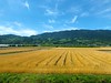
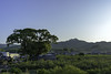
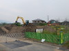
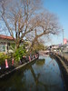
The above images may not be of the site on this page, but were taken nearby. They are loaded from Flickr so please click on them for image credits.
Click here to see more info for this site
Nearby sites
Click here to view sites on an interactive map of the areaKey: Red: member's photo, Blue: 3rd party photo, Yellow: other image, Green: no photo - please go there and take one, Grey: site destroyed
Download sites to:
KML (Google Earth)
GPX (GPS waypoints)
CSV (Garmin/Navman)
CSV (Excel)
To unlock full downloads you need to sign up as a Contributory Member. Otherwise downloads are limited to 50 sites.
Turn off the page maps and other distractions
Nearby sites listing. In the following links * = Image available
6.4km E 85° Asada pedestal stone* Burial Chamber or Dolmen
7.9km E 86° Haki* Hillfort
10.3km NW 314° Hatada* Burial Chamber or Dolmen
12.5km W 268° Tsukajima* Burial Chamber or Dolmen
13.7km NNW 341° Kuno Family Residence garden* Modern Stone Circle etc
17.3km WNW 288° Ōitai* Burial Chamber or Dolmen
17.7km WSW 252° Kōrasan* Hillfort
18.3km ESE 105° Jingabaru* Sculptured Stone
18.9km WNW 295° Mitsusawa* Burial Chamber or Dolmen
20.3km SW 229° Toyofuku* Sculptured Stone
20.4km W 261° Ishimaru* Burial Chamber or Dolmen
20.7km WSW 257° Nankun* Burial Chamber or Dolmen
21.3km WNW 302° Gorōyama Kofun* Passage Grave
21.8km NE 46° Hikosan temples complex* Modern Stone Circle etc
21.8km SW 232° Iwatoyama Kofun* Sculptured Stone
21.9km SW 232° Tsurumiyama Kofun* Sculptured Stone
23.1km NW 315° Ashiki* Hillfort
23.2km WNW 296° Kiinoki* Hillfort
24.0km WSW 238° Kōkadani Kofun* Passage Grave
24.1km NW 316° Matoishi* Burial Chamber or Dolmen
24.2km WSW 239° Sekijin-san Kofun* Sculptured Stone
25.9km W 265° Shirakabe Tenmangū shrine* Burial Chamber or Dolmen
26.6km NW 309° Shōgyō-ji temple* Modern Stone Circle etc
26.7km NW 314° Kōmyō zen-ji temple* Modern Stone Circle etc
27.4km W 271° Himekata* Ring Cairn
View more nearby sites and additional images


 We would like to know more about this location. Please feel free to add a brief description and any relevant information in your own language.
 Wir möchten mehr über diese Stätte erfahren. Bitte zögern Sie nicht, eine kurze Beschreibung und relevante Informationen in Deutsch hinzuzufügen.
 Nous aimerions en savoir encore un peu sur les lieux. S'il vous plaît n'hesitez pas à ajouter une courte description et tous les renseignements pertinents dans votre propre langue.
 Quisieramos informarnos un poco más de las lugares. No dude en añadir una breve descripción y otros datos relevantes en su propio idioma.