


<< Our Photo Pages >> Linford Barrows - Artificial Mound in Ireland (Northern) in Co. Antrim
Submitted by DavyOrr on Tuesday, 03 May 2016 Page Views: 7341
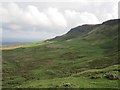
Multi-periodSite Name: Linford BarrowsCountry: Ireland (Northern) County: Co. Antrim Type: Artificial Mound
Nearest Town: Larne Nearest Village: Linford
Map Ref: D33230723
Latitude: 54.894978N Longitude: 5.924181W
Condition:
| 5 | Perfect |
| 4 | Almost Perfect |
| 3 | Reasonable but with some damage |
| 2 | Ruined but still recognisable as an ancient site |
| 1 | Pretty much destroyed, possibly visible as crop marks |
| 0 | No data. |
| -1 | Completely destroyed |
| 5 | Superb |
| 4 | Good |
| 3 | Ordinary |
| 2 | Not Good |
| 1 | Awful |
| 0 | No data. |
| 5 | Can be driven to, probably with disabled access |
| 4 | Short walk on a footpath |
| 3 | Requiring a bit more of a walk |
| 2 | A long walk |
| 1 | In the middle of nowhere, a nightmare to find |
| 0 | No data. |
| 5 | co-ordinates taken by GPS or official recorded co-ordinates |
| 4 | co-ordinates scaled from a detailed map |
| 3 | co-ordinates scaled from a bad map |
| 2 | co-ordinates of the nearest village |
| 1 | co-ordinates of the nearest town |
| 0 | no data |
Internal Links:
External Links:
")
You may be viewing yesterday's version of this page. To see the most up to date information please register for a free account.
")
Do not use the above information on other web sites or publications without permission of the contributor.
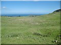
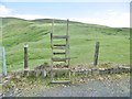
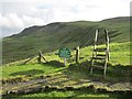
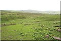
Nearby Images from Geograph Britain and Ireland:
©2018(licence)
©2018(licence)
©2012(licence)
©2007(licence)
©2013(licence)
The above images may not be of the site on this page, they are loaded from Geograph.
Please Submit an Image of this site or go out and take one for us!
Click here to see more info for this site
Nearby sites
Click here to view sites on an interactive map of the areaKey: Red: member's photo, Blue: 3rd party photo, Yellow: other image, Green: no photo - please go there and take one, Grey: site destroyed
Download sites to:
KML (Google Earth)
GPX (GPS waypoints)
CSV (Garmin/Navman)
CSV (Excel)
To unlock full downloads you need to sign up as a Contributory Member. Otherwise downloads are limited to 50 sites.
Turn off the page maps and other distractions
Nearby sites listing. In the following links * = Image available
147m N 6° Linford Round Cairn Round Cairn
1.0km SE 125° Knockdhu* Promontory Fort / Cliff Castle (NW493620)
1.2km NW 312° Dunteige* Wedge Tomb (D32350798)
2.9km S 172° Larne Standing Stone* Standing Stone (Menhir)
3.2km N 5° Ballygilbert* Standing Stone (Menhir) (D334104)
3.8km NNW 334° Deer Park Farms* Standing Stone (Menhir) (NW470661)
3.9km NNW 337° Goakstown* Wedge Tomb
6.1km SE 125° Ballycraigy Stone Circle (D384039)
8.2km SE 125° Larne Museum and Arts Centre* Museum (D401027)
8.5km WNW 298° Antynanum* Court Tomb (D25561094)
9.0km WNW 289° Tamybuck Wedge Tomb* Wedge Tomb (NW401660)
9.6km SSE 164° Ballrickard More Stone Circle (J362981)
9.9km S 184° Carndoo* Court Tomb (J32849731)
11.3km ESE 122° Ballylumford Dolmen* Burial Chamber or Dolmen (D4305201603)
11.4km S 173° Tureagh Stone Circle (J350960)
11.4km WNW 300° Ticloy* Portal Tomb (D232127)
17.4km W 265° St. Patrick's Stone* Standing Stone (Menhir) (NW310621)
17.7km NNW 348° Galboly Upper* Passage Grave (D2900724454)
18.1km N 349° Galboly Lower* Passage Grave
18.5km S 180° West Division Stone Row / Alignment (J338887)
18.8km SSW 210° Doagh* Holed Stone (J2416590683)
19.1km NNW 334° Cross-Carved Stone and Children's Burial Ground* Early Christian Sculptured Stone (NW411803)
19.4km SW 222° Browndod Court Tomb* Court Tomb
19.7km WSW 238° Carncome Standing Stone* Standing Stone (Menhir)
19.9km WSW 256° Ballymarlagh* Court Tomb (D14040175)
View more nearby sites and additional images


 We would like to know more about this location. Please feel free to add a brief description and any relevant information in your own language.
 Wir möchten mehr über diese Stätte erfahren. Bitte zögern Sie nicht, eine kurze Beschreibung und relevante Informationen in Deutsch hinzuzufügen.
 Nous aimerions en savoir encore un peu sur les lieux. S'il vous plaît n'hesitez pas à ajouter une courte description et tous les renseignements pertinents dans votre propre langue.
 Quisieramos informarnos un poco más de las lugares. No dude en añadir una breve descripción y otros datos relevantes en su propio idioma.