


<< Our Photo Pages >> Banc Du Causewayed Enclosure - Causewayed Enclosure in Wales in Pembrokeshire
Submitted by Bladup on Monday, 11 January 2016 Page Views: 5944
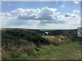
Neolithic and Bronze AgeSite Name: Banc Du Causewayed EnclosureCountry: Wales County: Pembrokeshire Type: Causewayed Enclosure
Map Ref: SN06123065
Latitude: 51.940483N Longitude: 4.822018W
Condition:
| 5 | Perfect |
| 4 | Almost Perfect |
| 3 | Reasonable but with some damage |
| 2 | Ruined but still recognisable as an ancient site |
| 1 | Pretty much destroyed, possibly visible as crop marks |
| 0 | No data. |
| -1 | Completely destroyed |
| 5 | Superb |
| 4 | Good |
| 3 | Ordinary |
| 2 | Not Good |
| 1 | Awful |
| 0 | No data. |
| 5 | Can be driven to, probably with disabled access |
| 4 | Short walk on a footpath |
| 3 | Requiring a bit more of a walk |
| 2 | A long walk |
| 1 | In the middle of nowhere, a nightmare to find |
| 0 | No data. |
| 5 | co-ordinates taken by GPS or official recorded co-ordinates |
| 4 | co-ordinates scaled from a detailed map |
| 3 | co-ordinates scaled from a bad map |
| 2 | co-ordinates of the nearest village |
| 1 | co-ordinates of the nearest town |
| 0 | no data |
Internal Links:
External Links:
")
Outside is an outer boundary that appears to start on the cragline, cross the neck of the promontory on the north side, and then curve around the west side to run close and parallel to the inner boundary to the south.
A single evaluation trench was opened in August 2005. This demonstrated that the bank, about 3.8m wide, was preserved to c. 40 cm, and had been apparently set onto an old, deturfed land surface. Postholes towards the front and rear were suggestive of a timber lacing within the bank. The ditch was 2.8m wide and a maximum of 1m deep with a U-shaped profile. Radiocarbon dates obtained through the AHRC-funded Neolithic Enclosure Dating Project show that the initial silt accumulated at around 3650 BC, whilst the middle fills contained material from the period 3000-2600 BC.
Examination of pollen evidence concludes that the enclosure was built in a heath-dominated landscape with some local scrubby woodland including oak and hazel.
The most recent phase comprises extensive ridge and furrow cultivation probably associated with a now-abandoned, putatively medieval or later, long house settlement or small hamlet downslope to the north-west. Earlier than this are two curved trackways that seem to provide access to a single long-house dwelling or structure. It is currently unclear whether these are contemporary or successive.
Coflein site no. 308024
Text by DeborahWales
You may be viewing yesterday's version of this page. To see the most up to date information please register for a free account.
")
")
Do not use the above information on other web sites or publications without permission of the contributor.
Nearby Images from Geograph Britain and Ireland:
©2010(licence)
©2023(licence)
©2010(licence)
©2015(licence)
©2023(licence)
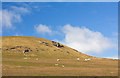
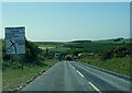
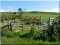
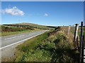
The above images may not be of the site on this page, they are loaded from Geograph.
Please Submit an Image of this site or go out and take one for us!
Click here to see more info for this site
Nearby sites
Key: Red: member's photo, Blue: 3rd party photo, Yellow: other image, Green: no photo - please go there and take one, Grey: site destroyed
Download sites to:
KML (Google Earth)
GPX (GPS waypoints)
CSV (Garmin/Navman)
CSV (Excel)
To unlock full downloads you need to sign up as a Contributory Member. Otherwise downloads are limited to 50 sites.
Turn off the page maps and other distractions
Nearby sites listing. In the following links * = Image available
1.3km SSW 196° Bernard's Well Mountain* Ancient Village or Settlement (SN057294)
1.5km NNE 30° Foel Eryr enclosure* Ancient Village or Settlement (SN069319)
1.5km NNE 16° Foel Eryr Cairn* Cairn (SN06583208)
1.7km NNE 17° Cerrig Lladron Stones* Stone Row / Alignment (SN067323)
1.8km NNE 23° Foel Eryr rock outcrop Rock Outcrop (SN06883227)
1.9km ENE 71° Mynydd Du* Cairn (SN079312)
2.2km SSE 166° Budloy Stone* Standing Stone (Menhir) (SN06562853)
2.2km S 183° Dyffryn Syfynwy* Stone Circle (SN05922845)
2.3km WNW 284° Mynydd Morvil Barrow Cemetery (SN039313)
2.5km ESE 122° Eithbed Cairn* Ring Cairn (SN08172927)
2.5km E 96° Cnwc Barrow 2 Round Barrow(s) (SN086303)
2.6km SSW 209° Tavern Farm Ancient Village or Settlement (SN04792842)
2.7km WNW 293° Morvil church* Early Christian Sculptured Stone (SN037318)
2.7km E 91° Cnwc Barrow 1 Round Barrow(s) (SN088305)
2.7km SE 133° Eithbed Enclosure* Ancient Village or Settlement (SN08052871)
2.7km SE 135° Eithbed Tombs* Chambered Tomb (SN07982864)
2.7km SSW 193° St Brynach's Well* Holy Well or Sacred Spring (SN054280)
3.0km SW 218° Tufton Castle Ancient Village or Settlement (SN04172834)
3.1km ESE 105° Mynydd Crwn Standing Stone Standing Stone (Menhir) (SN091297)
3.2km ESE 119° Eithbed Stone Standing Stone (Menhir) (SN089290)
3.3km ENE 78° Foel Cwmcerwyn* Cairn (SN094312)
3.3km SE 141° Maenclochog Standing Stones* Standing Stones (SN08152798)
3.4km ESE 113° Eithbed Circles* Stone Circle (SN092292)
3.5km WSW 250° Mynydd Castlebythe Cairn (SN028296)
3.6km SSW 205° Castell Hendre Ancient Village or Settlement (SN04472740)
View more nearby sites and additional images


 We would like to know more about this location. Please feel free to add a brief description and any relevant information in your own language.
 Wir möchten mehr über diese Stätte erfahren. Bitte zögern Sie nicht, eine kurze Beschreibung und relevante Informationen in Deutsch hinzuzufügen.
 Nous aimerions en savoir encore un peu sur les lieux. S'il vous plaît n'hesitez pas à ajouter une courte description et tous les renseignements pertinents dans votre propre langue.
 Quisieramos informarnos un poco más de las lugares. No dude en añadir una breve descripción y otros datos relevantes en su propio idioma.