Featured: How and why the ancients enchanted Great Britain and Brittany

How and why the ancients enchanted Great Britain and Brittany

Serpent’s Gold by Sam Osman

Serpent’s Gold by Sam Osman

Who's Online

There are currently, 272 guests and 0 members online.

You are a guest. To join in, please register for free by clicking here

Sponsors

<< Our Photo Pages >> Seven Lords' Lands - Stone Circle in England in Devon

Submitted by Tom_Bullock on Wednesday, 07 May 2008  Page Views: 10383

Neolithic and Bronze AgeSite Name: Seven Lords' Lands Alternative Name: Grinsell Widecombe in the Moor 13; Turner F1; 7 Lords Lands
Country: England County: Devon Type: Stone Circle
Nearest Town: Widecombe
Map Ref: SX74127623  Landranger Map Number: 191
Latitude: 50.572212N  Longitude: 3.779005W
Condition:
5Perfect
4Almost Perfect
3Reasonable but with some damage
2Ruined but still recognisable as an ancient site
1Pretty much destroyed, possibly visible as crop marks
0No data.
-1Completely destroyed
3 Ambience:
5Superb
4Good
3Ordinary
2Not Good
1Awful
0No data.
2 Access:
5Can be driven to, probably with disabled access
4Short walk on a footpath
3Requiring a bit more of a walk
2A long walk
1In the middle of nowhere, a nightmare to find
0No data.
5 Accuracy:
5co-ordinates taken by GPS or official recorded co-ordinates
4co-ordinates scaled from a detailed map
3co-ordinates scaled from a bad map
2co-ordinates of the nearest village
1co-ordinates of the nearest town
0no data
5

Internal Links:
External Links:

I have visited· I would like to visit

markj99 visited on 12th Sep 2022 - their rating: Cond: 3 Amb: 3 Access: 4 I love an unexpected cairn. On the way back from Hound Tor Medieval Village I noticed this cairn next to the road with a convenient car park. Bonus!

TheCaptain visited on 7th Sep 2022 - their rating: Cond: 4 Amb: 4 Access: 4 On the way back to Haytor, I stop to go and look at Seven Lords' Lands cairn with its large encircling ring of stones. Its really splendid here in the low sun, which occasionally peeps through the clouds. Now to the Rock Inn after a tiring day on the big moor, I sat quietly nursing a pint in the snug when Dave from Royle Family comes in with wife and dog, and sits next to me.

AngieLake have visited here

Average ratings for this site from all visit loggers: Condition: 3.5 Ambience: 3.5 Access: 4
Seven Lords' Lands
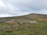
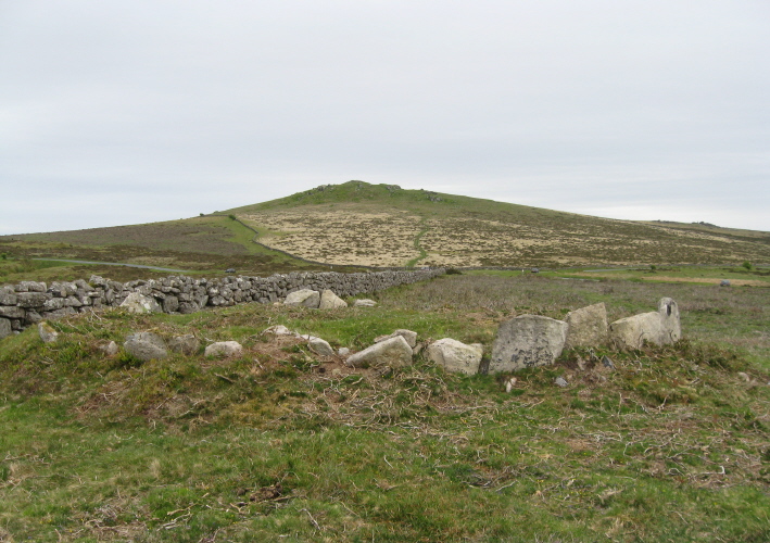
Seven Lords' Lands submitted by AngieLake : Looking towards Rippon Tor from the now tidied-up Seven Lords Lands Cairn. (Vote or comment on this photo)
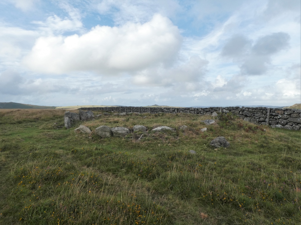
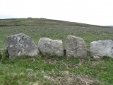
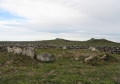
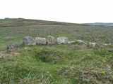
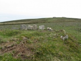
Cairn-circle in Devon. Circle diameter: 33 feet. Shown as a cairn on the OS Map, this well-preserved cairn is easily accessible from the nearby road. It is disguised by the surrounding gorse and bracken, but only six stones are missing from the close-set kerb of stones. A field wall curves slightly in order to avoid the cairn.

From Angie Lake:
According to Butler:
"This well-preserved cairn lies about 80m from the road near Hemsworthy Gate, next to a field wall which curves slightly to avoid it.
Perhaps the exceptional state of preservation is connected with its importance as the boundary point where seven manors are reputed to have met. A close-set kerb of stones surround the cairn, all but about six slabs still in place around the edge, though some are turf covered.
The overall diameter is 10m with the interior about 0.6m above surrounding ground level. The shallow central depression is obviously the result of an early exploration but perhaps not a very thorough one and this cairn may still preserve something of archaeological interest."

I visited about 6pm on 12th August 2006, when the brilliant evening sun was illuminating the striking colours of purple heather and yellow gorse
in which the cairn kerbstones were snuggling, like sleepy things that didn't want to be disturbed! It was impossible to see much more than three or four stones due to the close-matting of the undergrowth, but I will visit again in winter to get a better - though much less colourful -shot!
(It was described as a round barrow on a Widecombe website.)
NB: I only gave it 3 for condition, because I couldn't see it for vegetation!

Update December 2019: This cairn is featured on the Prehistoric Dartmoor Walks (PDW) website - see their entry for the Seven Lords' Lands Encircled Cairn, which tells us: "(This is) a cairn from 0.8m. to 1.2m. high, with a minor central excavation 0.5m. deep. The kerb retaining circle extends round the west and north quadrants".

The cairn is also recorded as Pastscape Monument No. 445151, as MDV7396 (CAIRN in the Parish of Widecombe in the Moor) on the Devon and Dartmoor HER, and scheduled as Historic England List Entry No. 103302 (Seven Lords' Lands round barrow).

Note: Maia investigates Beltane sunrise alignments on Dartmoor, see comment
You may be viewing yesterday's version of this page. To see the most up to date information please register for a free account.

 Seven Lords' Lands
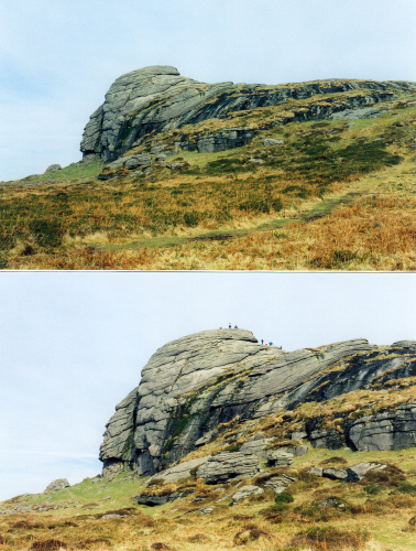
Seven Lords' Lands submitted by AngieLake : Low Man - part of Haytor (Hay Tor). Unmissable to left of road while driving from Widecombe towards Haytor. Thanks to Maia*, who viewed sunrise over this rock from Seven Lords Lands cairn on 6th May 08, at last I know what this rock is called! Every time I pass it I can't help marvelling at its likeness to an American Indian brave. The closer view shows people on its summit for comparison. (1 comment - Vote or comment on this photo)

 Seven Lords' Lands
Seven Lords' Lands submitted by Maia : (Vote or comment on this photo)

Seven Lords' Lands
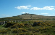
Seven Lords' Lands submitted by TheCaptain : even Lords' Lands cairn with its large encircling ring of stones. View looking east towards Haytor and Saddle Tor (Vote or comment on this photo)

Seven Lords' Lands
Seven Lords' Lands submitted by TheCaptain : even Lords' Lands cairn with its large encircling ring of stones. View looking northeast (Vote or comment on this photo)

Seven Lords' Lands
Seven Lords' Lands submitted by TheCaptain : even Lords' Lands cairn with its large encircling ring of stones. View looking north (Vote or comment on this photo)

Seven Lords' Lands
Seven Lords' Lands submitted by TheCaptain : even Lords' Lands cairn with its large encircling ring of stones. View looking northwest

Seven Lords' Lands
Seven Lords' Lands submitted by TheCaptain : even Lords' Lands cairn with its large encircling ring of stones. View looking south across Blackslade Mire

Seven Lords' Lands
Seven Lords' Lands submitted by TheCaptain : even Lords' Lands cairn with its large encircling ring of stones. View looking southeast towards Rippon Tor

Seven Lords' Lands
Seven Lords' Lands submitted by TheCaptain : even Lords' Lands cairn with its large encircling ring of stones. View looking east over the road to Haytor and Rippon Tor

Seven Lords' Lands
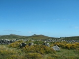
Seven Lords' Lands submitted by Bladup : Seven Lords' Lands kerb cairn looking east towards Saddle Tor (right) and Haytor (left).

Seven Lords' Lands
Seven Lords' Lands submitted by Bladup : Seven Lords' Lands kerb cairn looking south east towards Rippon Tor.

Seven Lords' Lands
Seven Lords' Lands submitted by Bladup : Seven Lords' Lands kerb cairn looking west.

Seven Lords' Lands
Seven Lords' Lands submitted by Bladup : Seven Lords' Lands kerb cairn.

Seven Lords' Lands
Seven Lords' Lands submitted by Bladup : Seven Lords' Lands kerb cairn looking north west.

Seven Lords' Lands
Seven Lords' Lands submitted by Bladup : Seven Lords' Lands kerb cairn looking south east at Rippon Tor.

Seven Lords' Lands
Seven Lords' Lands submitted by AngieLake : I noticed how, when the pointed stone on this side of the kerb aligned with a pointed stone at the far side, they both pointed to the dip between Hay Tor (Haytor) and Saddle Tor.

Seven Lords' Lands
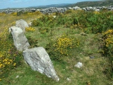
Seven Lords' Lands submitted by AngieLake : Closer look at the four bigger kerb stones, with Top Tor behind.

Seven Lords' Lands
Seven Lords' Lands submitted by AngieLake : As well as swaling (burning off the scrubby vegetation), someone has taken a scythe to this cairn, and we can now see what was hidden underneath all those bushes! Here, looking towards Hay Tor (L), and Saddle Tor (R), on 30 May 2010. [Not much sun at 5.50pm]

Seven Lords' Lands
Seven Lords' Lands submitted by AngieLake : That's Hound Tor in the distance, looking along the newly-exposed large kerb stones. 30.5.2010

Seven Lords' Lands
Seven Lords' Lands submitted by AngieLake : Now we can clearly see a pit just off-centre in the cairn, and some of the larger of its kerb stones.

Seven Lords' Lands
Seven Lords' Lands submitted by AngieLake : Seven Lords Lands cairn has been tidied up. Here is the view looking towards Top Tor.

 Seven Lords' Lands
Seven Lords' Lands submitted by Maia :

Seven Lords' Lands
Seven Lords' Lands submitted by Maia : (1 comment)

Seven Lords' Lands
Seven Lords' Lands submitted by Maia

These are just the first 25 photos of Seven Lords' Lands. If you log in with a free user account you will be able to see our entire collection.

Do not use the above information on other web sites or publications without permission of the contributor.
Click here to see more info for this site

Nearby sites

Click here to view sites on an interactive OS map

Key: Red: member's photo, Blue: 3rd party photo, Yellow: other image, Green: no photo - please go there and take one, Grey: site destroyed

Download sites to:
KML (Google Earth)
GPX (GPS waypoints)
CSV (Garmin/Navman)
CSV (Excel)

To unlock full downloads you need to sign up as a Contributory Member. Otherwise downloads are limited to 50 sites.


Turn off the page maps and other distractions

Nearby sites listing. In the following links * = Image available
 501m SW 223° Foales Arrishes* Ancient Village or Settlement (SX73777587)
 596m WNW 293° Top Tor Cairns* Cairn (SX7357476472)
 641m WNW 284° Top Tor row Stone Row / Alignment (SX735764)
 844m SE 139° Rippon Tor* Cairn (SX74667558)
 1.0km SW 223° Blackslade Down Cairn and Cist* Cist (SX7341275510)
 1.0km WSW 244° Tunhill Rocks* Ancient Village or Settlement (SX7318975796)
 1.3km SW 216° Wittaburrow Cairn* Cairn (SX73347521)
 2.3km NNW 328° Chinkwell Tor Cairn* Cairn (SX7293078250)
 2.4km WNW 282° Saxon Well* Holy Well or Sacred Spring (SX718768)
 2.5km NE 35° Smallacombe Rocks Settlement* Ancient Village or Settlement (SX7558378211)
 2.5km W 260° Dunstone Cup Stone Rock Art (SX71677585)
 2.5km N 358° Hound Tor Ring Cairn* Ring Cairn (SX7409778770)
 2.6km N 10° Hound Tor Deserted Medieval Village* Ancient Village or Settlement (SX74627878)
 2.7km N 2° Hound Tor Enclosure* Causewayed Enclosure (SX74307897)
 3.0km S 189° Buckland Ridge South Ring Cairn (SX73577324)
 3.1km NE 51° Haytor Down Ring Cairn (SX76617814)
 3.2km S 190° Ten Commandments Stone* Natural Stone / Erratic / Other Natural Feature (SX735731)
 3.3km NE 38° Black Hill Cairns* Cairn (SX762788)
 3.4km S 189° Stidwell* Holy Well or Sacred Spring (SX735729)
 3.8km WNW 303° Hamel Down Cairn and Cist* Cairn (SX7100878345)
 3.9km NE 38° Trendlebere Down Stone Row Cairn* Cairn (SX7662079230)
 3.9km NE 38° Trendlebere Down* Multiple Stone Rows / Avenue (SX76627928)
 4.2km N 358° Bowerman's Nose* Rock Outcrop (SX74108046)
 4.2km NW 308° Hamel Down Beacon cairn* Cairn (SX70837891)
 4.4km NW 308° Blackaton Down south (Hamel Down)* Cairn (SX70737904)
View more nearby sites and additional images

<< Menhir of Naxos

Isle of Vera >>

Please add your thoughts on this site

Prehistoric Settlements

Prehistoric Settlements

Sponsors

Auto-Translation (Google)

Translate from English into:

"Seven Lords' Lands" | Login/Create an Account | 4 News and Comments
  
Go back to top of page    Comments are owned by the poster. We aren't responsible for their content.
Re: Directions to Seven Lords Lands Cairn by markj99 on Monday, 19 September 2022
(User Info | Send a Message)
Directions for Seven Lords' Lands Cairn:
Take the Bovey Tracey / M'hampstead A382 turn off the A38. Turn left for Bovey Tracey. After c. 1.3 miles take the 2nd exit of the roundabout for Town Centre / Haytor. Take the 1st exit for Haytor / Widecombe B3387 at the next roundabout c. 0.8 miles later. After c. 0.4 miles on the B3387 bear left to stay on the B3387. Continue on the B3387 for c. 5 miles to reach Hemsworthy Gate Car Park (SX 74145 76095) at the B3387 / Ashburton Junction. Seven Lords' Lands Cairn is located c. 140 yards N from here adjacent to a stone wall.
[ Reply to This ]

Re: Seven Lords Lands Historical Note by AngieLake on Monday, 28 March 2011
(User Info | Send a Message)
Dipping into a book I picked up in a charity shop - 'Dartmoor 2001 . A Dartmoor Diary of Yesteryear' by Mike Brown [Forest Publishing, 2001] - amongst the diary entries spanning many centuries, was this one for 25th September:

"1683. A Buckland-in-the-Moor manor boundary report describes Seven Lords' Lands as "Hoartsberry where the seven Lords meete, and sevven [sic] stones are pitched so up together to each Lord a Stone...", proving, absolutely, that the spot was a place where the lords of the seven manors of the Haytor hundred held open-air meetings, rather than the spot where the boundaries of seven local manors met."

I wonder if the writer referred to the cairn circle (which appears to have more than seven when the bracken is cleared), or to seven other stones which have now disappeared?
[ Reply to This ]

Seven Lords Lands Street View by SteveDut on Wednesday, 31 March 2010
(User Info | Send a Message)

View Larger Map
[ Reply to This ]

Beltane alilgnments around Seven Lords Lands Cairn, Dartmoor by Andy B on Wednesday, 07 May 2008
(User Info | Send a Message)
Maia writes: For many years I have been attempting to check out Stannon Circle in Cornwall for a Beltane alignment with Rough Tor. I have achieved this to some extent, so I decided to try a new location this year. I turned to the Megalithic Portal as an excellent resource.

After reading a comment on your site by one of your contributors - Angie Lake - I chose 7 Lords Lands Cairn, Haytor, Dartmoor (SX741762) for a 'Beltane' sunrise alignment location. She had noted an interesting easterly horizon view, so I checked on the OS191, and saw Beltane sunrise might align with a prominent local feature. Could there be an alignment? If so, why might it have been chosen? Are there any clues in the landscape?

I use the solar position which is the exact midpoint between spring equinox and summer solstice. On this occasion it occurred best on Monday 5th May to Tuesday 6th May. The first was cloudy, but we were blessed with a fabulous clear dawn on the 6th.

As first light began at 0500, the feature known as Low Man (SX756770), being the more southerly granite outcrop of Haytor Rocks, was lit up in a haze of red. From close viewing, this feature appears to resemble the profile of a strong male, with a large nose and heavy brow. Low Man had a perfect halo around his head. The sun's first appearance at 0556 was a gleam from a notch behind his head. Solar and lunar gleams through notches are frequent occurrences in alignment research. The sun rose away from this point to a point of magnificence in between Low Man and Saddle Tor.

From a larger viewpoint - and I do admit the need for glasses! - the array of features from Saddle Tor, across Low Man, Haytor, towards Holwell, Haytor Down is very reminiscent of the hills that make 'The Old Woman of the Moors' as seen from Calanais 1, Lewis, Outer Hebrides. From the 7 Lords Lands Cairn I could see that Low Man was the distinct outline of the breast of this 'land goddess', with prominent nipple. The rising sun was the milk of the May morning collecting in a notch/cup below her breast! Legends of the Old Ways tell us that we must go out and seek the May Day Morning 'Dew', as it has magical properties. The latter is just a thought - please check it out.

Lammas sunrise is the next opportunity - 7th August 2008.

I have some photos and will send them to the site.

BB Maia
[ Reply to This ]

Your Name: Anonymous [ Register Now ]
Subject:


Add your comment or contribution to this page. Spam or offensive posts are deleted immediately, don't even bother

<<< What is five plus one as a number? (Please type the answer to this question in the little box on the left)
You can also embed videos and other things. For Youtube please copy and paste the 'embed code'.
For Google Street View please include Street View in the text.
Create a web link like this: <a href="https://www.megalithic.co.uk">This is a link</a>  

Allowed HTML is:
<p> <b> <i> <a> <img> <em> <br> <strong> <blockquote> <tt> <li> <ol> <ul> <object> <param> <embed> <iframe>

We would like to know more about this location. Please feel free to add a brief description and any relevant information in your own language.
Wir möchten mehr über diese Stätte erfahren. Bitte zögern Sie nicht, eine kurze Beschreibung und relevante Informationen in Deutsch hinzuzufügen.
Nous aimerions en savoir encore un peu sur les lieux. S'il vous plaît n'hesitez pas à ajouter une courte description et tous les renseignements pertinents dans votre propre langue.
Quisieramos informarnos un poco más de las lugares. No dude en añadir una breve descripción y otros datos relevantes en su propio idioma.