Featured: Current Archaeology Book of the Year 2019!

Current Archaeology Book of the Year 2019!

Stonehenge: The Story So Far, Julian Richards

Stonehenge: The Story So Far, Julian Richards

Who's Online

There are currently, 321 guests and 7 members online.

You are a guest. To join in, please register for free by clicking here

Sponsors

<< Our Photo Pages >> Mardon Down S - Stone Circle in England in Devon

Submitted by Tom_Bullock on Sunday, 14 July 2002  Page Views: 14345

Neolithic and Bronze AgeSite Name: Mardon Down S Alternative Name: Mardon Down Stone Circle
Country: England County: Devon Type: Stone Circle
Nearest Town: Moretonhampstead
Map Ref: SX76768719  Landranger Map Number: 191
Latitude: 50.671292N  Longitude: 3.745387W
Condition:
5Perfect
4Almost Perfect
3Reasonable but with some damage
2Ruined but still recognisable as an ancient site
1Pretty much destroyed, possibly visible as crop marks
0No data.
-1Completely destroyed
3 Ambience:
5Superb
4Good
3Ordinary
2Not Good
1Awful
0No data.
3 Access:
5Can be driven to, probably with disabled access
4Short walk on a footpath
3Requiring a bit more of a walk
2A long walk
1In the middle of nowhere, a nightmare to find
0No data.
4 Accuracy:
5co-ordinates taken by GPS or official recorded co-ordinates
4co-ordinates scaled from a detailed map
3co-ordinates scaled from a bad map
2co-ordinates of the nearest village
1co-ordinates of the nearest town
0no data
5

Internal Links:
External Links:

I have visited· I would like to visit

Catrinm visited on 2nd May 2022 - their rating: Cond: 2 Amb: 5 Access: 4 A very interesting and under visited complex.

Silkscream visited on 24th Feb 2021 - their rating: Cond: 3 Amb: 5 Access: 4

TheCaptain visited on 26th Feb 2019 - their rating: Cond: 3 Amb: 4 Access: 3 Further south along the ridgetop path, and I arrive at a large wide open green area, where I can see the remains of the stone circle extending around the exterior. The first part I get to has another of what looks like a little cairn right on the circumference of the circle, but again the hole in the centre looking too deep and recent. I initially wonder whether I can see the remains of a sort of cist capstone at one place, but which later I wonder whether it is one of the remaining circle stones fallen and buried here. The circle is the largest on Dartmoor at 38 metres diameter and clear to see, but in a very ruinous state, with only 2 or 3 stones still standing of what was probably once between 60 and 70. There is still a nice arc of stones on the southeast side, with one still standing and a large fallen block. Opposite to this on the northwest side is another good arc, with one very interesting shaped large slab still standing, and a couple more a bit further round. I dont get great feelings here, probably as its all pretty much wrecked, and too easy to find. Perhaps it would have been more atmospheric it it was all still hidden and lurking within the gorse. This gorse was still surruounding the whole circle, preventing seeing any of the fabulous views available from elsewhere on the hill.

AngieLake cazzyjane cazzyjane have visited here

Average ratings for this site from all visit loggers: Condition: 2.67 Ambience: 4.67 Access: 3.67
Mardon Down S
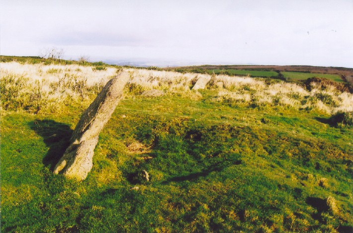
Mardon Down S submitted by AngieLake : Looking towards two smaller stones at approx 350 degs/ N, from the slab at 310 degs. (Vote or comment on this photo)
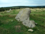
Mardon Down Stone Circle is the largest on Dartmoor at 38 metres diameter and nowadays clear to see but in a very ruinous state, with only 2 or 3 stones still standing of what was probably once between 60 and 70.

There is still a nice arc of stones on the southeast side, with one still standing and a large fallen block. Opposite to this on the northwest side is another good arc, with one very interesting shaped large slab still standing, and a couple more a bit further round.

Previous description from Tom Bullock in 2002:
Remnants of a large stone circle near to Dartmoor in Devon. A trail goes through the large circle, and a jumble of stones to the south (probably a damaged cairn) confuses the site. But the circle becomes obvious as stones on either side of trail define it. The largest stone stands at the NW, and is clearly seen from the trail.

Update November 2019: This site is featured on the Prehistoric Dartmoor Walks (PDW) website - see their entries for the Mardon Down Stone Circle and the Mardon Down Stone Circle & Cairns.

The circle with associated cairns are also recorded as Pastscape Monument No. 445394, as MDV8289 on the Devon and Dartmoor HER.
You may be viewing yesterday's version of this page. To see the most up to date information please register for a free account.


Mardon Down S
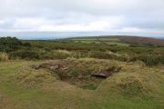
Mardon Down S submitted by Postman : Looking north across the circle. Kerb cairn on the left before the circle. (Vote or comment on this photo)

Mardon Down S
Mardon Down S submitted by Postman : Standing on the cairn just off the circles north west edge. (Vote or comment on this photo)

Mardon Down S
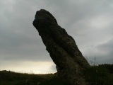
Mardon Down S submitted by Postman : The big stone, the only one still standing. Give it a round of applause. (Vote or comment on this photo)

Mardon Down S
Mardon Down S submitted by Postman : I'm so glad they cleared the circle of all that Gorse, Gorse is the enemy, the Devil's work, forget Covid get your guns on the Gorse. (Vote or comment on this photo)

Mardon Down S
Mardon Down S submitted by Postman : The west side of the circle (Vote or comment on this photo)

Mardon Down S
Mardon Down S submitted by Postman : Looking back on the last picture

Mardon Down S
Mardon Down S submitted by Postman : The southern arc of stones from the badly dug into cairn to the big stoney cairn.

Mardon Down S
Mardon Down S submitted by Postman : This heavily excavated cairn lies right on the circumference of the stone circle or if off it then only by inches. (1 comment)

Mardon Down S
Mardon Down S submitted by Postman : This clearly defined cairn is just a few yards off the circles north west edge.

Mardon Down S
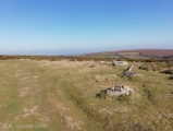
Mardon Down S submitted by TheCaptain : Panoramic of Mardon Down Stone Circle from the south. I was surprised to find it so easy to find and so clear of gorse and bracken. The circle is the largest on Dartmoor at 38 metres diameter and clear to see, but in a very ruinous state, with only 2 or 3 stones still standing of what was probably once between 60 and 70. I met with a couple out on the hill, who tell me thay are local c...

Mardon Down S
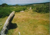
Mardon Down S submitted by TheCaptain : Mardon Down stone circle. On the northwest side is another good arc, with one very interesting shaped large slab still standing, and a couple more a bit further round. Who could believe this was February on Dartmoor !

Mardon Down S
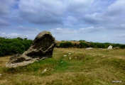
Mardon Down S submitted by TheCaptain : Mardon Down stone circle. There is still a nice arc of stones on the southeast side, with one still standing and a large fallen block. Who could believe this was February on Dartmoor !

Mardon Down S
Mardon Down S submitted by TheCaptain : View across Mardone Down stone circle. I was slightly surprised to find it so cleared of all the gorse, and easy to find. Who could believe this was February on Dartmoor !

Mardon Down S
Mardon Down S submitted by Bladup : Mardon Down South stone circle.

Mardon Down S
Mardon Down S submitted by Bladup : The wonderful and nearby Blackingstone Rock has the pleasure of the winter (summer) sun (moon) rising above it.

Mardon Down S
Mardon Down S submitted by Bladup : Mardon Down South stone circle.

Mardon Down S
Mardon Down S submitted by cazzyjane : Mardon Down Stone Circle.

Mardon Down S
Mardon Down S submitted by cazzyjane : The largest stone of Mardon Down Stone Circle.

Mardon Down S
Mardon Down S submitted by Bladup : Mardon Down South stone circle.

Mardon Down S
Mardon Down S submitted by Bladup : Mardon Down South stone circle, The biggest stone.

Mardon Down S
Mardon Down S submitted by Bladup : Mardon Down South stone circle.

Mardon Down S
Mardon Down S submitted by Bladup

Mardon Down S
Mardon Down S submitted by Bladup

Mardon Down S
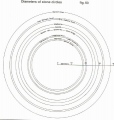
Mardon Down S submitted by AngieLake : A diagram from Dartmoor Atlas of Antiquities, Vol.5, by Jeremy Butler, showing how Mardon Down circle is by far the largest on Dartmoor. It is interesting to see the size comparisons of other local circles in Meg P site pages. I am sure the author wouldn't mind Meg P having this copy for research purposes, at the same time illustrating another reason why his books are so vital as guides when e...

Mardon Down S
Mardon Down S submitted by AngieLake : A map of Mardon Down sketched along the lines of one Jeremy Butler features in his book 'Dartmoor Atlas of Antiquities, Vol. 5'. This will be helpful to locate the various sites. The views from the ridge are wonderful and far-reaching. Situated on the NE of Dartmoor, not far from Moretonhampstead, it is quite popular with dog walkers, and the ridgeway path goes right through the circle.

These are just the first 25 photos of Mardon Down S. If you log in with a free user account you will be able to see our entire collection.

Do not use the above information on other web sites or publications without permission of the contributor.
Click here to see more info for this site

Nearby sites

Click here to view sites on an interactive OS map

Key: Red: member's photo, Blue: 3rd party photo, Yellow: other image, Green: no photo - please go there and take one, Grey: site destroyed

Download sites to:
KML (Google Earth)
GPX (GPS waypoints)
CSV (Garmin/Navman)
CSV (Excel)

To unlock full downloads you need to sign up as a Contributory Member. Otherwise downloads are limited to 50 sites.


Turn off the page maps and other distractions

Nearby sites listing. In the following links * = Image available
 30m S 178° Mardon Down Cairn 1* Cairn (SX76768716)
 80m NNW 336° Mardon Down Ring Cairn* Ring Cairn (SX7672987264)
 165m NNE 13° Mardon Down Mortar Pit* Modern Stone Circle etc (SX76808735)
 242m N 2° Mardon Down Cairn 3* Cairn (SX7677487432)
 270m N 359° The Giant's Grave Mardon Down* Cairn (SX76768746)
 433m NNE 17° Marden Down East* Ring Cairn (SX76908760)
 490m N 357° Mardon Down N* Stone Circle (SX76758768)
 688m NNE 24° Headless Cross (Moretonhampstead)* Modern Stone Circle etc (SX77068781)
 1.7km SW 226° Moretonhampstead Cross* Ancient Cross (SX7550886039)
 1.8km SSW 195° One Mill Bridge Cross* Ancient Cross (SX76268544)
 2.1km NW 304° Butterdon Down Cairns* Barrow Cemetery (SX75028843)
 2.2km N 354° Wooston Castle* Hillfort (SX76608935)
 2.3km WNW 300° Butterdon Down West* Standing Stone (Menhir) (SX74788840)
 3.4km NW 310° Charles Cross* Ancient Cross (SX742894)
 3.4km WNW 301° Cranbrook Castle* Hillfort (SX7386889010)
 3.5km SW 224° Horspit Cross* Ancient Cross (SX7430684741)
 3.5km NW 324° Prestonbury Castle* Hillfort (SX7477490045)
 3.6km S 178° Sanduck Cross* Ancient Cross (SX7681983610)
 4.2km W 262° Meacombe Cist Landscape Natural Stone / Erratic / Other Natural Feature (SX726867)
 4.3km W 265° Meacombe Cist* Burial Chamber or Dolmen (SX7249486904)
 4.3km SW 218° North Bovey* Ancient Cross (SX7399083879)
 4.8km SSE 167° Higher Combe Cross* Ancient Cross (SX7776482535)
 4.8km S 186° Hunter's Tor Fort* Hillfort (SX7616482412)
 4.9km S 173° South Harton Cross* Ancient Cross (SX7724982273)
 5.2km WSW 258° Chagford Druid's Well* Holy Well or Sacred Spring (SX71658625)
View more nearby sites and additional images

<< Drumlave

Rooves Beg >>

Please add your thoughts on this site

Prehistoric Settlements

Prehistoric Settlements

Sponsors

Auto-Translation (Google)

Translate from English into:

"Mardon Down S" | Login/Create an Account | 1 comment
  
Go back to top of page    Comments are owned by the poster. We aren't responsible for their content.
Re: Mardon Down S by AngieLake on Tuesday, 02 December 2008
(User Info | Send a Message)
In his 'Dartmoor Atlas of Antiquities, Vol. 5' Jeremy Butler has this to say about the large circle:

"The largest of all the regional stone circles, diameter 38 m, lies some distance from the main moorland mass, isolated from it by several minor valleys on the summit of Mardon Down 10 km to the east. The gorse and bracken covered ridge reaching to the 350 m contour remains unimproved above the surrounding fields, permitting the survival of both the stone circle and an interesting alignment of burial cairns (fig. 89)" [a rough copy of which is posted on this site page, with my own additions.] "The ridge top location, not quite on the highest point but unusually prominent for a Dartmoor stone circle, has an extensive outlook over much of East Devon and provides the only level ground in the vicinity. Despite the thick vegetation the site is not difficult to find as the ridgeway track, running the length of the high ground, passes right through the circle, the few granite slabs still remaining upright, protruding whitely above the gorse on either hand (fig. 90).
Though now much decayed it must have been an impressive monument when first put up. Some of the remaining slabs are truly megalithic, the largest facing each other across the centre: a tilted slab 2.3 m in width standing 1.4 m high and a massive fallen block 2.1 m in length. Only six stones are still on end and a further sixteen lie roughly in place, fallen radially, their surfaces not yet quite covered by turf. More it seems were visible in 1752 when the structure was first described by Dr Milles but no doubt many of the missing ones are buried where they fell, though some fractured blocks nearby show that stone-cutters have been at work in the vicinity. A short arc of seven regularly-spaced stones in the south-eastern quadrant is probably complete and if a similar interval was maintained around the rest of the perimeter (c.2 m) the original number would have been about sixty-one, a little less than the 'near seventy' recorded by Dr Milles. Within the circle the ground is quite flat, broken only by the modern track and a low bank with traces of a ditch alongside, of unknown date, curving slightly as it traverses the western half. Around the middle of the last century Rowe was able to identify intersecting 'tracklines' nearby, presumably reaves indicating the presence of a settlement somewhere in the area."

This book was published in 1997.

[ Reply to This ]

Your Name: Anonymous [ Register Now ]
Subject:


Add your comment or contribution to this page. Spam or offensive posts are deleted immediately, don't even bother

<<< What is five plus one as a number? (Please type the answer to this question in the little box on the left)
You can also embed videos and other things. For Youtube please copy and paste the 'embed code'.
For Google Street View please include Street View in the text.
Create a web link like this: <a href="https://www.megalithic.co.uk">This is a link</a>  

Allowed HTML is:
<p> <b> <i> <a> <img> <em> <br> <strong> <blockquote> <tt> <li> <ol> <ul> <object> <param> <embed> <iframe>

We would like to know more about this location. Please feel free to add a brief description and any relevant information in your own language.
Wir möchten mehr über diese Stätte erfahren. Bitte zögern Sie nicht, eine kurze Beschreibung und relevante Informationen in Deutsch hinzuzufügen.
Nous aimerions en savoir encore un peu sur les lieux. S'il vous plaît n'hesitez pas à ajouter une courte description et tous les renseignements pertinents dans votre propre langue.
Quisieramos informarnos un poco más de las lugares. No dude en añadir una breve descripción y otros datos relevantes en su propio idioma.