


<< Our Photo Pages >> Truro Eastern District Centre Neolithic Enclosure - Causewayed Enclosure in England in Cornwall
Submitted by Andy B on Thursday, 08 November 2012 Page Views: 20972
Neolithic and Bronze AgeSite Name: Truro Eastern District Centre Neolithic EnclosureCountry: England County: Cornwall Type: Causewayed Enclosure
Nearest Town: Truro
Map Ref: SW838459
Latitude: 50.273389N Longitude: 5.035486W
Condition:
| 5 | Perfect |
| 4 | Almost Perfect |
| 3 | Reasonable but with some damage |
| 2 | Ruined but still recognisable as an ancient site |
| 1 | Pretty much destroyed, possibly visible as crop marks |
| 0 | No data. |
| -1 | Completely destroyed |
| 5 | Superb |
| 4 | Good |
| 3 | Ordinary |
| 2 | Not Good |
| 1 | Awful |
| 0 | No data. |
| 5 | Can be driven to, probably with disabled access |
| 4 | Short walk on a footpath |
| 3 | Requiring a bit more of a walk |
| 2 | A long walk |
| 1 | In the middle of nowhere, a nightmare to find |
| 0 | No data. |
| 5 | co-ordinates taken by GPS or official recorded co-ordinates |
| 4 | co-ordinates scaled from a detailed map |
| 3 | co-ordinates scaled from a bad map |
| 2 | co-ordinates of the nearest village |
| 1 | co-ordinates of the nearest town |
| 0 | no data |
Internal Links:
External Links:
I have visited· I would like to visit
lucasn visited on 9th Jul 2019 - their rating: Cond: 1 Amb: 3 Access: 4
Andy B have visited here
")
Later activity on the site includes the deposition of Late Neolithic Grooved Ware in pits within the enclosure, one of which also contained a stunning piece of Neolithic art carved onto both sides of a slate disc.
Now the team led by Cornwall Council’s Historic Environment Service will catalogue their findings, take samples and carefully re-bury the site.
"While it is important that we take the opportunity to learn more about our findings now, best practice is for the site to be preserved for future generations of archaeologists who will have better technologies to understand it than we do today," said Dan Ratcliffe from the Council’s Historic Environment Service. "Scientific analysis of evidence recovered during the excavations is expected to take some years after the sample excavation has concluded."
Initial surveys of the site were carried out in 2009, with a condition of the planning approval being to carry out further archaeological research. This work was commissioned by the Council’s Transportation Service.
Tim Wood, Cornwall Council’s assistant head of transportation, said: “The proposed development has sufficient flexibility in the design to ensure that the construction above does not interfere with the archaeological remains.
“Following recommendations from the Council’s archaeological advisor, we will reflect the archaeological significance of the site including installing interpretation boards.”
Around 80 sites with evidence of causewayed enclosures are known across southern Britain. The find at Truro is the first to be discovered to the south west of the border between Dorset and Devon although the ‘tor enclosures’ at Carn Brea and Helman Tor are thought to have been built at the same time and may have served similar functions.
“A causewayed enclosure was a large circular or oval area enclosed by a large bank and ditch,” said Dan Ratcliffe. “These sites date to the early Neolithic period - a period which also saw the first introduction of agriculture to Britain, the domestication of animals, the manufacture of pottery, and the first appearance of large communally built and used ceremonial monuments. Both the construction of the site and the activities within and around it probably served to bring communities together.”
Cornish Archaeology add: We have uncovered a Neolithic enclosure comprising two, possibly three, segments of enclosure ditch of considerable scale enclosing an area approximately 70m across. There is evidence for an internal bank, and possibly an external one too. The survival of Neolithic stratigraphy is quite remarkable given the thin nature of the topsoil over the site.
We have yet to date the construction of the ditch but later activity on the site includes the deposition of Late Neolithic Grooved Ware in pits within the enclosure, one of which also contained a stunning piece of Neolithic art carved onto both sides of a slate disc. We have a tentative identification of Middle Neolithic Peterborough Ware from a pit cut into the possible external bank
Source: Cornwall County Council and Cornish Archaeology
Note: A stunning piece of Neolithic art carved onto both sides of a slate disc excavated in Cornwall
You may be viewing yesterday's version of this page. To see the most up to date information please register for a free account.
")
")
")
Do not use the above information on other web sites or publications without permission of the contributor.
Nearby Images from Geograph Britain and Ireland:
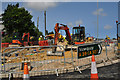
©2015(licence)
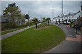
©2017(licence)
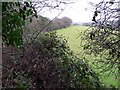
©2006(licence)
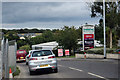
©2014(licence)
©2015(licence)
The above images may not be of the site on this page, they are loaded from Geograph.
Please Submit an Image of this site or go out and take one for us!
Click here to see more info for this site
Nearby sites
Key: Red: member's photo, Blue: 3rd party photo, Yellow: other image, Green: no photo - please go there and take one, Grey: site destroyed
Download sites to:
KML (Google Earth)
GPX (GPS waypoints)
CSV (Garmin/Navman)
CSV (Excel)
To unlock full downloads you need to sign up as a Contributory Member. Otherwise downloads are limited to 50 sites.
Turn off the page maps and other distractions
Nearby sites listing. In the following links * = Image available
1.6km SW 230° Truro Cathedral Celtic Cross* Early Christian Sculptured Stone (SW825449)
1.8km SW 229° Royal Cornwall Museum* Museum (SW824448)
1.9km W 265° Kenwyn* Holy Well or Sacred Spring (SW819458)
2.0km WSW 241° St Domnu's Well* Holy Well or Sacred Spring (SW820450)
2.4km SE 145° Ignioc Stone* Ancient Cross (SW851439)
2.6km SE 142° St Clement's Well* Holy Well or Sacred Spring (SW853438)
2.8km SSE 157° Malpas Tumulus* Round Barrow(s) (SW848433)
3.0km NNW 340° Bishops Wood Fort* Hillfort (SW82914873)
4.4km W 269° Penventinnie Round* Ancient Village or Settlement (SW79374603)
4.7km E 79° Trelowthas Cross* Ancient Cross (SW885466)
5.5km S 178° Round Wood* Promontory Fort / Cliff Castle (SW83754038)
5.5km W 271° Bosvisack Round* Hillfort (SW78254624)
6.2km S 171° Tolverne Holy Well or Sacred Spring (SW845397)
6.8km ESE 122° St Ruan's Well (Ruan Lanihorne)* Holy Well or Sacred Spring (SW894421)
6.9km SW 214° Carnon Downs Barrow* Round Barrow(s) (SW79754036)
7.2km ENE 59° Ventonglidder Holy Well or Sacred Spring (SW9015149402)
7.4km S 189° Feock Holy Well* Holy Well or Sacred Spring (SW8229038664)
7.5km W 259° Saveock Water Archaeology Modern Stone Circle etc (SW76324476)
7.6km S 188° Feock Church Cross* Ancient Cross (SW8248038417)
7.9km WNW 285° Kenwyn Four Burrows* Barrow Cemetery (SW762482)
8.0km N 3° Warren's Barrow* Barrow Cemetery (SW846539)
8.3km ENE 71° Carvossa* Ancient Village or Settlement (SW918483)
8.3km NE 43° Fentonladock* Holy Well or Sacred Spring (SW8978851719)
8.6km NW 317° Caer Kief* Ancient Village or Settlement (SW782525)
8.7km E 81° Golden Camp* Hillfort (SW92454685)
View more nearby sites and additional images


 We would like to know more about this location. Please feel free to add a brief description and any relevant information in your own language.
 Wir möchten mehr über diese Stätte erfahren. Bitte zögern Sie nicht, eine kurze Beschreibung und relevante Informationen in Deutsch hinzuzufügen.
 Nous aimerions en savoir encore un peu sur les lieux. S'il vous plaît n'hesitez pas à ajouter une courte description et tous les renseignements pertinents dans votre propre langue.
 Quisieramos informarnos un poco más de las lugares. No dude en añadir una breve descripción y otros datos relevantes en su propio idioma.