 with our Megalithic Portal iPhone app")


<< Our Photo Pages >> Akropolis der Kelten - Ancient Village or Settlement in Germany in Bavaria
Submitted by Klingon on Tuesday, 02 October 2012 Page Views: 2218
Multi-periodSite Name: Akropolis der KeltenCountry: Germany Land: Bavaria Type: Ancient Village or Settlement
Latitude: 49.481090N Longitude: 11.531570E
Condition:
| 5 | Perfect |
| 4 | Almost Perfect |
| 3 | Reasonable but with some damage |
| 2 | Ruined but still recognisable as an ancient site |
| 1 | Pretty much destroyed, possibly visible as crop marks |
| 0 | No data. |
| -1 | Completely destroyed |
| 5 | Superb |
| 4 | Good |
| 3 | Ordinary |
| 2 | Not Good |
| 1 | Awful |
| 0 | No data. |
| 5 | Can be driven to, probably with disabled access |
| 4 | Short walk on a footpath |
| 3 | Requiring a bit more of a walk |
| 2 | A long walk |
| 1 | In the middle of nowhere, a nightmare to find |
| 0 | No data. |
| 5 | co-ordinates taken by GPS or official recorded co-ordinates |
| 4 | co-ordinates scaled from a detailed map |
| 3 | co-ordinates scaled from a bad map |
| 2 | co-ordinates of the nearest village |
| 1 | co-ordinates of the nearest town |
| 0 | no data |
Internal Links:
External Links:
I have visited· I would like to visit
Klingon visited on 29th Sep 2012 - their rating: Cond: 2 Amb: 5 Access: 3
")
more pictures
You may be viewing yesterday's version of this page. To see the most up to date information please register for a free account.
")
")
Do not use the above information on other web sites or publications without permission of the contributor.
Nearby Images from Flickr
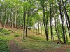
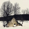
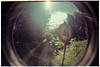
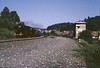
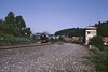
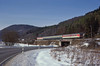
The above images may not be of the site on this page, but were taken nearby. They are loaded from Flickr so please click on them for image credits.
Click here to see more info for this site
Nearby sites
Click here to view sites on an interactive map of the areaKey: Red: member's photo, Blue: 3rd party photo, Yellow: other image, Green: no photo - please go there and take one, Grey: site destroyed
Download sites to:
KML (Google Earth)
GPX (GPS waypoints)
CSV (Garmin/Navman)
CSV (Excel)
To unlock full downloads you need to sign up as a Contributory Member. Otherwise downloads are limited to 50 sites.
Turn off the page maps and other distractions
Nearby sites listing. In the following links * = Image available
2.9km W 278° Hohler Fels Houbirg* Cave or Rock Shelter
3.8km WNW 289° Houbirg* Causewayed Enclosure
4.8km NNW 333° Wallanlage Windburg Hillfort
6.1km N 9° Neutrasfelsen Natural Stone / Erratic / Other Natural Feature
6.8km NNE 14° Starenfelshöhle* Cave or Rock Shelter
7.5km NNE 13° Dürrnberghöhlen* Cave or Rock Shelter
9.4km SE 134° Frühkeltische Siedlung Burkartshof* Ancient Village or Settlement
17.4km NNE 13° Maximilianshoehle* Cave or Rock Shelter
18.4km NNE 16° Rabenfels Natural Stone / Erratic / Other Natural Feature
18.6km N 352° Felsenloch Plech Cave or Rock Shelter
18.6km E 95° Mesolithische Freilandstation Amberg-Karmensölden 1 Ancient Village or Settlement
19.0km ESE 107° Grabhügel der Hallstattzeit in Amberg-Gailloh Round Barrow(s)
19.4km E 95° Mesolithische Freilandstation Amberg-Karmensölden 3 Ancient Village or Settlement
20.0km ESE 106° Grabhügel der La Tene Zeit in Amberg-Gailloh Round Barrow(s)
20.6km E 98° Mesolithische Freilandstation Amberg-Karmensölden 2 Ancient Village or Settlement
20.7km E 95° Mesolithische Freilandstation Amberg-Poppenricht Ancient Village or Settlement
21.3km S 188° Krähentisch Natural Stone / Erratic / Other Natural Feature
22.0km ENE 62° Hahnbacher Teufelstein Natural Stone / Erratic / Other Natural Feature
22.7km E 91° Mesolithische Freilandstation und vorgeschichtliche Siedlung Amberg-Ammersricht. Ancient Village or Settlement
23.0km E 95° Endpaläolithische und mesolithische Freilandstation Ancient Village or Settlement
23.0km E 100° Hallstattzeitliches Grabhügelfeld Amberg Barrow Cemetery
23.0km ESE 108° Mesolithische Freilandstation Amberg-Gailoh Ancient Village or Settlement
23.1km E 92° Mesolithische Freilandstation und lathenezeitliche Siedlung Amberg-Ammersricht. Ancient Village or Settlement
23.2km ESE 108° Mesolithische Freilandstation und Bronzezeitliche Siedlung Amberg-Gailoh Ancient Village or Settlement
23.9km E 99° Hallstattzeitliches Grabhügelfeld und frühmittelalterliche Reihengräber Amberg Barrow Cemetery
View more nearby sites and additional images


 We would like to know more about this location. Please feel free to add a brief description and any relevant information in your own language.
 Wir möchten mehr über diese Stätte erfahren. Bitte zögern Sie nicht, eine kurze Beschreibung und relevante Informationen in Deutsch hinzuzufügen.
 Nous aimerions en savoir encore un peu sur les lieux. S'il vous plaît n'hesitez pas à ajouter une courte description et tous les renseignements pertinents dans votre propre langue.
 Quisieramos informarnos un poco más de las lugares. No dude en añadir una breve descripción y otros datos relevantes en su propio idioma.