


<< Our Photo Pages >> La Glere de Pombie Cromlechs - Stone Circle in France in Aquitaine:Pyrénées-Atlantiques 64
Submitted by theCaptain on Tuesday, 28 August 2012 Page Views: 2176
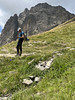
Neolithic and Bronze AgeSite Name: La Glere de Pombie Cromlechs Alternative Name: Cromlechs de la Glère de PombieCountry: France Département: Aquitaine:Pyrénées-Atlantiques 64 Type: Stone Circle
Nearest Town: Lourdes Nearest Village: Laruns
Latitude: 42.836300N Longitude: 0.4077W
Condition:
| 5 | Perfect |
| 4 | Almost Perfect |
| 3 | Reasonable but with some damage |
| 2 | Ruined but still recognisable as an ancient site |
| 1 | Pretty much destroyed, possibly visible as crop marks |
| 0 | No data. |
| -1 | Completely destroyed |
| 5 | Superb |
| 4 | Good |
| 3 | Ordinary |
| 2 | Not Good |
| 1 | Awful |
| 0 | No data. |
| 5 | Can be driven to, probably with disabled access |
| 4 | Short walk on a footpath |
| 3 | Requiring a bit more of a walk |
| 2 | A long walk |
| 1 | In the middle of nowhere, a nightmare to find |
| 0 | No data. |
| 5 | co-ordinates taken by GPS or official recorded co-ordinates |
| 4 | co-ordinates scaled from a detailed map |
| 3 | co-ordinates scaled from a bad map |
| 2 | co-ordinates of the nearest village |
| 1 | co-ordinates of the nearest town |
| 0 | no data |
Internal Links:
External Links:
")
You may be viewing yesterday's version of this page. To see the most up to date information please register for a free account.
")
")
")
")
Do not use the above information on other web sites or publications without permission of the contributor.
Nearby Images from Flickr
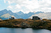
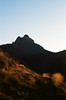
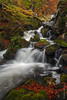

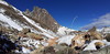
The above images may not be of the site on this page, but were taken nearby. They are loaded from Flickr so please click on them for image credits.
Click here to see more info for this site
Nearby sites
Click here to view sites on an interactive map of the areaKey: Red: member's photo, Blue: 3rd party photo, Yellow: other image, Green: no photo - please go there and take one, Grey: site destroyed
Download sites to:
KML (Google Earth)
GPX (GPS waypoints)
CSV (Garmin/Navman)
CSV (Excel)
To unlock full downloads you need to sign up as a Contributory Member. Otherwise downloads are limited to 50 sites.
Turn off the page maps and other distractions
Nearby sites listing. In the following links * = Image available
1.2km W 264° Pombie Dolmen* Burial Chamber or Dolmen
1.8km SE 125° Turoum-Bouchous Dolmen* Burial Chamber or Dolmen
2.3km NE 40° Les Quebottes de Brousset Cromlech* Stone Circle
2.5km SW 235° Senescau Cromlech* Stone Circle
2.5km NW 322° Magnabaigt Tumulus* Round Barrow(s)
2.5km NW 322° Magnabaigt Cromlechs* Stone Circle
2.6km SSW 203° L'Oelh Cluhat Tumulus* Cairn
2.6km SSW 203° L'Oelh Clucat Dolmen* Burial Chamber or Dolmen
3.2km SSW 202° Pourtalet dolmen* Burial Chamber or Dolmen
3.4km SW 218° Pluviomètre cromlech* Stone Circle
3.7km NNW 334° Cabane Magnabaigt Est Cromlech* Stone Circle
3.8km N 352° Cabane de Chérue Cromlechs* Stone Circle
3.9km S 170° Puerto Viejo de Sallent Dolmen* Burial Chamber or Dolmen
3.9km SSW 210° Mauhorat dolmen* Burial Chamber or Dolmen
4.2km SSW 197° Bacarizal Dolmen Burial Chamber or Dolmen
4.3km S 188° Espelunciecha Túmulo Round Barrow(s)
4.5km WNW 296° Plaa de Bious Cromlech* Stone Circle
4.6km NNW 326° Col Long de Magnabaigt Chromlechs* Stone Circle
4.7km S 190° O Batallero Chromlech 2 Stone Circle
4.8km SW 234° Plat de la Gradillere cromlech* Stone Circle
4.9km SSW 192° O Batallero Chromlech 1 Stone Circle
5.0km S 186° Os Faballones Túmulo Round Barrow(s)
5.1km S 178° Farallones Chromlech Stone Circle
5.2km NW 323° Cromlech de Bious Oumettes* Stone Circle
5.3km SSW 193° Corona De Los Faballones Dolmen Burial Chamber or Dolmen
View more nearby sites and additional images


 We would like to know more about this location. Please feel free to add a brief description and any relevant information in your own language.
 Wir möchten mehr über diese Stätte erfahren. Bitte zögern Sie nicht, eine kurze Beschreibung und relevante Informationen in Deutsch hinzuzufügen.
 Nous aimerions en savoir encore un peu sur les lieux. S'il vous plaît n'hesitez pas à ajouter une courte description et tous les renseignements pertinents dans votre propre langue.
 Quisieramos informarnos un poco más de las lugares. No dude en añadir una breve descripción y otros datos relevantes en su propio idioma.