


<< Our Photo Pages >> Dalnacabaig - Cairn in Scotland in Argyll
Submitted by caradoc68 on Friday, 17 February 2012 Page Views: 2901
Neolithic and Bronze AgeSite Name: DalnacabaigCountry: Scotland County: Argyll Type: Cairn
Nearest Town: Oban Nearest Village: Kilmore
Map Ref: NM90002429
Latitude: 56.364169N Longitude: 5.401421W
Condition:
| 5 | Perfect |
| 4 | Almost Perfect |
| 3 | Reasonable but with some damage |
| 2 | Ruined but still recognisable as an ancient site |
| 1 | Pretty much destroyed, possibly visible as crop marks |
| 0 | No data. |
| -1 | Completely destroyed |
| 5 | Superb |
| 4 | Good |
| 3 | Ordinary |
| 2 | Not Good |
| 1 | Awful |
| 0 | No data. |
| 5 | Can be driven to, probably with disabled access |
| 4 | Short walk on a footpath |
| 3 | Requiring a bit more of a walk |
| 2 | A long walk |
| 1 | In the middle of nowhere, a nightmare to find |
| 0 | No data. |
| 5 | co-ordinates taken by GPS or official recorded co-ordinates |
| 4 | co-ordinates scaled from a detailed map |
| 3 | co-ordinates scaled from a bad map |
| 2 | co-ordinates of the nearest village |
| 1 | co-ordinates of the nearest town |
| 0 | no data |
Internal Links:
External Links:
")
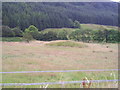
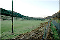
This cairn, about 260 metres west of Dalnacabaig farmhouse, is situated on the edge of a level shelf above the flood-plain of the stream Feochan Bheag. A conspicuous oval mound, it measures 19.5 by 17.4 metres and has a maximum height of 2.3 metres. Although almost completely grass-covered, the cairn can be seen to have been bordered by a kerb of massive boulders, particularly well-preserved on the SE arc. On the SW, however, the kerb has been largely removed by stone-robbing.
RCAHMS 1975, visited June 1975
You may be viewing yesterday's version of this page. To see the most up to date information please register for a free account.
")
")
Do not use the above information on other web sites or publications without permission of the contributor.
Nearby Images from Geograph Britain and Ireland:
©2009(licence)
©2010(licence)
©2011(licence)
©2015(licence)
©2008(licence)
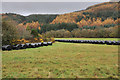
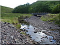
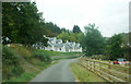
The above images may not be of the site on this page, they are loaded from Geograph.
Please Submit an Image of this site or go out and take one for us!
Click here to see more info for this site
Nearby sites
Key: Red: member's photo, Blue: 3rd party photo, Yellow: other image, Green: no photo - please go there and take one, Grey: site destroyed
Download sites to:
KML (Google Earth)
GPX (GPS waypoints)
CSV (Garmin/Navman)
CSV (Excel)
To unlock full downloads you need to sign up as a Contributory Member. Otherwise downloads are limited to 50 sites.
Turn off the page maps and other distractions
Nearby sites listing. In the following links * = Image available
1.1km E 100° Dun Iadain* Stone Fort or Dun (NM91122404)
1.9km WNW 294° Kilmore House* Cairn (NM88292515)
2.1km WNW 297° Kilmore Cairn* Cairn (NM88172533)
2.2km WNW 295° Cnoc Buidhe* Cairn (NM88032532)
2.5km NW 309° Dalinaneun Farm Cairn 2* Cairn (NM881260)
2.6km NW 310° Cleigh* Misc. Earthwork (NM88112602)
2.6km NW 311° Possible cairn at Kilmore* Cairn (NM88092609)
2.8km NW 314° Moleigh* Cairn (NM88082631)
2.8km NW 322° Barnacarry* Crannog (NM88362662)
3.1km NW 318° Dalineun* Chambered Tomb (NM8799326710)
3.2km NW 319° Dalinaneun Farm Cairn 3 Cairn (NM880268)
3.2km NW 319° Serpent Mound - Loch Nell* Artificial Mound (NM880268)
3.6km NW 325° Killiechonich* Rock Art (NM88082736)
3.8km N 354° Rubha Na Moine* Crannog (NM89812807)
4.1km N 349° Skull Shaped Stone - Loch Nell* Natural Stone / Erratic / Other Natural Feature (NM8939628383)
4.7km N 7° Diarmid's Grave* Cairn (NM9077828950)
4.7km N 6° Clach na Carraig* Standing Stone (Menhir) (NM9076728957)
4.8km N 6° Strontoiller Large Cairn* Cairn (NM90732907)
4.9km NNE 23° Glenamachrie Cairn* Cairn (NM92132870)
4.9km N 5° Strontoiller circle* Stone Circle (NM90672914)
4.9km NNE 27° Glenamacrie Farm* Cairn (NM92452854)
4.9km NNE 28° Clenamacrie Stone Row* Stone Row / Alignment (NM9251128550)
5.0km NNE 32° Glenamacrie Dun* Stone Fort or Dun (NM92862836)
5.2km SW 220° Lagganbeg* Cairn (NM86492046)
5.3km WNW 302° Ariogan Cairn* Cairn (NM85602731)
View more nearby sites and additional images


 We would like to know more about this location. Please feel free to add a brief description and any relevant information in your own language.
 Wir möchten mehr über diese Stätte erfahren. Bitte zögern Sie nicht, eine kurze Beschreibung und relevante Informationen in Deutsch hinzuzufügen.
 Nous aimerions en savoir encore un peu sur les lieux. S'il vous plaît n'hesitez pas à ajouter une courte description et tous les renseignements pertinents dans votre propre langue.
 Quisieramos informarnos un poco más de las lugares. No dude en añadir una breve descripción y otros datos relevantes en su propio idioma.