


<< Our Photo Pages >> Broubster (Caithness) - Stone Circle in Scotland in Caithness
Submitted by Tom_Bullock on Monday, 11 November 2002 Page Views: 12590
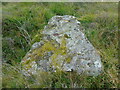
Neolithic and Bronze AgeSite Name: Broubster (Caithness)Country: Scotland County: Caithness Type: Stone Circle
Map Ref: ND04776014 Landranger Map Number: 11
Latitude: 58.518948N Longitude: 3.636566W
Condition:
| 5 | Perfect |
| 4 | Almost Perfect |
| 3 | Reasonable but with some damage |
| 2 | Ruined but still recognisable as an ancient site |
| 1 | Pretty much destroyed, possibly visible as crop marks |
| 0 | No data. |
| -1 | Completely destroyed |
| 5 | Superb |
| 4 | Good |
| 3 | Ordinary |
| 2 | Not Good |
| 1 | Awful |
| 0 | No data. |
| 5 | Can be driven to, probably with disabled access |
| 4 | Short walk on a footpath |
| 3 | Requiring a bit more of a walk |
| 2 | A long walk |
| 1 | In the middle of nowhere, a nightmare to find |
| 0 | No data. |
| 5 | co-ordinates taken by GPS or official recorded co-ordinates |
| 4 | co-ordinates scaled from a detailed map |
| 3 | co-ordinates scaled from a bad map |
| 2 | co-ordinates of the nearest village |
| 1 | co-ordinates of the nearest town |
| 0 | no data |
Internal Links:
External Links:
I have visited· I would like to visit
tom_bullock has visited here
 (PID:11902)")
Have you visited this site? Please add a comment below.
You may be viewing yesterday's version of this page. To see the most up to date information please register for a free account.
 (PID:95797)")
 (PID:11903)")
Do not use the above information on other web sites or publications without permission of the contributor.
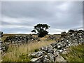
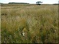
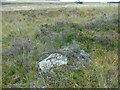
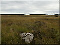
Nearby Images from Geograph Britain and Ireland:
©2022(licence)
©2022(licence)
©2022(licence)
©2022(licence)
©2022(licence)
The above images may not be of the site on this page, they are loaded from Geograph.
Please Submit an Image of this site or go out and take one for us!
Click here to see more info for this site
Nearby sites
Key: Red: member's photo, Blue: 3rd party photo, Yellow: other image, Green: no photo - please go there and take one, Grey: site destroyed
Download sites to:
KML (Google Earth)
GPX (GPS waypoints)
CSV (Garmin/Navman)
CSV (Excel)
To unlock full downloads you need to sign up as a Contributory Member. Otherwise downloads are limited to 50 sites.
Turn off the page maps and other distractions
Nearby sites listing. In the following links * = Image available
318m SW 222° Aultan Broubster* Stone Circle (ND04555991)
1.3km NNW 344° Torr A' Chaise Cairn (ND04446139)
1.4km S 174° Monadh Nan Carn* Chambered Cairn (ND04885874)
1.8km S 172° Sithean Dubh Chambered Cairn (ND04975834)
2.1km SSW 203° Carn Liath, Shurrery* Cairn (ND03895822)
2.7km NE 48° Tulloch of Assery (A and B)* Chambered Cairn (ND06826188)
2.9km NE 50° Tulach An T-sionnaich Chambered Cairn (ND07046192)
3.1km S 190° Tulach Gorm (Forse Water) Broch or Nuraghe (ND04185710)
3.2km SSW 192° Shurrery Stone Circle (ND040570)
3.8km E 96° Tulloch of Achavarn* Broch or Nuraghe (ND08545962)
4.5km ENE 64° Framside* Broch or Nuraghe (ND08906199)
4.5km SSE 164° Beinn Freiceadain Hillfort (ND05945574)
5.0km SSE 153° Dorrery* Stone Circle (ND06895565)
5.4km N 350° Tulloch of Stemster* Broch or Nuraghe (ND03996548)
5.7km ENE 74° North Calder* Broch or Nuraghe (ND10356160)
6.1km E 85° Upper Sour Broch or Nuraghe (ND10856056)
6.3km NW 324° Na Tri Sithean* Chambered Cairn (ND01246532)
6.3km NW 325° Cnoc Freiceadain* Chambered Cairn (ND0132065415)
6.4km WNW 297° Achvarasdal Burn* Standing Stone (Menhir) (NC99156316)
6.6km NNW 328° Cnoc Freiceadain N* Cairn (ND01386585)
6.8km N 0° Brimside Tulloch* Broch or Nuraghe (ND04956696)
6.8km NNW 327° Upper Dounreay I* Multiple Stone Rows / Avenue (ND01176596)
7.0km NW 309° Achunabust* Broch or Nuraghe (NC99436463)
7.1km NW 325° Upper Dounreay Cairn* Chambered Cairn (ND00796604)
7.1km NW 324° Upper Dounreay II Multiple Stone Rows / Avenue (ND007660)
View more nearby sites and additional images


 We would like to know more about this location. Please feel free to add a brief description and any relevant information in your own language.
 Wir möchten mehr über diese Stätte erfahren. Bitte zögern Sie nicht, eine kurze Beschreibung und relevante Informationen in Deutsch hinzuzufügen.
 Nous aimerions en savoir encore un peu sur les lieux. S'il vous plaît n'hesitez pas à ajouter une courte description et tous les renseignements pertinents dans votre propre langue.
 Quisieramos informarnos un poco más de las lugares. No dude en añadir una breve descripción y otros datos relevantes en su propio idioma.