


<< Text Pages >> Gates Of Heaven - Burial Chamber or Dolmen in Ireland (Republic of) in Co. Wicklow
Submitted by Anonymous on Thursday, 15 February 2001 Page Views: 7139
Neolithic and Bronze AgeSite Name: Gates Of Heaven Alternative Name: Kilranelagh CemeteryCountry: Ireland (Republic of) County: Co. Wicklow Type: Burial Chamber or Dolmen
Nearest Village: Kilranelagh
Latitude: 52.945147N Longitude: 6.632034W
Condition:
| 5 | Perfect |
| 4 | Almost Perfect |
| 3 | Reasonable but with some damage |
| 2 | Ruined but still recognisable as an ancient site |
| 1 | Pretty much destroyed, possibly visible as crop marks |
| 0 | No data. |
| -1 | Completely destroyed |
| 5 | Superb |
| 4 | Good |
| 3 | Ordinary |
| 2 | Not Good |
| 1 | Awful |
| 0 | No data. |
| 5 | Can be driven to, probably with disabled access |
| 4 | Short walk on a footpath |
| 3 | Requiring a bit more of a walk |
| 2 | A long walk |
| 1 | In the middle of nowhere, a nightmare to find |
| 0 | No data. |
| 5 | co-ordinates taken by GPS or official recorded co-ordinates |
| 4 | co-ordinates scaled from a detailed map |
| 3 | co-ordinates scaled from a bad map |
| 2 | co-ordinates of the nearest village |
| 1 | co-ordinates of the nearest town |
| 0 | no data |
Be the first person to rate this site - see the 'Contribute!' box in the right hand menu.
Internal Links:
External Links:
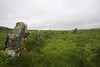
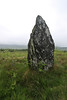
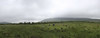
Burial Chamber (Dolmen) in Co. Wicklow
Have you visited this site? Please contribute a description or any thoughts by adding a comment.
You may be viewing yesterday's version of this page. To see the most up to date information please register for a free account.
Do not use the above information on other web sites or publications without permission of the contributor.
davidmorgan has found this location on Google Street View:
Nearby Images from Flickr
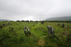
The above images may not be of the site on this page, but were taken nearby. They are loaded from Flickr so please click on them for image credits.
Click here to see more info for this site
Nearby sites
Click here to view sites on an interactive map of the areaKey: Red: member's photo, Blue: 3rd party photo, Yellow: other image, Green: no photo - please go there and take one, Grey: site destroyed
Download sites to:
KML (Google Earth)
GPX (GPS waypoints)
CSV (Garmin/Navman)
CSV (Excel)
To unlock full downloads you need to sign up as a Contributory Member. Otherwise downloads are limited to 50 sites.
![]()
Turn off the page maps and other distractions
Nearby sites listing. In the following links * = Image available
1.5km E 86° Boleycarrigeen* Stone Circle
3.4km W 274° Baltinglass* Passage Grave (S8855289249)
4.6km N 7° Castleruddery Stone Row / Alignment (S925937)
5.1km N 356° Castleruddery* Stone Circle (S9159394210)
8.5km NE 49° The Long Stone (Knickeen)* Standing Stone (Menhir) (S983948)
11.3km S 191° Haroldstown* Portal Tomb (S90087793)
12.0km NNW 336° Tournant Stone Circle (N870000)
13.5km WNW 286° Moone High Cross* Ancient Cross (S7891192693)
13.8km SSE 162° Clonmore* Ancient Cross
14.1km N 5° Athgreany* Stone Circle (N930032)
14.1km WSW 254° Castledermot High Crosses* Ancient Cross
15.0km NW 326° Brewel Hill Stone Circle (N833013)
16.0km S 187° Rathgall Hill Fort* Hillfort (S90227315)
16.2km S 188° Rathgall Destroyed Stone Circle Stone Circle (S900730)
17.1km NNW 329° Kilgowan* Standing Stone (Menhir)
17.7km N 3° Whiteleas Stone Circle
18.5km N 4° Broadleas* Stone Circle (N9292507609)
19.4km SSW 205° Ardristan* Standing Stone (Menhir) (S8413871337)
20.0km NNW 335° Old Kilcullen High Cross Ancient Cross
20.3km ENE 71° Glendalough settlement and pilgrim cross* Ancient Village or Settlement
20.6km SW 235° Browne’s Hill* Portal Tomb (S7538476873)
21.2km NNW 333° Knockaulin Timber Circle (N820078)
22.0km ENE 70° The Glendalough Cross and Deer Stone* Early Christian Sculptured Stone (T126969)
24.4km NNE 13° Blessington Desmesne Stone Circle (N9713)
27.2km N 359° Craddockstown West* Standing Stone (Menhir) (N9116416282)
View more nearby sites and additional images


 We would like to know more about this location. Please feel free to add a brief description and any relevant information in your own language.
 Wir möchten mehr über diese Stätte erfahren. Bitte zögern Sie nicht, eine kurze Beschreibung und relevante Informationen in Deutsch hinzuzufügen.
 Nous aimerions en savoir encore un peu sur les lieux. S'il vous plaît n'hesitez pas à ajouter une courte description et tous les renseignements pertinents dans votre propre langue.
 Quisieramos informarnos un poco más de las lugares. No dude en añadir una breve descripción y otros datos relevantes en su propio idioma.