<< Our Photo Pages >> Beidha - Ancient Village or Settlement in Jordan
Submitted by motist on Saturday, 18 September 2010 Page Views: 12424
DigsSite Name: BeidhaCountry: Jordan Type: Ancient Village or Settlement
Nearest Town: Petra-Wadi Musa Nearest Village: Al-Beidha
Latitude: 30.370780N Longitude: 35.447756E
Condition:
| 5 | Perfect |
| 4 | Almost Perfect |
| 3 | Reasonable but with some damage |
| 2 | Ruined but still recognisable as an ancient site |
| 1 | Pretty much destroyed, possibly visible as crop marks |
| 0 | No data. |
| -1 | Completely destroyed |
| 5 | Superb |
| 4 | Good |
| 3 | Ordinary |
| 2 | Not Good |
| 1 | Awful |
| 0 | No data. |
| 5 | Can be driven to, probably with disabled access |
| 4 | Short walk on a footpath |
| 3 | Requiring a bit more of a walk |
| 2 | A long walk |
| 1 | In the middle of nowhere, a nightmare to find |
| 0 | No data. |
| 5 | co-ordinates taken by GPS or official recorded co-ordinates |
| 4 | co-ordinates scaled from a detailed map |
| 3 | co-ordinates scaled from a bad map |
| 2 | co-ordinates of the nearest village |
| 1 | co-ordinates of the nearest town |
| 0 | no data |
Internal Links:
External Links:
I have visited· I would like to visit
43559959 would like to visit
neolithique02 has visited here
Notable among the cultural developments associated with the Pre-Pottery Neolithic B is institutionalized animal domestication. Plant domestication is associated with the Pre-Pottery Neolithic A, just previous in the chronological sequence established by Kirkbride and other archaeologists of her time. Kirkbride found a Natufian occupation below the Pre-Pottery Neolithic B settlement at Beidha. The Natufian occurs just prior to the Pre-Pottery Neolithic A, and therefore, just before plant domestication.
Archaeological excavations conducted by Diana Kirkbride were reported both by her (1966, 1968, 1989) and by Brian Byrd (1987), who participated in the final field season in 1983. Excavations discovered a Pre-Pottery Neolithic B occupation from about 7,500 to 9,200 B.P. Also discovered were earlier occupations, from about 11,000 to 11,300 B.P. and 12,000 to 12,500 B.P., both of which were Natufian.
The Natufian occupations are best characterized as hunting encampments. Great quantities of caprine bone were recovered. Some of this was ibex (Capra ibex), but Kirkbride's analysis indicated that most was the Bezoar goat (Capra aegagrus), the ancestor of the domesticated goat. Only a few artifacts indicated collecting of wheat and barley, grains that were later domesticated at Beidha. Just two grinding artifacts and a few sickle blades and nongeometric lithics mounted in sickles to form harvesting implements were found. The only features discovered were hearths and roasting areas, the latter found in association with large animal bones. Absent were walls, structures, storage facilities, burials, and stone paving.
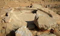
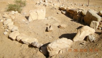
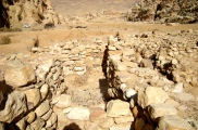
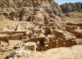
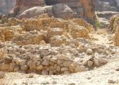
Seven levels were found in the later Pre-Pottery Neolithic B occupation at Beidha, each displaying architecture of increasing sophistication. Round and somewhat irregularly shaped structures of the earliest levels (levels VII–V) change by steps into the more regular, strictly rectilinear structures of Level III. Rooms are increasingly differentiated into storage rooms, work shops, and living areas. Other signs of rapidly increasing cultural complexity lay in flora and fauna recovered. Kirkbride wrote in 1989 that barley constituted most of the botanical material she recovered from the earliest level with permanent buildings (Level VI). Carbonized plant remains and imprints in clay roofs and walls established that Hordeum spontaneum, the wild, hulled two-row barley, was being cultivated. She could say at that time that, "This cultivation of wild cereals is a stage in the process of domestication that was known of theoretically, but had never yet been demonstrated in the field" (1989:120). Similarly, Dexter Perkins, who conducted the analysis of the faunal material recovered by Kirkbride, wrote that "…the Madamagh-Beidha faunas strongly suggest that goats were domesticated at Beidha during the Neolithic" (1966:66).
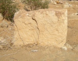
Major archeological studies have been conducted over the last 50 years at Beidha by several archeologists including Diana Kirkbride and more recently, Brian Byrd. Byrd suggests that Beidha has a Netufian period of occupation around 9000 BC, followed by a period of abandonment. Then between 7000 - 5000 BC a Neolithic period of occupation occurred with three phases followed by abandonment until the site was developed by the Nabataeans about the time of Christ (300 BC - 100 AD) . Bryd take the view that there are three occupational Phases (A, B, C) at Beidha that occurred continuously between 7000-5000 BC.
See more about Beidha linked below
Note: Moti has just returned from a trip to Jordan, this was
You may be viewing yesterday's version of this page. To see the most up to date information please register for a free account.







Do not use the above information on other web sites or publications without permission of the contributor.
Click here to see more info for this site
Nearby sites
Click here to view sites on an interactive map of the areaKey: Red: member's photo, Blue: 3rd party photo, Yellow: other image, Green: no photo - please go there and take one, Grey: site destroyed
Download sites to:
KML (Google Earth)
GPX (GPS waypoints)
CSV (Garmin/Navman)
CSV (Excel)
To unlock full downloads you need to sign up as a Contributory Member. Otherwise downloads are limited to 50 sites.
Turn off the page maps and other distractions
Nearby sites listing. In the following links * = Image available
630m NE 38° Siq al-Barid-Little Petra* Ancient Village or Settlement
3.7km SSW 209° Jabal Fatouma Dolmen* Burial Chamber or Dolmen
4.7km S 187° Petra, Nabataean Town* Ancient Village or Settlement
14.1km ESE 109° Big Circle J5 Misc. Earthwork
14.8km E 87° Big Circle J6 Misc. Earthwork
16.3km SW 230° Wadi Masoudah - David Roberts Rock* Rock Cut Tomb
18.8km NNE 31° Al-Shobak Dolmen* Burial Chamber or Dolmen
19.2km N 2° Wadi Malaqa Petroglyphs* Carving
19.9km N 2° Small Wadi Malaqa Petroglyph* Carving
20.9km NNE 31° Shobak Castle* Hillfort
25.8km SW 216° Petroglyphs near Jebel al Samra Um al Hidha* Carving
27.6km W 266° Kipat 'Eshet rock shelter* Ancient Village or Settlement
27.9km NE 42° East of Dana Nature Reserve* Ancient Village or Settlement
28.9km N 8° Wadi Feinan* Ancient Mine, Quarry or other Industry
31.2km W 278° Ramat Tsofar early Islamic settlement* Ancient Village or Settlement
31.2km WNW 297° lower wadi 'Ashosh* Ancient Temple
33.9km NE 48° Jabal Al-Aswad* Hillfort
34.2km SSE 158° M'aan district* Carving
34.3km WSW 241° South of Lower Wadi Hayun Masseboth* Standing Stones
34.5km N 358° Khirbat en-Nahas* Ancient Mine, Quarry or other Industry
35.0km WSW 258° wadi Dmama open air sanctuaries* Ancient Temple
35.8km WSW 240° Beer-Menucha* Ancient Temple
36.1km NE 40° Khirbat Dabur* Ancient Village or Settlement
36.1km W 260° Mt. 'Eshet* Ancient Trackway
36.2km W 262° Wadi Paran tributary camp site & Tumuli* Ancient Village or Settlement
View more nearby sites and additional images





 We would like to know more about this location. Please feel free to add a brief description and any relevant information in your own language.
 Wir möchten mehr über diese Stätte erfahren. Bitte zögern Sie nicht, eine kurze Beschreibung und relevante Informationen in Deutsch hinzuzufügen.
 Nous aimerions en savoir encore un peu sur les lieux. S'il vous plaît n'hesitez pas à ajouter une courte description et tous les renseignements pertinents dans votre propre langue.
 Quisieramos informarnos un poco más de las lugares. No dude en añadir una breve descripción y otros datos relevantes en su propio idioma.