


<< Our Photo Pages >> Fordell Standing Stone - Standing Stone (Menhir) in Scotland in Fife
Submitted by cosmic on Monday, 03 May 2010 Page Views: 9033
Neolithic and Bronze AgeSite Name: Fordell Standing Stone Alternative Name: Aberdour LodgeCountry: Scotland County: Fife Type: Standing Stone (Menhir)
Nearest Town: Dunfermline Nearest Village: Dalgety bay
Map Ref: NT15938446
Latitude: 56.045600N Longitude: 3.351148W
Condition:
| 5 | Perfect |
| 4 | Almost Perfect |
| 3 | Reasonable but with some damage |
| 2 | Ruined but still recognisable as an ancient site |
| 1 | Pretty much destroyed, possibly visible as crop marks |
| 0 | No data. |
| -1 | Completely destroyed |
| 5 | Superb |
| 4 | Good |
| 3 | Ordinary |
| 2 | Not Good |
| 1 | Awful |
| 0 | No data. |
| 5 | Can be driven to, probably with disabled access |
| 4 | Short walk on a footpath |
| 3 | Requiring a bit more of a walk |
| 2 | A long walk |
| 1 | In the middle of nowhere, a nightmare to find |
| 0 | No data. |
| 5 | co-ordinates taken by GPS or official recorded co-ordinates |
| 4 | co-ordinates scaled from a detailed map |
| 3 | co-ordinates scaled from a bad map |
| 2 | co-ordinates of the nearest village |
| 1 | co-ordinates of the nearest town |
| 0 | no data |
Internal Links:
External Links:
")
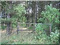
Located just behind the stables at South Lodge, this stone is some six and a half feet high and roughly rectangular in shape.
You may be viewing yesterday's version of this page. To see the most up to date information please register for a free account.
")
")
")
Do not use the above information on other web sites or publications without permission of the contributor.
Nearby Images from Geograph Britain and Ireland:
©2005(licence)

©2005(licence)
©2020(licence)
©2014(licence)
©2014(licence)
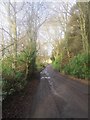
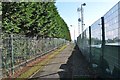
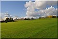
The above images may not be of the site on this page, they are loaded from Geograph.
Please Submit an Image of this site or go out and take one for us!
Click here to see more info for this site
Nearby sites
Key: Red: member's photo, Blue: 3rd party photo, Yellow: other image, Green: no photo - please go there and take one, Grey: site destroyed
Download sites to:
KML (Google Earth)
GPX (GPS waypoints)
CSV (Garmin/Navman)
CSV (Excel)
To unlock full downloads you need to sign up as a Contributory Member. Otherwise downloads are limited to 50 sites.
Turn off the page maps and other distractions
Nearby sites listing. In the following links * = Image available
1.5km WNW 303° St Theriot's Well* Holy Well or Sacred Spring (NT147853)
1.9km E 97° Barns Farm Dalgety Fife* Barrow Cemetery (NT178842)
3.1km E 79° Aberdour Cairn Cairn (NT1985)
3.5km ESE 121° Inchcolm Sculptured Stone (NT18888260)
3.6km ENE 74° St Fillan's Well (Aberdour)* Holy Well or Sacred Spring (NT194854)
4.3km WNW 285° North Wood (Dunfermline)* Cairn (NT11788565)
4.9km WNW 291° Pitcorthie.* Standing Stone (Menhir) (NT11398633)
6.6km S 188° Crossall Hill (South Queensferry)* Ancient Cross (NT14907791)
6.8km SSW 206° Bell Stane (Queensferry) Standing Stone (Menhir) (NT12827840)
7.3km ENE 69° Binn (Burntisland)* Rock Art (NT2278886891)
7.5km NE 39° Auchertool Holy Well* Holy Well or Sacred Spring (NT208902)
7.9km ENE 77° Craigkennockie (Burntisland) Cairn (NT237861)
8.0km SSE 157° Cramond Ancient Village or Settlement (NT18957706)
8.0km NNW 337° St Ninians Fife Earth Project* Modern Stone Circle etc (NT129919)
9.3km ENE 64° North Glassmount* Standing Stones (NT244884)
9.4km SW 234° Abercorn Sculptured Stone (NT08147910)
9.9km S 170° Cammo Stone* Standing Stone (Menhir) (NT1747774681)
10.1km S 191° Carlowrie (Kirkliston) Rock Art (NT138746)
10.1km S 185° Cat Stane (Kirkliston)* Standing Stone (Menhir) (NT1489374373)
10.4km SW 228° Justice Stone Standing Stone (Menhir) (NT08087759)
11.5km N 8° Kirkhall, Lochore Stone Circle (NT177958)
12.0km NNE 12° Hare Law (Fife)* Cairn (NT187961)
12.3km SSW 194° Lochend menhir* Standing Stone (Menhir) (NT12667263)
12.4km SSW 196° Huly Hill Standing Stones* Standing Stones (NT1234272610)
12.4km SSW 196° Huly Hill Cairn* Round Cairn (NT1234272610)
View more nearby sites and additional images


 We would like to know more about this location. Please feel free to add a brief description and any relevant information in your own language.
 Wir möchten mehr über diese Stätte erfahren. Bitte zögern Sie nicht, eine kurze Beschreibung und relevante Informationen in Deutsch hinzuzufügen.
 Nous aimerions en savoir encore un peu sur les lieux. S'il vous plaît n'hesitez pas à ajouter une courte description et tous les renseignements pertinents dans votre propre langue.
 Quisieramos informarnos un poco más de las lugares. No dude en añadir una breve descripción y otros datos relevantes en su propio idioma.