

<< Our Photo Pages >> Knowe of Gullow - Broch or Nuraghe in Scotland in Orkney
Submitted by Andy B on Sunday, 18 April 2010 Page Views: 3728
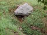
Iron Age and Later PrehistorySite Name: Knowe of GullowCountry: Scotland County: Orkney Type: Broch or Nuraghe
Map Ref: HY307163
Latitude: 59.028095N Longitude: 3.208946W
Condition:
| 5 | Perfect |
| 4 | Almost Perfect |
| 3 | Reasonable but with some damage |
| 2 | Ruined but still recognisable as an ancient site |
| 1 | Pretty much destroyed, possibly visible as crop marks |
| 0 | No data. |
| -1 | Completely destroyed |
| 5 | Superb |
| 4 | Good |
| 3 | Ordinary |
| 2 | Not Good |
| 1 | Awful |
| 0 | No data. |
| 5 | Can be driven to, probably with disabled access |
| 4 | Short walk on a footpath |
| 3 | Requiring a bit more of a walk |
| 2 | A long walk |
| 1 | In the middle of nowhere, a nightmare to find |
| 0 | No data. |
| 5 | co-ordinates taken by GPS or official recorded co-ordinates |
| 4 | co-ordinates scaled from a detailed map |
| 3 | co-ordinates scaled from a bad map |
| 2 | co-ordinates of the nearest village |
| 1 | co-ordinates of the nearest town |
| 0 | no data |
Internal Links:
External Links:
I have visited· I would like to visit
Andy B has visited here
")
One of at least eight brochs within two miles of here.
You may be viewing yesterday's version of this page. To see the most up to date information please register for a free account.
")
")
Do not use the above information on other web sites or publications without permission of the contributor.
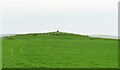
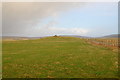
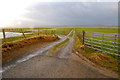
Nearby Images from Geograph Britain and Ireland:
©2021(licence)
©2008(licence)
©2008(licence)
©2008(licence)
©2008(licence)
The above images may not be of the site on this page, they are loaded from Geograph.
Please Submit an Image of this site or go out and take one for us!
Click here to see more info for this site
Nearby sites
Key: Red: member's photo, Blue: 3rd party photo, Yellow: other image, Green: no photo - please go there and take one, Grey: site destroyed
Download sites to:
KML (Google Earth)
GPX (GPS waypoints)
CSV (Garmin/Navman)
CSV (Excel)
To unlock full downloads you need to sign up as a Contributory Member. Otherwise downloads are limited to 50 sites.
Turn off the page maps and other distractions
Nearby sites listing. In the following links * = Image available
446m ENE 62° Maesquoy* Standing Stones (HY311165)
513m NNE 12° Knowe of Burrian (Garth Farm)* Broch or Nuraghe (HY30821680)
982m ESE 113° Staney Hill* Chambered Tomb (HY316159)
1.3km SE 126° Feolquoy* Round Barrow(s) (HY31741551)
1.4km NE 53° Caperhouse* Standing Stones (HY318171)
1.5km ESE 117° Staney stone* Standing Stone (Menhir) (HY320156)
1.6km ESE 119° Venus of the Whins* Round Barrow(s) (HY321155)
1.7km SE 137° Langskaill Mound* Artificial Mound (HY31811505)
1.7km NNE 21° Overbrough* Broch or Nuraghe (HY31361790)
1.9km E 92° Appiehouse* Standing Stone (Menhir) (HY32621620)
2.0km NE 54° Nettletar* Broch or Nuraghe (HY32321741)
2.1km E 99° Woodwyn* Cairn (HY32781594)
2.1km S 171° Campston (Grimeston)* Broch or Nuraghe (HY310142)
2.1km S 171° Grimston Broch* Broch or Nuraghe (HY310142)
2.3km NNW 332° Burrian (Russland)* Broch or Nuraghe (HY29641835)
2.5km SSE 161° Vola* Round Barrow(s) (HY31471395)
2.6km ESE 110° Dale Souterrain* Artificial Mound (HY33111538)
2.6km N 4° Uvigar* Artificial Mound (HY30951888)
2.8km N 358° Foldarol's Hole* Artificial Mound (HY30631909)
2.9km SW 217° Bookan Stones* Standing Stones (HY28921406)
2.9km SW 225° The Brecks* Cairn (HY286143)
2.9km N 357° Knowe of Browsky* Artificial Mound (HY306192)
3.0km SW 232° Ring of Bookan* Henge (HY283145)
3.0km SW 218° Wasbister Cairn* Cairn (HY28811397)
3.0km SW 216° Bookan Cairns* Cairn (HY289139)
View more nearby sites and additional images


 We would like to know more about this location. Please feel free to add a brief description and any relevant information in your own language.
 Wir möchten mehr über diese Stätte erfahren. Bitte zögern Sie nicht, eine kurze Beschreibung und relevante Informationen in Deutsch hinzuzufügen.
 Nous aimerions en savoir encore un peu sur les lieux. S'il vous plaît n'hesitez pas à ajouter une courte description et tous les renseignements pertinents dans votre propre langue.
 Quisieramos informarnos un poco más de las lugares. No dude en añadir una breve descripción y otros datos relevantes en su propio idioma.