 with our Megalithic Portal iPhone app")


<< Text Pages >> Era de Pando - Ancient Village or Settlement in Peru
Submitted by bat400 on Saturday, 17 April 2010 Page Views: 6705
Site WatchSite Name: Era de PandoCountry: Peru Type: Ancient Village or Settlement
Nearest Village: Pando
Latitude: 10.84S Longitude: 77.5961W
Condition:
| 5 | Perfect |
| 4 | Almost Perfect |
| 3 | Reasonable but with some damage |
| 2 | Ruined but still recognisable as an ancient site |
| 1 | Pretty much destroyed, possibly visible as crop marks |
| 0 | No data. |
| -1 | Completely destroyed |
| 5 | Superb |
| 4 | Good |
| 3 | Ordinary |
| 2 | Not Good |
| 1 | Awful |
| 0 | No data. |
| 5 | Can be driven to, probably with disabled access |
| 4 | Short walk on a footpath |
| 3 | Requiring a bit more of a walk |
| 2 | A long walk |
| 1 | In the middle of nowhere, a nightmare to find |
| 0 | No data. |
| 5 | co-ordinates taken by GPS or official recorded co-ordinates |
| 4 | co-ordinates scaled from a detailed map |
| 3 | co-ordinates scaled from a bad map |
| 2 | co-ordinates of the nearest village |
| 1 | co-ordinates of the nearest town |
| 0 | no data |
Be the first person to rate this site - see the 'Contribute!' box in the right hand menu.
Internal Links:
External Links:
Ancient Village in Liberec Department, Peru.This is a late Archaic site, thought to be created by the same Supe Culture responsible for the larger nearby site, Caral. The site includes and adobe pyramid and about two dozen buildings.
A comparison aerial view on Google maps of both Caral and Era de Pando shows the similarities in architectural layout.
Note: Neighbouring city of Peru's ancient Caral at risk.
You may be viewing yesterday's version of this page. To see the most up to date information please register for a free account.
Do not use the above information on other web sites or publications without permission of the contributor.
Nearby Images from Flickr
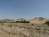
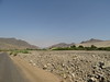
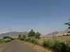
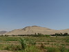
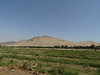
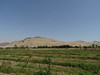
The above images may not be of the site on this page, but were taken nearby. They are loaded from Flickr so please click on them for image credits.
Click here to see more info for this site
Nearby sites
Click here to view sites on an interactive map of the areaKey: Red: member's photo, Blue: 3rd party photo, Yellow: other image, Green: no photo - please go there and take one, Grey: site destroyed
Download sites to:
KML (Google Earth)
GPX (GPS waypoints)
CSV (Garmin/Navman)
CSV (Excel)
To unlock full downloads you need to sign up as a Contributory Member. Otherwise downloads are limited to 50 sites.
Turn off the page maps and other distractions
Nearby sites listing. In the following links * = Image available
3.0km SE 125° Pando Ancient Village or Settlement
5.9km ESE 115° Pueblo Nuevo Ancient Village or Settlement
6.4km SE 129° Lurihuasi Ancient Village or Settlement
7.8km SE 128° Miraya Ancient Village or Settlement
7.9km ESE 116° Cerro Colorado Ancient Village or Settlement
9.0km SE 129° Chupacigarro Ancient Village or Settlement
9.9km ESE 117° Allpacoto Ancient Village or Settlement
10.0km SE 125° Caral* Ancient Village or Settlement
12.4km ESE 117° Llaqta Ancient Village or Settlement
16.1km W 280° Áspero Ancient Village or Settlement
19.4km NNW 328° Vinto Alto Ancient Village or Settlement
19.9km ESE 117° Huacache Ancient Village or Settlement
20.9km ESE 120° Peñico Ancient Village or Settlement
21.0km S 191° Vichama* Ancient Village or Settlement
21.8km NNW 342° Huayto Ancient Village or Settlement
22.7km NNW 328° Carreteria Ancient Village or Settlement
23.5km NW 312° Punta Y Suela Ancient Village or Settlement
24.1km NW 319° Upaca Ancient Village or Settlement
24.2km NNW 328° Pampa San José Ancient Village or Settlement
24.9km ESE 107° Capilla Ancient Village or Settlement
25.6km ESE 102° Jaiva Ancient Village or Settlement
30.5km NW 318° Cerro Lampay Ancient Village or Settlement
32.5km NW 326° Cerro Blanco 1 Ancient Village or Settlement
33.1km NNW 327° Cerro Blanco 2 Ancient Village or Settlement
33.2km NW 313° Porvenir Ancient Village or Settlement
View more nearby sites and additional images


 We would like to know more about this location. Please feel free to add a brief description and any relevant information in your own language.
 Wir möchten mehr über diese Stätte erfahren. Bitte zögern Sie nicht, eine kurze Beschreibung und relevante Informationen in Deutsch hinzuzufügen.
 Nous aimerions en savoir encore un peu sur les lieux. S'il vous plaît n'hesitez pas à ajouter une courte description et tous les renseignements pertinents dans votre propre langue.
 Quisieramos informarnos un poco más de las lugares. No dude en añadir una breve descripción y otros datos relevantes en su propio idioma.