


<< Our Photo Pages >> Nasenstein - Standing Stone (Menhir) in Germany in North Rhine-Westphalia
Submitted by Andreas on Monday, 14 September 2009 Page Views: 9361
Neolithic and Bronze AgeSite Name: NasensteinCountry: Germany Land: North Rhine-Westphalia Type: Standing Stone (Menhir)
Nearest Town: Soest Nearest Village: Schmerlecke
Latitude: 51.592000N Longitude: 8.230500E
Condition:
| 5 | Perfect |
| 4 | Almost Perfect |
| 3 | Reasonable but with some damage |
| 2 | Ruined but still recognisable as an ancient site |
| 1 | Pretty much destroyed, possibly visible as crop marks |
| 0 | No data. |
| -1 | Completely destroyed |
| 5 | Superb |
| 4 | Good |
| 3 | Ordinary |
| 2 | Not Good |
| 1 | Awful |
| 0 | No data. |
| 5 | Can be driven to, probably with disabled access |
| 4 | Short walk on a footpath |
| 3 | Requiring a bit more of a walk |
| 2 | A long walk |
| 1 | In the middle of nowhere, a nightmare to find |
| 0 | No data. |
| 5 | co-ordinates taken by GPS or official recorded co-ordinates |
| 4 | co-ordinates scaled from a detailed map |
| 3 | co-ordinates scaled from a bad map |
| 2 | co-ordinates of the nearest village |
| 1 | co-ordinates of the nearest town |
| 0 | no data |
Internal Links:
External Links:
I have visited· I would like to visit
Andreas has visited here
")
The Nasenstein (translation: "Nose Stone") is situated a few meters south of the road Soest-Paderborn (B1), southwest of Schmerlecke.
The weight of the stone is about 1,5 ton.
Originally the Nasenstein had been located in southern Sweden.
But with the extending ice during the glacial period (Saale period, about 240000-125000 BP) the stone was moved to Westphalia, not far from the southern border of the ice's expansion, which caused the incidence of erratics.
(This border approximately can be described as a line from Düsseldorf via Dortmund to Paderborn.)
The Nasenstein is situated close to the "Hellweg", a long distance track with neolithic origins.
Close to this way two late neolithic gallery graves are known: tomb Schmerlecke I (destroyed) and tomb Schmerlecke II, which has been preserved under the ground level.
Most probably the Nasenstein's site was a neolithic or bronze aged cult place. But of course the exact age of this cult place is hard to define.
In the late Middle Ages close to the site the Hellweg was crossed by the "Soester Landwehr", a fortification of the medieval hanseatic town Soest.
At that time the Nasenstein's ambience was not very pleasant.
The site was used as a medieval and early modern law-court and execution site.
So until about AD 1800 dozens of people were hanged or broken on the wheel, especially in the 15th and 16th century.
About 1880 the stone was saled to a host, who transferred it to his restaurant at the village.
However in 2005 the Nasenstein was brought back to its traditional site, known as "Lohner Warte" (a section of the Soester Landwehr).
The Nasenstein's name sounds like a modern joke, but in fact this name has been known since the late Middle Ages.
At least two sources from the 15th century (1441 and about 1444) mention the term.
So I guess, this name is one of the earliest known "megalithic proper names" in Germany on the whole.
Nowadays the site is quite peaceful.
And some friendly geese and goats cause a homelike atmosphere.
References:
P. Sukkau: Geschichte an der Lohner Warte- Der Nasenstein, die Landwehr mit der Warte, der Galgen, in: Lippstädter Heimatblätter, (18) 2005, p. 137-143
W. Marcus: Der Nasenstein- Eine alte Gerichtsstätte bei Schmerlecke, in: Vertell mui watt, No. 274 ff., 2005
You may be viewing yesterday's version of this page. To see the most up to date information please register for a free account.
")
Do not use the above information on other web sites or publications without permission of the contributor.
Nearby Images from Flickr
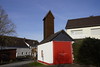
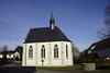
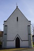

The above images may not be of the site on this page, but were taken nearby. They are loaded from Flickr so please click on them for image credits.
Click here to see more info for this site
Nearby sites
Click here to view sites on an interactive map of the areaKey: Red: member's photo, Blue: 3rd party photo, Yellow: other image, Green: no photo - please go there and take one, Grey: site destroyed
Download sites to:
KML (Google Earth)
GPX (GPS waypoints)
CSV (Garmin/Navman)
CSV (Excel)
To unlock full downloads you need to sign up as a Contributory Member. Otherwise downloads are limited to 50 sites.
Turn off the page maps and other distractions
Nearby sites listing. In the following links * = Image available
481m ENE 70° Schmerlecke (1) Chambered Tomb
645m NE 47° Schmerlecke Galeriegrab (3) Passage Grave
661m NE 46° Schmerlecke (2) Chambered Tomb
2.8km SW 231° Erdwerk Bad Sassendorf Misc. Earthwork
3.6km E 81° Völlinghausen Chambered Tomb
4.7km E 86° Völlinghausen Galeriegrab Chambered Tomb
9.2km WSW 256° Erdwerk von Soest Misc. Earthwork
10.2km SE 145° Uelde Galeriegrab Chambered Tomb
10.4km W 259° Soest-Ardey Opferteich Holy Well or Sacred Spring
10.5km SW 231° Hiddingsen Galeriegrab* Chambered Tomb
13.8km SSE 148° Summstein Belecke Modern Stone Circle etc
14.7km WNW 302° Lippborg Galeriegrab Chambered Tomb
16.3km WSW 253° Ostönnen Galeriegrab Chambered Tomb
18.1km SW 236° Grabhügel in den Bilmer Büschen Barrow Cemetery
19.9km NW 317° Beckum 2* Chambered Tomb
20.4km SE 146° Hoher Stein (bei Suttrop)* Cave or Rock Shelter
20.7km WSW 244° Ruhner Weg* Ancient Village or Settlement
20.7km SE 135° Wallburg Schaftsköppen* Hillfort
20.8km ENE 76° Tudorfer Weg Barrow Cemetery
21.0km SW 229° Grabhügel Große Aupke* Round Barrow(s)
21.0km SE 145° Hohler Stein bei Kallenhardt* Cave or Rock Shelter
21.1km SW 227° Grabhügelgruppe am Alten Holzweg* Barrow Cemetery
21.4km WSW 244° Gräberfeld von Ense-Bremen* Barrow Cemetery
21.7km SW 226° Grabhügelgruppe am Rehbocksweg* Barrow Cemetery
22.8km W 259° Werl Iron Age Saline Ancient Mine, Quarry or other Industry
View more nearby sites and additional images


 We would like to know more about this location. Please feel free to add a brief description and any relevant information in your own language.
 Wir möchten mehr über diese Stätte erfahren. Bitte zögern Sie nicht, eine kurze Beschreibung und relevante Informationen in Deutsch hinzuzufügen.
 Nous aimerions en savoir encore un peu sur les lieux. S'il vous plaît n'hesitez pas à ajouter une courte description et tous les renseignements pertinents dans votre propre langue.
 Quisieramos informarnos un poco más de las lugares. No dude en añadir una breve descripción y otros datos relevantes en su propio idioma.