


<< Our Photo Pages >> Barnstedt Steingrab - Chambered Tomb in Germany in Lower Saxony, Bremen
Submitted by holger_rix on Tuesday, 02 June 2009 Page Views: 2778
Neolithic and Bronze AgeSite Name: Barnstedt SteingrabCountry: Germany Land: Lower Saxony, Bremen Type: Chambered Tomb
Nearest Town: Uelzen Nearest Village: Barnstedt
Latitude: 53.121290N Longitude: 10.348050E
Condition:
| 5 | Perfect |
| 4 | Almost Perfect |
| 3 | Reasonable but with some damage |
| 2 | Ruined but still recognisable as an ancient site |
| 1 | Pretty much destroyed, possibly visible as crop marks |
| 0 | No data. |
| -1 | Completely destroyed |
| 5 | Superb |
| 4 | Good |
| 3 | Ordinary |
| 2 | Not Good |
| 1 | Awful |
| 0 | No data. |
| 5 | Can be driven to, probably with disabled access |
| 4 | Short walk on a footpath |
| 3 | Requiring a bit more of a walk |
| 2 | A long walk |
| 1 | In the middle of nowhere, a nightmare to find |
| 0 | No data. |
| 5 | co-ordinates taken by GPS or official recorded co-ordinates |
| 4 | co-ordinates scaled from a detailed map |
| 3 | co-ordinates scaled from a bad map |
| 2 | co-ordinates of the nearest village |
| 1 | co-ordinates of the nearest town |
| 0 | no data |
Internal Links:
External Links:
")
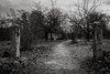
Possible remains of a neolithic tomb.
Marked as stone tomb on the topografic map.
Source:
Niedersachsen Bremen 3D v1.5 DVD
Note: http://yfrog.com/59barnstedtj
You may be viewing yesterday's version of this page. To see the most up to date information please register for a free account.
")
")
")
")
Do not use the above information on other web sites or publications without permission of the contributor.
Nearby Images from Flickr
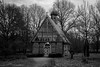
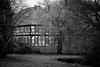
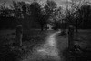
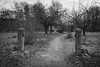
The above images may not be of the site on this page, but were taken nearby. They are loaded from Flickr so please click on them for image credits.
Click here to see more info for this site
Nearby sites
Click here to view sites on an interactive map of the areaKey: Red: member's photo, Blue: 3rd party photo, Yellow: other image, Green: no photo - please go there and take one, Grey: site destroyed
Download sites to:
KML (Google Earth)
GPX (GPS waypoints)
CSV (Garmin/Navman)
CSV (Excel)
To unlock full downloads you need to sign up as a Contributory Member. Otherwise downloads are limited to 50 sites.
Turn off the page maps and other distractions
Nearby sites listing. In the following links * = Image available
865m SW 234° Gluesingen Steingrab* Chambered Tomb
4.2km W 273° Betzendorf Steingrab* Chambered Tomb
5.1km W 267° Diersbuettel Steingrab 3 Chambered Tomb
5.2km ESE 110° Bornsen Langbett 1 Long Barrow
5.6km W 265° Diersbuettel Steingrab 1* Chambered Tomb
6.1km W 265° Diersbuettel Steingrab 2* Chambered Tomb
6.3km SE 129° Bornsen Langbett 2* Long Barrow
6.4km SE 128° Bornsen Langbett 3* Long Barrow
6.9km E 101° Rieste Steingrab* Chambered Tomb
7.0km W 264° Amelinghausen Steingrab Chambered Tomb
7.0km WNW 282° Amelinghausen Sottorf Steingrab 3* Chambered Tomb
7.1km WNW 282° Amelinghausen Sottorf Steingrab 2* Chambered Tomb
7.3km ESE 103° Rieste Langbett* Long Barrow
7.8km WNW 283° Amelinghausen Sottorf Steingrab 1* Chambered Tomb
9.0km WNW 288° Oldendorf Langbett 4* Long Barrow
9.0km WNW 289° Oldendorf Huegelgrab 5* Round Barrow(s)
9.0km WNW 288° Oldendorf Huegelgrab 6* Round Barrow(s)
9.1km WNW 289° Oldendorf Steingrab 2* Chambered Tomb
9.1km WNW 288° Oldendorf Langbett 3* Long Barrow
9.1km WNW 289° Oldendorf Langbett 1* Long Barrow
9.1km WNW 289° Oldendorfer Totenstatt* Barrow Cemetery
9.7km WNW 292° Oldendorf Archaeologisches Museum* Museum
10.2km ESE 104° Addenstorf Grabhuegelgruppe* Barrow Cemetery
11.9km WNW 285° Aspelhorn Huegelgrab 1* Round Barrow(s)
11.9km WNW 284° Aspelhorn Steingrab* Chambered Tomb
View more nearby sites and additional images


 We would like to know more about this location. Please feel free to add a brief description and any relevant information in your own language.
 Wir möchten mehr über diese Stätte erfahren. Bitte zögern Sie nicht, eine kurze Beschreibung und relevante Informationen in Deutsch hinzuzufügen.
 Nous aimerions en savoir encore un peu sur les lieux. S'il vous plaît n'hesitez pas à ajouter une courte description et tous les renseignements pertinents dans votre propre langue.
 Quisieramos informarnos un poco más de las lugares. No dude en añadir una breve descripción y otros datos relevantes en su propio idioma.