


<< Our Photo Pages >> Bagargi Dolmen - Burial Chamber or Dolmen in France in Aquitaine:Pyrénées-Atlantiques 64
Submitted by irundarra on Friday, 22 May 2009 Page Views: 2928
Neolithic and Bronze AgeSite Name: Bagargi DolmenCountry: France Département: Aquitaine:Pyrénées-Atlantiques 64 Type: Burial Chamber or Dolmen
Nearest Town: S. Jean Pied de Port Nearest Village: Larrau
Latitude: 43.038884N Longitude: 1.026523W
Condition:
| 5 | Perfect |
| 4 | Almost Perfect |
| 3 | Reasonable but with some damage |
| 2 | Ruined but still recognisable as an ancient site |
| 1 | Pretty much destroyed, possibly visible as crop marks |
| 0 | No data. |
| -1 | Completely destroyed |
| 5 | Superb |
| 4 | Good |
| 3 | Ordinary |
| 2 | Not Good |
| 1 | Awful |
| 0 | No data. |
| 5 | Can be driven to, probably with disabled access |
| 4 | Short walk on a footpath |
| 3 | Requiring a bit more of a walk |
| 2 | A long walk |
| 1 | In the middle of nowhere, a nightmare to find |
| 0 | No data. |
| 5 | co-ordinates taken by GPS or official recorded co-ordinates |
| 4 | co-ordinates scaled from a detailed map |
| 3 | co-ordinates scaled from a bad map |
| 2 | co-ordinates of the nearest village |
| 1 | co-ordinates of the nearest town |
| 0 | no data |
Internal Links:
External Links:
")
In the Chalets de Irati
You may be viewing yesterday's version of this page. To see the most up to date information please register for a free account.
")
Do not use the above information on other web sites or publications without permission of the contributor.
Nearby Images from Flickr

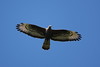
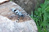
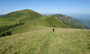


The above images may not be of the site on this page, but were taken nearby. They are loaded from Flickr so please click on them for image credits.
Click here to see more info for this site
Nearby sites
Click here to view sites on an interactive map of the areaKey: Red: member's photo, Blue: 3rd party photo, Yellow: other image, Green: no photo - please go there and take one, Grey: site destroyed
Download sites to:
KML (Google Earth)
GPX (GPS waypoints)
CSV (Garmin/Navman)
CSV (Excel)
To unlock full downloads you need to sign up as a Contributory Member. Otherwise downloads are limited to 50 sites.
Turn off the page maps and other distractions
Nearby sites listing. In the following links * = Image available
1.3km SW 216° Organbideska Chromlech Stone Circle
1.7km SW 225° Ilharreko Ordokia Chromlech 2 Stone Circle
1.9km NE 39° Ugatze Chromlech Stone Circle
1.9km SSW 212° Lapatiñegañe Tumulus* Round Barrow(s)
2.0km SSW 212° Lapatiñegañe Chromlech Stone Circle
2.0km SW 223° Ilharreko Ordokia Chromlech 1* Stone Circle
2.1km NE 41° Ugatze Barrow Cemetery Barrow Cemetery
2.2km NE 37° Ugatze Tumulus Round Barrow(s)
2.2km NNE 12° Hartsudurra Chromlech Stone Circle
2.7km WSW 240° Xardeka Tumulus Round Barrow(s)
2.7km WSW 240° Xardeka Chromlech* Stone Circle
3.2km N 359° Croix Garat Chromlech Stone Circle
3.3km S 184° Millagate Chromlechs* Stone Circle
3.4km S 186° Millagate Tumulus Round Barrow(s)
3.7km SW 228° Bagurdineta Tumulus 2 Round Barrow(s)
3.8km S 184° Ibarrondo Barrow Cemetery Barrow Cemetery
3.9km W 276° Iratisoro Tumulus Round Barrow(s)
3.9km SSW 211° Murkhuillako Lépoua Chromlech Stone Circle
3.9km W 278° Iratisoro Sud Chromlech* Stone Circle
4.0km W 278° Iratisoro Nord Chromlech Stone Circle
4.0km W 266° Dolmen de Petilarre Burial Chamber or Dolmen
4.3km N 9° Lutogaïna Tumulus Round Barrow(s)
4.5km E 85° Bagozabalaga Dolmen 2 Burial Chamber or Dolmen
4.5km E 84° Bagozabalaga Dolmen 3* Burial Chamber or Dolmen
4.6km E 83° Bagozabalaga Dolmen 1 Burial Chamber or Dolmen
View more nearby sites and additional images


 We would like to know more about this location. Please feel free to add a brief description and any relevant information in your own language.
 Wir möchten mehr über diese Stätte erfahren. Bitte zögern Sie nicht, eine kurze Beschreibung und relevante Informationen in Deutsch hinzuzufügen.
 Nous aimerions en savoir encore un peu sur les lieux. S'il vous plaît n'hesitez pas à ajouter une courte description et tous les renseignements pertinents dans votre propre langue.
 Quisieramos informarnos un poco más de las lugares. No dude en añadir una breve descripción y otros datos relevantes en su propio idioma.