


<< Our Photo Pages >> Tonkararin (in Hiroshima) - Souterrain (Fogou, Earth House) in Japan in Honshū
Submitted by Aska on Sunday, 17 May 2009 Page Views: 4842
Date UncertainSite Name: Tonkararin (in Hiroshima) Alternative Name: トンカラリンCountry: Japan Region: Honshū Type: Souterrain (Fogou, Earth House)
Nearest Town: Higashi-Hiroshima (Hiroshima pref.) Nearest Village: Akitsuchō-Mitsu 安芸
Latitude: 34.349570N Longitude: 132.821430E
Condition:
| 5 | Perfect |
| 4 | Almost Perfect |
| 3 | Reasonable but with some damage |
| 2 | Ruined but still recognisable as an ancient site |
| 1 | Pretty much destroyed, possibly visible as crop marks |
| 0 | No data. |
| -1 | Completely destroyed |
| 5 | Superb |
| 4 | Good |
| 3 | Ordinary |
| 2 | Not Good |
| 1 | Awful |
| 0 | No data. |
| 5 | Can be driven to, probably with disabled access |
| 4 | Short walk on a footpath |
| 3 | Requiring a bit more of a walk |
| 2 | A long walk |
| 1 | In the middle of nowhere, a nightmare to find |
| 0 | No data. |
| 5 | co-ordinates taken by GPS or official recorded co-ordinates |
| 4 | co-ordinates scaled from a detailed map |
| 3 | co-ordinates scaled from a bad map |
| 2 | co-ordinates of the nearest village |
| 1 | co-ordinates of the nearest town |
| 0 | no data |
Internal Links:
External Links:
 (PID:47335)")
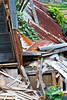
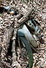
L-sheped underground structure, a combination of 3m vertical well with footholds and 18m horizontal tunnel, in a wood discovered in 1976.
You may be viewing yesterday's version of this page. To see the most up to date information please register for a free account.
 (PID:47334)")
Do not use the above information on other web sites or publications without permission of the contributor.
Nearby Images from Flickr

The above images may not be of the site on this page, but were taken nearby. They are loaded from Flickr so please click on them for image credits.
Click here to see more info for this site
Nearby sites
Click here to view sites on an interactive map of the areaKey: Red: member's photo, Blue: 3rd party photo, Yellow: other image, Green: no photo - please go there and take one, Grey: site destroyed
Download sites to:
KML (Google Earth)
GPX (GPS waypoints)
CSV (Garmin/Navman)
CSV (Excel)
To unlock full downloads you need to sign up as a Contributory Member. Otherwise downloads are limited to 50 sites.
Turn off the page maps and other distractions
Nearby sites listing. In the following links * = Image available
10.9km NW 313° Mitsujō Kofun* Long Barrow
20.0km SE 124° Ōmishima Bijutsukan art gallery* Modern Stone Circle etc
26.6km WSW 243° Irifune-yama park* Modern Stone Circle etc
30.0km WNW 290° Senninzuka Kofun* Chambered Cairn
30.8km W 275° Hambē restaurant* Modern Stone Circle etc
31.5km WNW 289° Yugama Kofun* Chambered Cairn
31.9km NE 48° Kui-no Gankai* Natural Stone / Erratic / Other Natural Feature
32.6km WNW 294° Saiganjiyama Funbogun* Cist
33.9km SSE 163° Myōkensan Kofun* Long Barrow
35.4km E 101° Ōjizuka* Chambered Cairn
36.3km E 79° Jōdo-ji temple* Modern Stone Circle etc
36.5km WNW 304° Kyūjinhara Kofungun* Chambered Cairn
41.7km SSE 157° Takinomiya Kofungun* Chambered Cairn
43.9km NE 37° Yano-no Gankai* Natural Stone / Erratic / Other Natural Feature
46.4km SSE 152° Einōsan* Hillfort
49.3km E 81° Jōkoku-ji temple* Modern Stone Circle etc
50.6km NE 56° Oichi Kofun* Passage Grave
51.4km E 85° Ankoku-ji temple* Modern Stone Circle etc
57.5km SSE 152° Busshin-ji temple* Modern Stone Circle etc
59.6km S 178° Hazaike Kofun* Long Barrow
61.0km SSE 147° Hōkoku-ji temple* Modern Stone Circle etc
61.7km S 172° Kawakami Jinja Kofun* Passage Grave
62.6km WSW 252° Mekada Family Residence garden* Modern Stone Circle etc
62.9km WSW 252° Yōkō-ji temple* Modern Stone Circle etc
64.8km S 182° Ōgeta Kofungun* Passage Grave
View more nearby sites and additional images

")
 We would like to know more about this location. Please feel free to add a brief description and any relevant information in your own language.
 Wir möchten mehr über diese Stätte erfahren. Bitte zögern Sie nicht, eine kurze Beschreibung und relevante Informationen in Deutsch hinzuzufügen.
 Nous aimerions en savoir encore un peu sur les lieux. S'il vous plaît n'hesitez pas à ajouter une courte description et tous les renseignements pertinents dans votre propre langue.
 Quisieramos informarnos un poco más de las lugares. No dude en añadir una breve descripción y otros datos relevantes en su propio idioma.