


<< Text Pages >> Troed y rhiw - Stone Row / Alignment in Wales in Pembrokeshire
Submitted by SandyB on Monday, 30 September 2002 Page Views: 8611
Neolithic and Bronze AgeSite Name: Troed y rhiwCountry: Wales County: Pembrokeshire Type: Stone Row / Alignment
Nearest Town: Fishguard Nearest Village: Puncheston
Map Ref: SN0879235756 Landranger Map Number: 145
Latitude: 51.987260N Longitude: 4.786039W
Condition:
| 5 | Perfect |
| 4 | Almost Perfect |
| 3 | Reasonable but with some damage |
| 2 | Ruined but still recognisable as an ancient site |
| 1 | Pretty much destroyed, possibly visible as crop marks |
| 0 | No data. |
| -1 | Completely destroyed |
| 5 | Superb |
| 4 | Good |
| 3 | Ordinary |
| 2 | Not Good |
| 1 | Awful |
| 0 | No data. |
| 5 | Can be driven to, probably with disabled access |
| 4 | Short walk on a footpath |
| 3 | Requiring a bit more of a walk |
| 2 | A long walk |
| 1 | In the middle of nowhere, a nightmare to find |
| 0 | No data. |
| 5 | co-ordinates taken by GPS or official recorded co-ordinates |
| 4 | co-ordinates scaled from a detailed map |
| 3 | co-ordinates scaled from a bad map |
| 2 | co-ordinates of the nearest village |
| 1 | co-ordinates of the nearest town |
| 0 | no data |
Internal Links:
External Links:
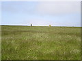
Site where twenty four small stones once lay in a row.
Some details of this now destroyed row are recorded by the Stone Rows of Great Britain - see their entry for Troed y rhiw, who tell us this single row is "only known from a description in the Royal Commission Inventory". It measured 12.2m long and the stones had an average height of 0.6m leading from a stone circle which had at least 12 stones.
The Stone Rows of Great Britain also gives a link to the Royal Commission Inventory: RCI (1914, 644 pages) (An Inventory of the Ancient Monuments in Wales and Monmouthshire: County of Denbigh. IV, Volume 4), but concludes that "The site was destroyed before it could be recorded in detail and because the stones are described as contiguous, the possibility should be acknowledged that this site represented a wall rather than a stone row".
Note: Do you have any information, historical drawings or illustrations you can add?
You may be viewing yesterday's version of this page. To see the most up to date information please register for a free account.
 (PID:220847)")
 (PID:220854)")
Do not use the above information on other web sites or publications without permission of the contributor.
Nearby Images from Geograph Britain and Ireland:
©2019(licence)
©2019(licence)
©2019(licence)
©2010(licence)
©2011(licence)
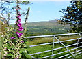
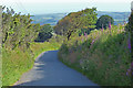
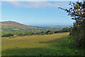
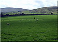
The above images may not be of the site on this page, they are loaded from Geograph.
Please Submit an Image of this site or go out and take one for us!
Click here to see more info for this site
Nearby sites
Key: Red: member's photo, Blue: 3rd party photo, Yellow: other image, Green: no photo - please go there and take one, Grey: site destroyed
Download sites to:
KML (Google Earth)
GPX (GPS waypoints)
CSV (Garmin/Navman)
CSV (Excel)
To unlock full downloads you need to sign up as a Contributory Member. Otherwise downloads are limited to 50 sites.
![]()
Turn off the page maps and other distractions
Nearby sites listing. In the following links * = Image available
237m E 89° Penlan Stone Pair* Standing Stones (SN09033575)
384m E 99° St Brynach's Well Holy Well or Sacred Spring (SN09173568)
400m SE 138° The Penlan Stone* Standing Stone (Menhir) (SN09053545)
679m NE 35° Carnedd Meibion Owen Tor 3* Natural Stone / Erratic / Other Natural Feature (SN092363)
992m NNE 16° Tycanol Hillfort (SN091367)
1.6km NE 42° Penfeidr Coedan* Ancient Mine, Quarry or other Industry (SN099369)
1.6km NE 42° Penfeidr Coedan Stone* Standing Stone (Menhir) (SN099369)
1.7km NE 40° Pentre Ifan* Portal Tomb (SN09943702)
1.8km SSW 192° Waun Mawn NE* Standing Stones (SN08353405)
1.9km W 262° Trefach Enclosure Hillfort (SN06923555)
2.0km SSW 201° Waun Mawn W* Standing Stone (Menhir) (SN08033394)
2.2km SSW 196° Tafarn-y-Bwlch* Standing Stones (SN08133370)
2.3km ESE 118° Bedd yr Afanc* Passage Grave (SN10793458)
2.3km WSW 241° Carn Wrach Cairn (SN067347)
2.5km WSW 252° Trefach* Standing Stone (Menhir) (SN064351)
2.5km ESE 103° Brynberian Round Barrow(s) (SN112351)
2.5km NNW 328° Brithdir Mawr Barrow* Modern Stone Circle etc (SN0753137967)
2.7km SSE 167° Banc Llwydlos* Ancient Village or Settlement (SN093331)
2.7km NW 320° Brithdir Mawr stone circle* Modern Stone Circle etc (SN071379)
2.9km WNW 294° Carn Ingli Settlement South Ancient Village or Settlement (SN0621237014)
2.9km E 80° Craig Rhosyfelin* Rock Outcrop (SN11653614)
2.9km WSW 240° Banc Du (Pembs)* Standing Stone (Menhir) (SN062344)
2.9km WNW 299° Carn Ingli Mountain Fort* Hillfort (SN0627737260)
3.1km NW 304° Mynydd Carn Ingli* Standing Stone (Menhir) (SN063376)
3.1km NW 304° Carn Ingli Barrows Round Barrow(s) (SN063376)
View more nearby sites and additional images


 We would like to know more about this location. Please feel free to add a brief description and any relevant information in your own language.
 Wir möchten mehr über diese Stätte erfahren. Bitte zögern Sie nicht, eine kurze Beschreibung und relevante Informationen in Deutsch hinzuzufügen.
 Nous aimerions en savoir encore un peu sur les lieux. S'il vous plaît n'hesitez pas à ajouter une courte description et tous les renseignements pertinents dans votre propre langue.
 Quisieramos informarnos un poco más de las lugares. No dude en añadir una breve descripción y otros datos relevantes en su propio idioma.