 with our Megalithic Portal iPhone app")


<< Text Pages >> Skelpick Stone Rows - Multiple Stone Rows / Avenue in Scotland in Highlands
Submitted by Andy B on Monday, 11 November 2002 Page Views: 6718
Neolithic and Bronze AgeSite Name: Skelpick Stone Rows Alternative Name: Dail Na DrochaideCountry: Scotland County: Highlands Type: Multiple Stone Rows / Avenue
Nearest Town: Thurso Nearest Village: Skelpick / Leckfurin
Map Ref: NC722574 Landranger Map Number: 10
Latitude: 58.486017N Longitude: 4.193763W
Condition:
| 5 | Perfect |
| 4 | Almost Perfect |
| 3 | Reasonable but with some damage |
| 2 | Ruined but still recognisable as an ancient site |
| 1 | Pretty much destroyed, possibly visible as crop marks |
| 0 | No data. |
| -1 | Completely destroyed |
| 5 | Superb |
| 4 | Good |
| 3 | Ordinary |
| 2 | Not Good |
| 1 | Awful |
| 0 | No data. |
| 5 | Can be driven to, probably with disabled access |
| 4 | Short walk on a footpath |
| 3 | Requiring a bit more of a walk |
| 2 | A long walk |
| 1 | In the middle of nowhere, a nightmare to find |
| 0 | No data. |
| 5 | co-ordinates taken by GPS or official recorded co-ordinates |
| 4 | co-ordinates scaled from a detailed map |
| 3 | co-ordinates scaled from a bad map |
| 2 | co-ordinates of the nearest village |
| 1 | co-ordinates of the nearest town |
| 0 | no data |
Internal Links:
External Links:
Multiple Stone Rows in Highland, possibly five in total.
Update October 2019: This now destroyed stone row is featured on the Stone Rows of Great Britain website - see their entry for Dail Na Drochaide (Skelpick), which tells us this row was destroyed in 1982. It was: "A fan-shaped multiple stone row measuring 31m long, including at least 37 small-sized stones arranged in at least 5 separate lines and situated on a gentle west facing slope within the valley of the River Naver … (it) was orientated north to south and stood in an area containing a number of prehistoric cairns, settlements and burnt mounds".
The SRoGB includes a simplified plan of the row from a survey by L.J. Myatt from the Caithness Field Club Bulletin The Multiple Stone Rows of Caithness and Sutherland, 3. Their Description II (1983).
The row is also recorded as Canmore ID 6237 and as MHG10787 (Stone Rows, Dail Na Crochaide) on the Highland HER.
Note: Do you have any photographs, illustrations, drawings or other information you can add?
You may be viewing yesterday's version of this page. To see the most up to date information please register for a free account.
Do not use the above information on other web sites or publications without permission of the contributor.
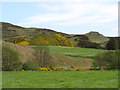
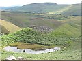
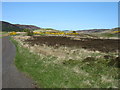
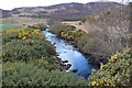
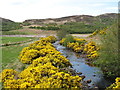
Nearby Images from Geograph Britain and Ireland:
©2016(licence)
©2010(licence)
©2016(licence)
©2018(licence)
©2016(licence)
The above images may not be of the site on this page, they are loaded from Geograph.
Please Submit an Image of this site or go out and take one for us!
Click here to see more info for this site
Nearby sites
Key: Red: member's photo, Blue: 3rd party photo, Yellow: other image, Green: no photo - please go there and take one, Grey: site destroyed
Download sites to:
KML (Google Earth)
GPX (GPS waypoints)
CSV (Garmin/Navman)
CSV (Excel)
To unlock full downloads you need to sign up as a Contributory Member. Otherwise downloads are limited to 50 sites.
![]()
![]()
Turn off the page maps and other distractions
Nearby sites listing. In the following links * = Image available
192m NE 49° Allt an Duin (Skelpick)* Broch or Nuraghe (NC72355752)
348m ENE 61° Allt a' Chaisteil* Stone Circle (NC72515756)
681m S 174° Skelpick Chambered Cairn 1* Chambered Cairn (NC72255672)
1.0km S 180° Skelpick Chambered Cairn 2 Chambered Cairn (NC72175635)
1.4km SSE 166° Skelpick Chambered Cairn 3 Chambered Cairn (NC72495605)
1.7km NNW 336° Coille na Borgie* Chambered Cairn (NC7154359000)
2.0km ENE 77° Achamore Chambered Cairn (NC74175779)
2.2km NNW 336° Achcoillenaborgie Broch or Nuraghe (NC71395942)
3.7km S 172° Loch Ma Naire* Holy Well or Sacred Spring (NC726537)
3.8km NNW 340° Cai Dun Broch or Nuraghe (NC7161)
4.3km NW 324° Baile Mhargaite* Broch or Nuraghe (NC6973560973)
4.3km NNW 326° Baile Mhargaite Cist 1* Cist (NC6990861102)
4.5km NNW 327° Baile Mhargaite Enclosure 1 Ancient Village or Settlement (NC6984361228)
4.7km S 179° Dun Carnachaidh* Broch or Nuraghe (NC72135269)
4.9km WNW 291° Borgie Souterrain* Souterrain (Fogou, Earth House) (NC67625929)
5.1km N 349° Farr Stone* Class II Pictish Symbol Stone (NC7141662460)
5.2km N 9° Fiscary (Farr)* Cairn (NC7322062480)
5.3km NW 317° Dun Riaskidh* Chambered Cairn (NC68766140)
5.3km N 8° Fiscary B (Farr)* Chambered Cairn (NC7311262604)
5.3km N 8° Fiscary A (Farr)* Chambered Cairn (NC7310262629)
5.4km N 6° Loch Swordily Broch or Nuraghe (NC729628)
5.5km S 173° Dun Viden* Broch or Nuraghe (NC72655188)
5.9km NNE 16° Kirtomy Class I Pictish Symbol Stone (NC7463)
6.0km N 354° Clerkhill Broch or Nuraghe (NC71756338)
6.0km S 180° Dun Chealamy* Broch or Nuraghe (NC71995140)
View more nearby sites and additional images


 We would like to know more about this location. Please feel free to add a brief description and any relevant information in your own language.
 Wir möchten mehr über diese Stätte erfahren. Bitte zögern Sie nicht, eine kurze Beschreibung und relevante Informationen in Deutsch hinzuzufügen.
 Nous aimerions en savoir encore un peu sur les lieux. S'il vous plaît n'hesitez pas à ajouter une courte description et tous les renseignements pertinents dans votre propre langue.
 Quisieramos informarnos un poco más de las lugares. No dude en añadir una breve descripción y otros datos relevantes en su propio idioma.